Situation Summary
Kuwait faces elevated near-term security risk driven by cross-border military activity and hostile drone/aerial operations targeting critical infrastructure. A July 12 attack on northern land border posts and an offshore oil rig represents the most significant recent incident, causing material damage and one injury. Regional tensions involving Iran, Iraq, and Jordan—evidenced by multiple aerial weapons events logged on July 14–15—are creating a volatile operational environment. The overall threat ranking (4/10, #162 globally) remains moderate, but trajectory is deteriorating.
Key Developments
- July 12 · Northern border posts and offshore oil rig · Jahra/Ahmadi Governorates — Three land border posts in northern Kuwait sustained attacks; a separate hostile drone strike impacted an offshore oil rig in Kuwaiti territorial waters, injuring one worker and causing material damage to both sites.
- July 14–15 · Aerial weapons activity · Multiple locations — GeoBit event feeds logged conventional military force activity on July 14, followed by multiple aerial weapons incidents on July 15 involving Kuwait, Jordan, Iran, and Iraq (Basra region), indicating sustained cross-border air operations.
- July 15 · Threaten signal vs. US — A public threat statement directed at the United States was recorded, concurrent with escalating military signaling in the region; context and originating actor require further clarification.
- July 13 · Military rejection signal — A military-to-Kuwait rejection statement was logged, suggesting internal or allied force posturing; underlying dispute remains under clarification.
Highest-Risk Areas
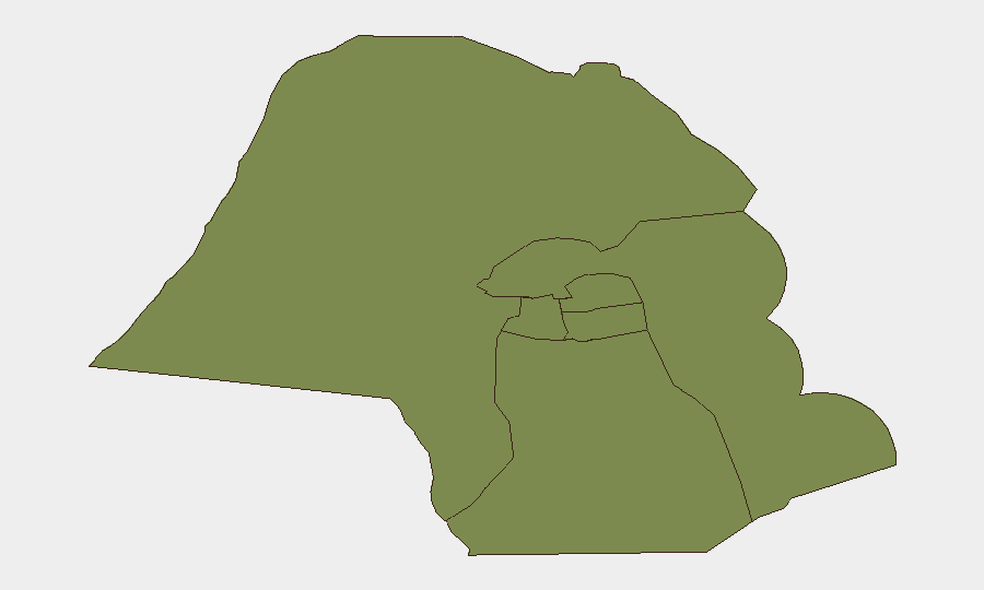
Jahra Governorate (risk 31.5) is substantially more exposed than all other regions and is the primary locus of current threat activity—the July 12 border attacks occurred in its northern sector. The remaining five governorates (Ahmadi, Farwaniya, Hawalli, Mubarak al-Kabir, Capital) cluster at risk 1.5, indicating that northern borders and infrastructure corridors near the Iraqi and Iranian boundaries are the dominant vulnerability. Offshore oil and gas assets in Ahmadi remain exposed to drone strikes, while the Capital Governorate faces secondary risk from political instability signals and potential spillover from escalating rhetoric.
How GeoBit Would Assist
Security teams should deploy AOI Monitoring & Early Warning on Jahra's border sector and all offshore oil infrastructure, enabling real-time alerting on military movement, drone launches, or hostile actor positioning. Battle mapping and force-structure tracking combined with multi-language OSINT and Telegram/X monitoring would surface early indicators of escalation (troop deployments, militia mobilization, rhetoric shifts) before kinetic activity occurs. Maritime and aviation tracking, layered with satellite imagery analysis, provides persistent coverage of cross-border incursions and airspace violations, critical for duty-of-care notification to personnel and asset-protection teams.
7-Day Outlook
Cross-border aerial and drone operations will likely persist at current or elevated levels through mid-to-late July, with Jahra and offshore assets remaining high-risk. If regional mediation efforts (implicit in the public statements recorded) fail or tensions escalate further, a secondary wave of attacks on border infrastructure or energy facilities is credible within 7–10 days. Corporate security teams should assume sustained threat posture, restrict non-essential travel to northern governorates, and implement enhanced asset-protection protocols for offshore and border-zone operations.
Highest-Risk Areas — Ranked
| # | State / Region | Risk |
|---|---|---|
| 1 | Jahra Governorate | 31.5 |
| 2 | Ahmadi Governorate | 1.5 |
| 3 | Farwaniya Governorate | 1.5 |
| 4 | Hawalli Governorate | 1.5 |
| 5 | Mubarak al-Kabir Governorate | 1.5 |
| 6 | Capital Governorate | 1.5 |
Sources
Previous Daily Briefs
A new Kuwait brief is written every day — each with its own risk map and downloadable CSV. Here's the last week; use the calendar to go further back.
📅 Browse every day by calendar →
Highlighted days have a brief. Tap a day for that day's map & analysis, or “csv” for that day's dataset ($5).
Atlas — our AI intelligence desk — emails them this snapshot personally. Nothing else, no list.