Situation Summary
Latvia remains a low-intensity threat environment overall (global rank #180), with no major security, civil unrest, crime, or infrastructure incidents reported in the last 24–48 hours as of 07 July 2026. The country's current risk profile is shaped primarily by structural vulnerabilities: proximity to the Russian border, elevated cyberspace threat activity, and residual airspace alerts following confirmed Russian drone incursions on the night of 4–5 July in Rēzekne district. Risk is geographically concentrated in eastern border municipalities rather than systemic across the country.
Key Developments
- No verified major incidents reported in Latvia in the 24–48 hours preceding 07 July 2026. Open-source monitoring, mainstream media, and social-platform intelligence confirm absence of new attacks, protests, significant crime spikes, or infrastructure disruptions in this window.
- Airspace threat warnings remain active in three eastern districts as of morning 05 July 2026. Authorities continued elevated airspace monitoring following the overnight 4–5 July drone incursion, indicating unresolved border-region risk posture that continues to affect operational security in eastern areas.
- Three public statements issued by Latvia on 07 July 2026 in relation to Lithuania. Content and significance of these diplomatic signals not yet confirmed in available OSINT; monitoring recommended for trade, sanctions, or bilateral security implications.
- Administrative sanctions applied to a Latvian school entity on 07 July 2026. Scope and enforcement details remain unclear from current web research; no indication of security or mass-disruption impact at this stage.
- Latvian cyberspace remains under sustained multi-vector attack pressure. High concentration of vulnerable devices and active exploitation attempts reported in national-level cybersecurity assessments; represents ongoing operational risk to corporate networks and critical infrastructure reliant on local connectivity.
Highest-Risk Areas
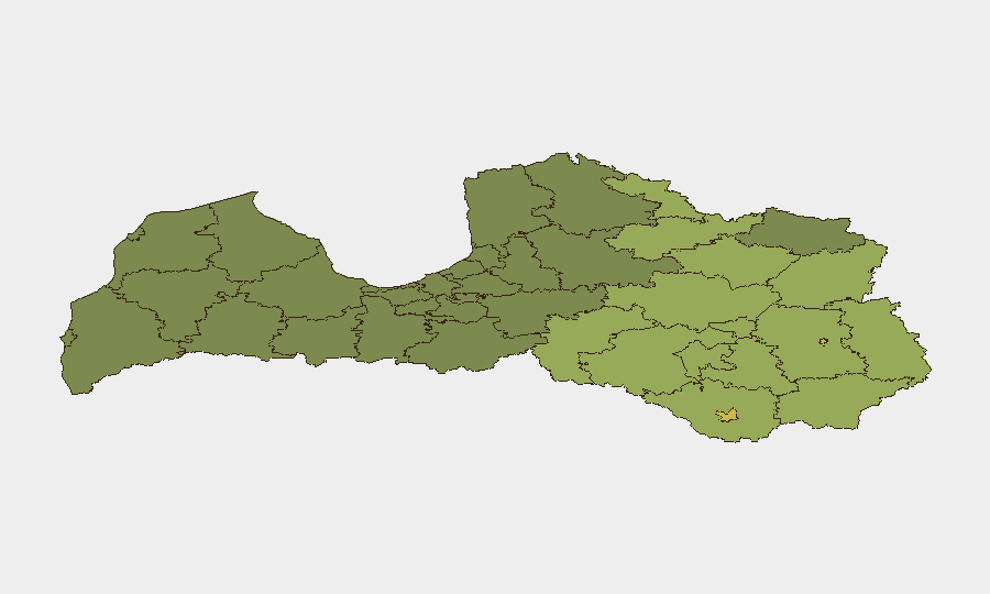
Rēzekne (risk 68) and Daugavpils (risk 65) dominate the sub-national ranking, reflecting their proximity to the Russian border and recent drone-incursion activity. The eastern Latgale region (Rēzekne district, Rēzeknes novads, Ludzas novads, Balvu novads) accounts for six of the top twelve highest-risk municipalities, with risk scores ranging from 68 down to 44. Risk in these areas is driven by border exposure, confirmed recent airspace breaches, and structural proximity to hybrid-threat origination points rather than by active civil unrest or local security deterioration. Western and central Latvia remain substantially lower-risk by comparison.
How GeoBit Would Assist
Corporate and duty-of-care teams with personnel or assets in eastern Latvia should employ AOI Monitoring & Early Warning to maintain persistent watch on Rēzekne, Daugavpils, and surrounding border districts for new airspace alerts, drone activity, or military escalation. OSINT fusion and corroboration (drawing on X/Twitter, Telegram, YouTube, multi-language sources, and entity extraction) will provide rapid alert on the 07 July Latvia–Lithuania statements and their implications for supply chains, border crossings, or sanctions. Routing & Network Analysis can support contingency planning for personnel travel or asset movement in eastern zones, identifying lower-risk alternative routes where operationally feasible.
7-Day Outlook
Near-term trajectory is expected to remain low-intensity, with airspace threat warnings likely to normalize within 48–72 hours absent new incursions. Monitoring of the Latvia–Lithuania diplomatic signals is warranted to detect any escalation into trade, sanctions, or border restrictions affecting supply chains. Cyber threat pressure on Latvian infrastructure is expected to persist as an ongoing operational background risk rather than spike into acute incident activity.
Highest-Risk Areas — Ranked
| # | State / Region | Risk |
|---|---|---|
| 1 | Rēzekne | 68 |
| 2 | Daugavpils | 65 |
| 3 | Rēzeknes novads | 58 |
| 4 | Ludzas novads | 55 |
| 5 | Balvu novads | 52 |
| 6 | Preiļu novads | 50 |
| 7 | Krāslavas novads | 48 |
| 8 | Jēkabpils novads | 47 |
| 9 | Augšdaugavas novads | 46 |
| 10 | Aizkraukles novads | 45 |
| 11 | Varakļānu novads | 44 |
| 12 | Līvānu novads | 43 |
Sources
Previous Daily Briefs
A new Latvia brief is written every day — each with its own risk map and downloadable CSV. Here's the last week; use the calendar to go further back.
📅 Browse every day by calendar →
Highlighted days have a brief. Tap a day for that day's map & analysis, or “csv” for that day's dataset ($5).
Atlas — our AI intelligence desk — emails them this snapshot personally. Nothing else, no list.