Situation Summary
Nepal's composite threat environment remains moderate (rank #null globally; score 14/100) but exhibits acute localized risks concentrated in Bagamati Province, which accounts for the majority of tracked security events. The past 24–48 hours have seen elevated transport and environmental hazards—including a fatal elephant attack, a major microbus incident on the Karnali Highway, and monsoon-related flooding—overlaid on ongoing political messaging and a national bird flu emergency. Duty-of-care teams should expect continued infrastructure disruption, wildlife and weather-related incidents, and heightened police enforcement operations, particularly in peri-urban and remote areas.
Key Developments
- Bharatpur, Chitwan District (Night of 24–25 July): A wild elephant attacked a residential home in Bharatpur Metropolitan City-23, killing a woman and four-year-old child. Indicates sustained wildlife–human conflict in peri-urban fringe settlements near forested zones.
- Dailekh District, Karnali Highway (Ongoing as of 25 July): A microbus plunged into the Karnali River four days prior; remains missing. Search operation involving 176 security personnel, divers, drones, and military helicopter continues. Likely disruption to traffic and travel on the Karnali Highway persists.
- Dhankuta District, Koshi Highway (25 July): Nepal Police seized approximately 775 kg of marijuana in a mini-truck at Sangurigadhi RM-6, Kolbote. Arrest made; indicates active narcotics trafficking on a major highway corridor.
- Dolpa District (24–25 July): Flood event killed one person, injured six, and damaged homes and public buildings. Security personnel deployed for rescue and relief; confirms active monsoon hazards in remote areas.
- Nationwide (24–25 July): Nepal Police recorded at least seven road fatalities and 105 injuries in the past 24 hours across Nepal, reflecting elevated transport risk during monsoon season.
- Biratnagar, Koshi Province (25 July): Home Minister Sudhan Gurung ordered immediate clearing of encroached land at Koshi Hospital. Warning issued against illegal occupation; enforcement action expected imminently and may provoke local resistance.
- National Bird Flu Response (25 July): Government released Rs 500 million in compensation to poultry farmers and announced strict legal action against sale of infected poultry. Public-health alert issued; adds regulatory enforcement pressure and movement restrictions on poultry trade.
Highest-Risk Areas
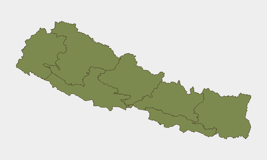
Bagamati Province dominates the sub-national risk landscape with a composite score of 31.3—over four times higher than the second-ranked region. This concentration reflects multiple recent incidents in and around the Kathmandu Valley and Chitwan District, including the elephant attack and ongoing political/administrative activity. Lumbini Province (6.7) and Karnali Province (3.1) present secondary concerns driven by the Karnali Highway microbus incident and active monsoon-related hazards; remaining provinces (Koshi, Sudurpashchim, Gandaki, Madhesh) carry lower scores but warrant monitoring for enforcement operations and flood events.
How GeoBit Would Assist
Intel Sweep and OSINT Fusion would consolidate fragmented police, local media, and government sources to track evolving incidents (the microbus search, land-clearing operations, wildlife attacks) in real time. AOI Monitoring & Early Warning on Bagamati, Karnali, and Dolpa provinces would provide persistent alerting on monsoon impacts, road incidents, and enforcement actions affecting duty-of-care staff. Routing & Network Analysis would offer alternative journey planning around the Karnali Highway disruption and other monsoon-affected corridors, reducing exposure to blocked or hazardous routes.
7-Day Outlook
Monsoon conditions are expected to persist, elevating road-accident and flooding risk across Nepal through early August; the Karnali Highway search will likely remain active. Enforcement operations—including the Biratnagar hospital land-clearing and poultry trade inspections—may trigger localized unrest or administrative disruption. No major escalation of political unrest is currently signaled, but duty-of-care teams should maintain heightened situational awareness in Bagamati Province and monitor weather bulletins and police advisories daily.
Highest-Risk Areas — Ranked
| # | State / Region | Risk |
|---|---|---|
| 1 | Bagamati Province | 31.3 |
| 2 | Lumbini Province | 6.7 |
| 3 | Karnali Province | 3.1 |
| 4 | Koshi Province | 2.5 |
| 5 | Sudurpashchim Province | 1.3 |
| 6 | Gandaki Province | 1.3 |
| 7 | Madhesh Province | 1.3 |
Sources
Previous Daily Briefs
A new Nepal brief is written every day — each with its own risk map and downloadable CSV. Here's the last week; use the calendar to go further back.
📅 Browse every day by calendar →
Highlighted days have a brief. Tap a day for that day's map & analysis, or “csv” for that day's dataset ($5).
Atlas — our AI intelligence desk — emails them this snapshot personally. Nothing else, no list.