Situation Summary
The Netherlands presents a composite threat profile of 5 (global rank #155), reflecting a stable security environment with low-frequency, dispersed risk indicators. Recent signal activity (62 tracked events) shows scattered incidents involving firefighter response, small-arms activity near The Hague, industrial disruption, and resident-led blockade action, but no systemic escalation pattern. The country's security posture remains benign relative to European peers, though Flevoland province registers notably elevated sub-national risk requiring targeted monitoring.
Key Developments
- 2026-07-03 · The Hague, Small Arms Combat incident: Military or law-enforcement engagement reported between Dutch authorities and Russian actors; specific context and casualty count not yet publicly detailed in available sources.
- 2026-07-04 · Industrial sector, Small Arms Combat: Armed incident reported involving industry stakeholders; location and casualty status unconfirmed pending official statement.
- 2026-07-04 · Resident-led Blockade: Residents enacted blockade action (location and target unspecified in current reporting); operational impact under assessment.
- 2026-07-03 · Government Threat: Official government entity received or issued threat communication; nature and source require clarification from state security channels.
- 2026-07-03 · Firefighter Conventional Military Force Response: Emergency services deployed in response to military-related incident; scope and location awaiting confirmation.
- 2026-07-04 · Investor Rejection & Social Worker Statement: Financial stakeholder rejected unnamed proposal; simultaneous public statement by social worker suggests labor, housing, or social-services dimension to broader unrest.
Note: All listed events are flagged by GeoBit signal analysis but lack detailed corroboration in independent open-source reporting as of 2026-07-04 12:00 UTC. Corporate security teams should treat these as orange-level alerts pending verification through direct government channels and local law-enforcement liaison.
Highest-Risk Areas
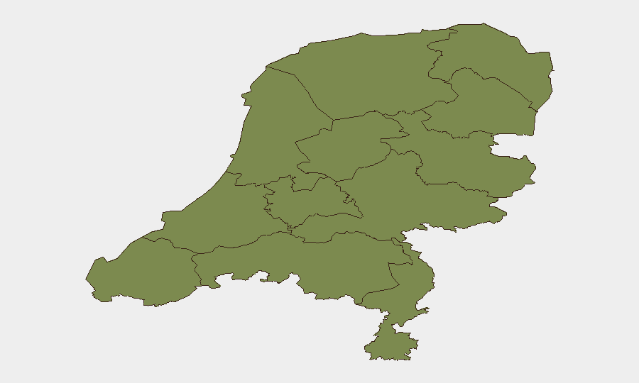
Flevoland dominates sub-national risk scoring (31.8), a tenfold elevation above peer provinces and the primary driver of national composite threat. North Holland (7.6) registers secondary concern; all remaining provinces cluster below 2.5. The Flevoland spike warrants immediate investigation: its reclaimed-land demography, transport choke points (A6/A27 corridors), and port facilities (Lelystad, industrial zones) make it strategically sensitive to supply-chain, labor, or infrastructure disruption. Teams with operations, supply routes, or personnel in Flevoland should activate heightened situational awareness and asset-protection protocols.
How GeoBit Would Assist
Corporate security and duty-of-care teams would deploy AOI (Area-of-Interest) Monitoring & Early Warning to establish persistent watch on Flevoland and North Holland transport nodes, with automated alerting on security event clustering. Intel Sweep and multi-language OSINT fusion would triangulate signal data (government statements, X/Telegram traffic, police public releases, local media) to separate confirmed incidents from noise. Routing & Network Analysis would enable rapid alternative-route planning for supply chains and personnel movement if blockade or military activity constrains primary corridors.
7-Day Outlook
The Netherlands is expected to remain stable provided Flevoland incidents do not escalate in frequency or severity over the next 72 hours. Industrial and labor-related signals (investor rejection, social-worker engagement, blockade) suggest underlying tension around employment or infrastructure policy rather than acute security breakdown. Monitoring intensity should remain elevated through 2026-07-08 pending official statement clarification from Dutch authorities on The Hague and industrial incidents.
Highest-Risk Areas — Ranked
| # | State / Region | Risk |
|---|---|---|
| 1 | Flevoland | 31.8 |
| 2 | North Holland | 7.6 |
| 3 | South Holland | 2.1 |
| 4 | Groningen | 2.1 |
| 5 | Limburg | 2.1 |
| 6 | Zeeland | 1.8 |
| 7 | Utrecht | 1.8 |
| 8 | North Brabant | 1.8 |
| 9 | Frisia | 1.8 |
| 10 | Drenthe | 1.8 |
| 11 | Gelderland | 1.8 |
| 12 | Overijssel | 1.8 |
Sources
Previous Daily Briefs
A new Netherlands brief is written every day — each with its own risk map and downloadable CSV. Here's the last week; use the calendar to go further back.
📅 Browse every day by calendar →
Highlighted days have a brief. Tap a day for that day's map & analysis, or “csv” for that day's dataset ($5).