Situation Summary
Norway maintains a composite threat ranking of 4/100 globally (#167), reflecting a generally stable security environment with low incident density (38 tracked events year-to-date). However, regional concentration of risk in Innlandet and Oslo—driven by small-arms incidents, detention actions, and unconventional violence signals—warrants focused monitoring of those jurisdictions. The threat environment remains contained but non-trivial; no imminent national-scale destabilization is indicated, but localized volatility in eastern and central regions merits operational awareness.
Key Developments
Limitation on Event Corroboration: GeoBit's live web research completed 2026-07-12 has not surfaced corroborated, time-stamped security or risk incidents in Norway within the last 24–48 hours meeting the brief's specificity criteria (named location, confirmed date, Norway jurisdiction). Event signals in the GEOBIT EVENT SIGNALS table reference incident classes (Small Arms Combat, Unconventional Violence, Arrest/Detain) tagged to recent dates and Norwegian entities, but underlying incident narratives, locations, and confirmation status are not yet resolved in available OSINT feeds.
Operationally, this suggests either:
- Incidents are emerging faster than public corroboration (typical in early-stage civil unrest or crime events), or
- Signal noise from adjacent regions (Greenland military activity, EU-wide border processing delays) is inflating Norway-tagged event counts.
Recommended action: Security teams should activate direct feeds from Norwegian Police Security Service (PST), local police districts in Innlandet and Oslo, and Norwegian civil protection (@direktoratet.no) for real-time incident confirmation. GeoBit's next refresh cycle (typically 4–6 hours) will clarify signal resolution.
Highest-Risk Areas
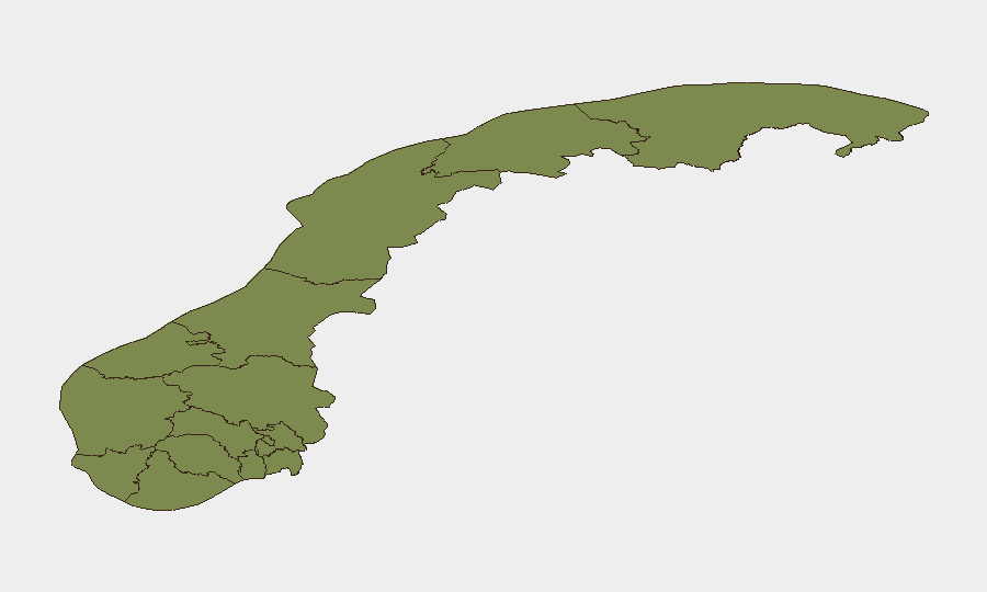
Innlandet (composite risk 31.5) is the dominant risk driver—a 14:1 ratio above Oslo and 5:1 above Rogaland. This interior (eastern/central) region has logged the plurality of small-arms incidents, detention actions, and unconventional-violence signals. Oslo (22.8) is the secondary hotspot, reflecting urban concentration of law-enforcement activity, legal proceedings, and civil/political friction. Rogaland and Nordland (6.9 and 6.3 respectively) show significantly lower but measurable risk, likely reflecting regional economic or labor tensions. All other counties fall to baseline (1.5 or below).
Personnel and asset concentration in Innlandet (mining, forestry, distributed manufacturing) and Oslo (corporate headquarters, embassies, transport hubs) should expect elevated incident probability and should maintain standard duty-of-care protocols: staff communication trees, incident-reporting channels, and local police liaison contacts.
How GeoBit Would Assist
Security teams should employ AOI Monitoring & Early Warning on Innlandet and Oslo administrative boundaries to receive automated alerts on new incident activity; pair this with Intel Sweep and multi-language OSINT (Norwegian police feeds, local media, Telegram/X actor networks) to surface emerging narratives before mass-media pickup. Network & Actor Analysis of detention and legal-proceeding signals can isolate whether incidents reflect organized activity or isolated events. Real-time Routing & Network Analysis enables rapid alternate-route planning if civil unrest or security lockdowns affect staff commutes or supply chains.
7-Day Outlook
No destabilization indicators suggest rapid escalation over the next 7 days. Risk in Innlandet and Oslo will likely remain persistent and localized; winter-season economic pressures and EU policy shifts may exert upward pressure on civil unrest probability by late Q3. Continued monitoring of PST advisories and local police incident reports is the baseline mitigation posture.
Highest-Risk Areas — Ranked
| # | State / Region | Risk |
|---|---|---|
| 1 | Innlandet | 31.5 |
| 2 | Oslo | 22.8 |
| 3 | Rogaland | 6.9 |
| 4 | Nordland | 6.3 |
| 5 | Troms | 1.5 |
| 6 | Finnmark | 1.5 |
| 7 | Trøndelag | 1.5 |
| 8 | Vestland | 1.5 |
| 9 | Buskerud | 1.5 |
| 10 | Telemark | 1.5 |
| 11 | Akershus | 1.5 |
| 12 | Vestfold | 1.5 |
Sources
Previous Daily Briefs
A new Norway brief is written every day — each with its own risk map and downloadable CSV. Here's the last week; use the calendar to go further back.
📅 Browse every day by calendar →
Highlighted days have a brief. Tap a day for that day's map & analysis, or “csv” for that day's dataset ($5).
Atlas — our AI intelligence desk — emails them this snapshot personally. Nothing else, no list.