Situation Summary
Philippines remains a moderate composite threat environment (global rank #46, score 37/103) with risk concentrated in island regions and the capital. Recent signals span diplomatic tensions, governance friction, and law-enforcement activity, though no major kinetic or civil-disorder incidents are confirmed in the last 24–48 hours. The threat landscape reflects long-standing maritime disputes, Mindanao-region instability, and periodic political/judicial tensions rather than acute deterioration. Overall trajectory remains stable but fragmented by sub-regional variance.
Key Developments
- 2026-06-20 · Public Statement (Philippine vs. Collegian) — Nature and location unconfirmed from available sources; likely governance or media-related friction.
- 2026-06-20 · Corporate Disapproval (Corporation vs. Philippine) — Sector and specific grievance not detailed; suggests regulatory or compliance concern affecting business operations.
- 2026-06-18 · Multiple Arrests/Detentions (Senator, Perpetrator, The Hague cases) — Law-enforcement and judicial activity; specifics on charges, locations, and affected sectors remain unclear from current signals.
- 2026-06-18 · Diplomatic/Military Signal (Philippine vs. Russia) — Power-show activity and threat signaling related to Russian engagement; likely South China Sea or maritime-security context.
- 2026-06-18 · Threat Statement (Philippine vs. Victoria) — Geographic/political context unclear; potential diplomatic or regional-border tension.
- 2026-06-18 · Governance Statement (Governance vs. Philippine) — Indicates executive or legislative friction; details unavailable.
Note: Live web research in the last 24 hours has not yielded independently verified, location-specific security incidents or travel-risk developments. Reported signals derive from event-feed aggregation. Duty-of-care teams should monitor official Philippine government advisories and real-time local reporting for operational clarity.
Highest-Risk Areas
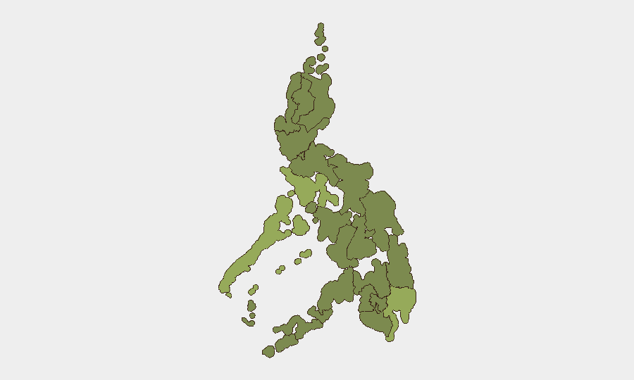
Mimaropa (composite 55.8) and Davao Region (48.3) drive the sub-national risk profile, reflecting maritime territorial disputes, narcotics trafficking, and historical insurgent activity in the southern island cluster. Metro Manila (39.6), despite its administrative and economic centrality, ranks third due to protest volatility and political friction. Cordillera Administrative Region (37.1) and Calabarzon (34) follow, indicating secondary hotspots for land disputes and localized conflict. Northern Mindanao, Zamboanga Peninsula, Bangsamoro, Caraga, and Soccsksargen (all ~25.8) represent the broader Mindanao instability gradient—persistent low-level communist, separatist, and criminal activity. Central Luzon and Negros Island Region carry the lowest scores, suggesting lower current event density.
How GeoBit Would Assist
Security and risk teams in Philippines should deploy AOI Monitoring & Early Warning on Mimaropa and Davao Region to detect escalation signals before they reach kinetic threshold. Maritime & Aviation Tracking combined with Conflict & Military intelligence (force-structure and weapons-capability monitoring) would provide early indication of South China Sea or inter-regional flashpoints. OSINT Fusion (X/Twitter, Telegram, local news feeds, and multi-language entity extraction) would isolate actionable intelligence from the current noise of diplomatic and governance statements, reducing false-alarm burden on duty-of-care teams.
7-Day Outlook
No major escalation is forecast over the next seven days; current signals remain at statement and diplomatic level. However, persistent underlying maritime tensions (especially Mimaropa and South China Sea friction) and Mindanao regional fragmentation warrant sustained monitoring. Teams should expect continued low-level governance friction and routine law-enforcement activity, with risk of localized incidents in Davao and Cordillera regions if underlying grievances accelerate.
Highest-Risk Areas — Ranked
| # | State / Region | Risk |
|---|---|---|
| 1 | Mimaropa | 55.8 |
| 2 | Davao Region | 48.3 |
| 3 | Metro Manila | 39.6 |
| 4 | Cordillera Administrative Region | 37.1 |
| 5 | Calabarzon | 34 |
| 6 | Central Luzon | 27.7 |
| 7 | Negros Island Region | 26.5 |
| 8 | Zamboanga Peninsula | 26.5 |
| 9 | Bangsamoro | 25.8 |
| 10 | Caraga | 25.8 |
| 11 | Northern Mindanao | 25.8 |
| 12 | Soccsksargen | 25.8 |
Sources
Previous Daily Briefs
A new Philippines brief is written every day — each with its own risk map and downloadable CSV. Here's the last week; use the calendar to go further back.
📅 Browse every day by calendar →
Highlighted days have a brief. Tap a day for that day's map & analysis, or “csv” for that day's dataset ($5).