Situation Summary
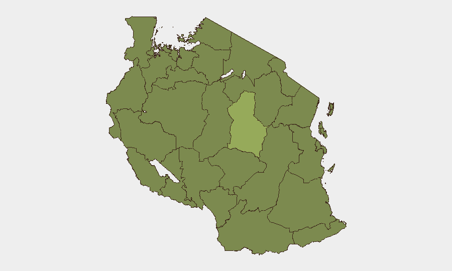
Tanzania remains in a controlled but volatile political environment following suppression of Saba Saba (July 7) anti-government demonstrations in Dar es Salaam. Heavy security deployments and pre-emptive arrests have deterred open protests, but underlying grievances persist and surveillance of digital platforms has intensified. The national threat ranking (#52 globally) reflects concentrated risk in Dodoma Region (56.7) and episodic wildfire events, with Dar es Salaam currently the primary flashpoint for state-opposition friction.
Key Developments
- Dar es Salaam (citywide) – July 7, 2026: Riot police and military units pre-positioned at major intersections, government sites, and transport hubs suppressed planned Saba Saba anti-government marches through visible deterrence; no significant clashes were reported, though security presence remained elevated throughout the day.
- Kimara, Ubungo, Magomeni, Kinondoni, Tandale districts (Dar es Salaam) – July 7, 2026: Security forces established checkpoints and conducted intensive patrols in working-class neighborhoods previously identified as protest flashpoints, limiting movement and freedom of assembly in these areas.
- Dar es Salaam (pre-protest period) – July 6–7, 2026: Police conducted multiple pre-emptive arrests of alleged demonstration organizers on charges of planning violence or attacks on officials, contributing to an atmosphere of political intimidation and raising localized detention and potential abuse risk.
- Tanzania (nationwide) – July 6–7, 2026: Authorities formally banned all political rallies and publicly signaled willingness to deploy tear gas and live ammunition if demonstrations proceeded, while increasing surveillance monitoring of digital platforms (X/Twitter, WhatsApp, domestic forums).
- Dar es Salaam (media environment) – July 6–7, 2026: Government throttling and access constraints on X/Twitter and other social media platforms were documented by civil-rights monitors, reducing real-time situational awareness and public documentation of security operations.
- Tanzania (wildfire incidents) – Recent (dates unspecified): Eight concurrent wildfire events logged across the country (IDs: 1029268, 1029303, 1029269, 1029182, 1029157, 1029217, 1029122, 1029184), with locations and scale not yet detailed; potential for air-quality impacts and disruption to transport/logistics in affected regions.
Highest-Risk Areas
Dodoma Region stands significantly apart at risk score 56.7, more than 1.5× the second-ranked Singida Region (36.7), suggesting concentrated political, administrative, or security activity there. The remaining ten regions cluster at 26.7, indicating a relatively dispersed secondary risk layer. Dodoma's elevated score likely reflects its status as the capital, center of government institutions, and seat of political decision-making; Dar es Salaam, though not separately ranked at sub-national level, is the economic and media center and currently the locus of state-opposition friction over Saba Saba protests. Western regions (Kigoma, Kagera, Mwanza, Geita, Shinyanga, Tabora, Katavi, Rukwa) and Songwe maintain moderate baseline risk, while wildfire events may temporarily elevate environmental and logistical risk in any region.
How GeoBit Would Assist
Security and duty-of-care teams would use AOI Monitoring & Early Warning to track police and military movements in Dar es Salaam and Dodoma, alerting on checkpoint establishment and assembly of security units before they affect staff movement. OSINT Fusion (X/Twitter, Telegram, local media) and Sentiment & Temporal Analysis would flag emerging protest narratives and online-platform disruptions in real time, enabling advance communication to personnel. Routing & Network Analysis would identify alternative routes and transport corridors if primary roads are blocked by security operations or wildfires.
7-Day Outlook
Near-term trajectory suggests continued heightened security posture in Dar es Salaam and potential secondary mobilization attempts around July 14 (two weeks post-Saba Saba). Wildfire events may escalate logistical friction in western and central regions. Digital surveillance and media constraints are likely to persist as the government consolidates control over the political space.
Highest-Risk Areas — Ranked
| # | State / Region | Risk |
|---|---|---|
| 1 | Dodoma Region | 56.7 |
| 2 | Singida Region | 36.7 |
| 3 | Kigoma Region | 26.7 |
| 4 | Kagera | 26.7 |
| 5 | Mwanza Region | 26.7 |
| 6 | Geita | 26.7 |
| 7 | Shinyanga Region | 26.7 |
| 8 | Tabora Region | 26.7 |
| 9 | Katavi Region | 26.7 |
| 10 | Rukwa Region | 26.7 |
| 11 | Songwe Region | 26.7 |
| 12 | Mara Region | 26.7 |
Sources
Previous Daily Briefs
A new Tanzania brief is written every day — each with its own risk map and downloadable CSV. Here's the last week; use the calendar to go further back.
📅 Browse every day by calendar →
Highlighted days have a brief. Tap a day for that day's map & analysis, or “csv” for that day's dataset ($5).
Atlas — our AI intelligence desk — emails them this snapshot personally. Nothing else, no list.