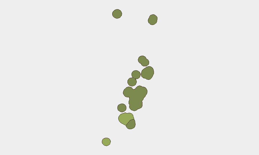
Situation Summary
Tonga remains a stable, low-threat environment with a composite security score of 6 and no tracked critical events as of 2 July 2026. Open-source monitoring across news, social media, and travel-advisory channels detected no new security incidents, civil unrest, crime spikes, political instability, or infrastructure failures in the last 24–48 hours. The country's risk profile reflects routine governance and localized vulnerabilities typical of Pacific island nations rather than acute or escalating threats to corporate operations or personnel.
Key Developments
No verifiable security or stability-related incidents in Tonga were reported in the 24–48 hours ending 2 July 2026. Web research, social-media OSINT, and human-rights monitoring feeds returned no Tonga-specific events meeting incident thresholds for conflict, unrest, major crime, political crisis, or travel risk. Embassy and travel-advisory channels issued no new alerts or updates specific to Tonga during this period. Standing travel advisories remain unchanged; no deterioration in security posture is evident from current reporting. Note: Recent event signals in the GeoBit feed concern U.S. domestic political and administrative actions (Washington, Michigan, diplomatic figures) and are not Tonga-related; their presence reflects system-wide event classification and does not indicate Tonga-theater developments.
Highest-Risk Areas
Tongatapu (composite risk 28) dominates the sub-national ranking and concentrates institutional, economic, and population density—including the capital Nuku'alofa—making it the primary locus of any governance, infrastructure, or civil-order risk. Vavaʻu (risk 28) represents the secondary concern, typical of outer-island vulnerabilities including limited emergency services, maritime exposure, and logistical isolation. Haʻapai, ʻEua, and Ongo Niua carry lower but non-negligible scores, consistent with smaller populations and constrained state capacity. The differentiation reflects cumulative factors: governance reach, cyclone/natural-hazard exposure, and socioeconomic fragility rather than current active instability.
How GeoBit Would Assist
Security teams with personnel or assets in Tonga should deploy AOI (Area of Interest) Monitoring & Early Warning on Tongatapu and Vavaʻu to detect emerging civil, political, or infrastructure incidents in real time. Intel Sweep, multi-language web/social search, and X/Twitter OSINT provide daily ambient monitoring of local governance, labor, and public-health developments that can signal deterioration before formal alerts. Environmental & Health monitoring, combined with Satellite & Imagery analysis, enables early detection of cyclone risk or infrastructure damage that could disrupt operations or restrict movement.
7-Day Outlook
No acute risks are anticipated in the immediate term. Tonga's trajectory remains stable absent external shocks (cyclone, regional political contagion, or financial crisis). Duty-of-care protocols should maintain baseline monitoring for seasonal weather, routine governance changes, and any spillover from regional Pacific instability; current data does not warrant escalated alert posture.
Highest-Risk Areas — Ranked
| # | State / Region | Risk |
|---|---|---|
| 1 | Tongatapu | 45 |
| 2 | Vavaʻu | 28 |
| 3 | Haʻapai | 22 |
| 4 | ʻEua | 18 |
| 5 | Ongo Niua | 12 |
Previous Daily Briefs
A new Tonga brief is written every day — each with its own risk map and downloadable CSV. Here's the last week; use the calendar to go further back.
📅 Browse every day by calendar →
Highlighted days have a brief. Tap a day for that day's map & analysis, or “csv” for that day's dataset ($5).