Situation Summary
Vanuatu remains in a low-threat security environment with no reported incidents in the past 24–48 hours across crime, civil unrest, infrastructure, or geohazard domains. The nation ranks #189 globally on composite threat indices, with zero tracked security events in the current assessment window. Current trajectory indicates continued stability, though sub-national variations in risk persist, particularly in Shefa Province.
Key Developments
- Nationwide (16 July 2026): Web monitoring and regional security feeds confirm no new security incidents, civil unrest, or crime spikes across Vanuatu in the past 24–48 hours. Environment classified as calm and low-threat.
- Port Vila & Transport Hubs (16 July 2026): No new travel warnings, airport or port closures, or service disruptions reported affecting movement in or out of the country during the assessment window.
- Seismic & Geohazard Status (16 July 2026): National Meteorology and Geohazards Department reports no new significant earthquakes, tsunami warnings, or severe weather alerts impacting populated areas in the past 24–48 hours.
- Domestic Security & Politics (16 July 2026): No newly reported protests, riots, political violence, or confrontations inside Vanuatu in the past 24–48 hours; prior diplomatic and political statements referenced in event signals predate this window and show no connection to fresh incidents.
- Crime & Public Safety (16 July 2026): No verified reports of major crime incidents (armed robbery, homicide, organized crime) with timestamps in the past 24–48 hours across open-source news or security monitoring specific to Vanuatu.
- Infrastructure & Utilities (16 July 2026): No reported power grid failures, telecommunications outages, or road/port closures during the past 24–48 hours affecting resident or traveler safety.
Highest-Risk Areas
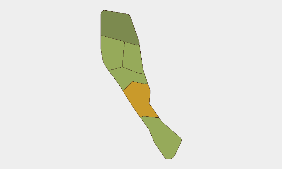
Shefa Province drives the highest sub-national risk (score 72), likely reflecting Port Vila's role as the capital and primary urban/commercial hub, where density and economic activity concentrate potential exposure to crime, civil disorder, and maritime security concerns. Penama (58) and Sanma (52) present moderate-to-elevated risk, while Tafea, Malampa, and Torba remain lower-risk peripheral zones. The concentration of risk in Shefa aligns with typical patterns in Pacific island capitals and does not indicate imminent escalation; however, teams with operations or personnel in Port Vila should maintain standard situational awareness protocols.
How GeoBit Would Assist
Security teams operating in Vanuatu would benefit from AOI Monitoring & Early Warning to track Port Vila and Shefa Province for emerging civil unrest, crime clusters, or political flashpoints with automated alerting; OSINT Fusion & Corroboration (combining X/Twitter, regional news, and official channels) to verify rumors and distinguish noise from genuine threats; and Risk & Threat Assessment to establish baseline profiles for personnel and asset movements. Routing & Network Analysis supports alternative journey planning should localized incidents restrict primary routes.
7-Day Outlook
No significant security deterioration is anticipated over the next seven days. The low incident baseline and absence of scheduled high-risk events (political rallies, elections, or geohazard warnings) support continued stability. Monitoring should remain routine, with focus on Shefa Province and Port Vila as persistent areas of slightly elevated relative risk within an overall benign threat environment.
Highest-Risk Areas — Ranked
| # | State / Region | Risk |
|---|---|---|
| 1 | Shefa Province | 72 |
| 2 | Penama | 58 |
| 3 | Sanma | 52 |
| 4 | Malampa | 48 |
| 5 | Tafea | 45 |
| 6 | Torba | 35 |
Sources
Previous Daily Briefs
A new Vanuatu brief is written every day — each with its own risk map and downloadable CSV. Here's the last week; use the calendar to go further back.
📅 Browse every day by calendar →
Highlighted days have a brief. Tap a day for that day's map & analysis, or “csv” for that day's dataset ($5).
Atlas — our AI intelligence desk — emails them this snapshot personally. Nothing else, no list.