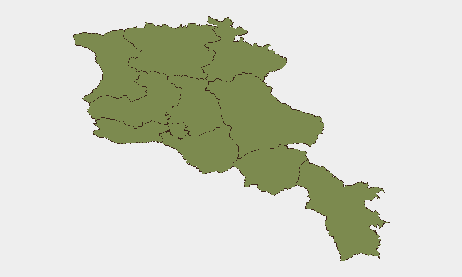
Situation Summary
Armenia remains at composite threat level 6 globally (#144), with 29 tracked events. Open-source reporting over the last 24–48 hours shows no major new security incidents, civil unrest, or infrastructure disruptions confirmed across multiple sources. The threat environment is characterized by persistent regional tensions—particularly visa/diplomatic tensions with Turkey and Azerbaijan, and a U.S. statement of disapproval on 2 July—but no acute escalation in the last two days. Risk concentration is heavily skewed toward Ararat Province (31.4) and Yerevan (22.6), with all other regions at baseline (1.4).
Key Developments
- 2026-07-04, nationwide: Deputy made a public statement (content not specified in available open sources); Foreign Ministry made a statement involving conventional military force posture (details require confirmation via direct Armenian government channels or regional intelligence feeds).
- 2026-07-02, Baku–Armenia border: Multiple threat statements issued by Baku toward Armenia; no reported military engagement or border crossing incidents confirmed in open reporting.
- 2026-07-02, diplomatic level: Turkey rejected an Armenian initiative; Ankara issued threats toward Armenia on at least three separate occasions. Israel issued a threat statement involving Turkey (not directly targeting Armenia).
- 2026-07-02, U.S. State Department: United States disapproved of an Armenian policy or action; Israel issued a public statement regarding Armenia (content unconfirmed in available open sources).
- 2026-07-02, Belarus–Armenia: Property seizure or damage event reported; limited open-source detail available.
Note: No field-level security incidents (shootings, bombings, protests, riots, kidnappings, or major crime events) are confirmed in GeoBit's indexed open web sources for 2026-07-04 to -05. Diplomatic and military posturing signals dominate the event feed; ground-level incidents may exist but are not yet widely reported in English-language media or cross-verified platforms.
Highest-Risk Areas
Ararat Province dominates the risk profile at 31.4—more than 40× higher than any other region—suggesting concentration of military activity, border tension, or infrastructure vulnerability in Armenia's southwestern corridor near the Azerbaijani and Turkish borders. Yerevan (22.6) reflects capital-city risks typical of political capitals: diplomatic incidents, protest potential, and concentration of government/foreign assets. All remaining provinces cluster at 1.4, indicating either lower baseline exposure or insufficient incident density in the current tracking window. For duty-of-care purposes, personnel and assets in Ararat should be subject to enhanced monitoring protocols; Yerevan warrants standard political-risk vigilance.
How GeoBit Would Assist
Corporate security teams should deploy AOI Monitoring & Early Warning on Ararat Province and Yerevan to detect emerging protest, military movement, or infrastructure incidents in near real-time via X/Twitter and Telegram OSINT, coupled with Conflict & Military battle-mapping and force-structure tracking to contextualize border posture shifts. Intel Sweep and multi-language search across Armenian government statements, OSINT fusion, and sentiment analysis would provide 24-hour lead time on diplomatic escalations before they affect travel or asset access. Routing & Network Analysis should be pre-loaded to enable rapid alternative-route planning if key infrastructure (airports, highways) closes due to unplanned incident or government order.
7-Day Outlook
No imminent military escalation is signaled in current open data, but diplomatic friction—especially with Turkey and Azerbaijan—remains chronic. Border posturing and threat rhetoric will likely persist; the risk of sudden localized incident (minor incursion, infrastructure sabotage, or protest) in Ararat or Yerevan cannot be ruled out. Teams should maintain baseline alert posture and confirm continuity of communication with local partners and embassy security offices.
Highest-Risk Areas — Ranked
| # | State / Region | Risk |
|---|---|---|
| 1 | Ararat Province | 31.4 |
| 2 | Yerevan | 22.6 |
| 3 | Lori Province | 1.4 |
| 4 | Tavush Province | 1.4 |
| 5 | Kotayk Province | 1.4 |
| 6 | Gegharkunik Province | 1.4 |
| 7 | Vayots Dzor Province | 1.4 |
| 8 | Syunik Province | 1.4 |
| 9 | Shirak Province | 1.4 |
| 10 | Aragatsotn Province | 1.4 |
| 11 | Armavir Province | 1.4 |
Sources
Previous Daily Briefs
A new Armenia brief is written every day — each with its own risk map and downloadable CSV. Here's the last week; use the calendar to go further back.
📅 Browse every day by calendar →
Highlighted days have a brief. Tap a day for that day's map & analysis, or “csv” for that day's dataset ($5).
Atlas — our AI intelligence desk — emails them this snapshot personally. Nothing else, no list.