Situation Summary
Azerbaijan remains in a low-threat operating environment with a composite threat score of 1 globally (rank #null) and no confirmed large-scale armed conflict, terrorism, or civil unrest in the last 24–48 hours. Recent activity centers on media-freedom tensions, isolated infrastructure incidents, and routine military operations rather than direct security threats to personnel or assets. The sub-national risk profile is heavily concentrated in Imishli District (risk 31.3), while Baku and other major urban centers register moderate risk, driven primarily by political and media-related friction rather than kinetic incidents.
Key Developments
- Baku (national) – 27 July 2026 – Media ban on Iranian outlets. Azerbaijan's Media Development Agency declared operations by Iranian outlets Sahar TV and Mehr News Agency illegal, citing threats to national interests and sovereignty. This reflects escalating information-sector tensions between Baku and Tehran but does not represent a direct physical security threat.
- Nakhchivan Autonomous Republic (Nakhchivan city) – 26–27 July 2026 – Transformer explosion. A localized electrical-infrastructure incident injured one person. Emergency services responded; the incident is classified as infrastructure/safety-related rather than deliberate sabotage, but signals potential utility disruptions in the region.
- Countrywide – 26–27 July 2026 – Large-scale Ground Forces exercise ongoing. Azerbaijan's military is conducting extensive operational maneuvers under the 2026 training plan, involving troop and equipment movements in unspecified training areas. This heightens visibility of military activity but remains routine.
- Jabrayil District (Shyukurbeyli village) – 26–27 July 2026 – Resettlement movement. 46 families (223 people) returned to a formerly conflict-affected area under state resettlement programs, indicating sustained post-conflict population reintegration into border-proximate zones.
- Baku (Correctional Facility No. 17) – 26–27 July 2026 – Activist hunger strike. Trade union activist Elvin Mustafaev was placed in a punishment cell and initiated a hunger strike, reflecting ongoing detainee-rights tensions within the penal system.
- Baku (Appellate Court) – 26–27 July 2026 – Activist sentence reduction. The court partially granted an appeal by activist Zamin Zaki, reducing his sentence by three months, signaling incremental movement within the judicial system on activism-related cases.
- Baku (Serious Crimes Court) – 26–27 July 2026 – Meydan TV trial continues. The independent-media trial resumed after judicial panel changes, reflecting persistent legal pressures on independent outlets.
Highest-Risk Areas
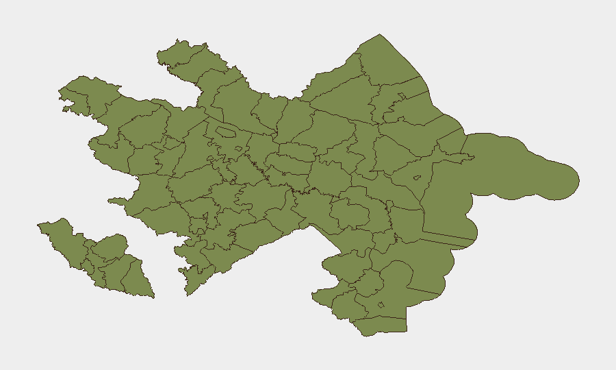
Imishli District drives the national risk profile at 31.3—roughly double all other regions—though the underlying drivers remain unclear from open-source reporting and warrant direct intelligence collection. Baku City (15.3) reflects media-freedom pressures, penitentiary tensions, and judicial activity around activist and media cases. Khankendi (3.3) and border districts including Sadarak, Qazakh, Sharur, and Tovuz carry lower but non-negligible scores, likely reflecting post-conflict sensitivities, resettlement dynamics, and proximity to disputed or formerly contested zones. Personnel and assets in Imishli should be prioritized for risk monitoring.
How GeoBit Would Assist
Security teams would deploy AOI Monitoring & Early Warning on Imishli District and Baku to detect escalation in political, media, or infrastructure incidents in real time. Intel Sweep and X/Twitter OSINT would track media-freedom developments and activist-related tensions that can precede broader civil friction. GIS & Spatial Analysis combined with conflict mapping would clarify risk drivers in border-proximate districts undergoing resettlement and help route personnel safely around heightened-activity zones.
7-Day Outlook
No material escalation is forecast in the near term; the operating environment is expected to remain low-threat with routine political and administrative friction. Military exercises and media-regulation moves are unlikely to generate kinetic incidents. Continued monitoring of Imishli District and penitentiary-related developments is warranted to detect any inflection point in activist or civil-society pressure.
Highest-Risk Areas — Ranked
| # | State / Region | Risk |
|---|---|---|
| 1 | Imishli District | 31.3 |
| 2 | Baku City | 15.3 |
| 3 | Khankendi | 3.3 |
| 4 | Sadarak District | 1.3 |
| 5 | Qazakh District | 1.3 |
| 6 | Sharur District | 1.3 |
| 7 | Yevlakh District | 1.3 |
| 8 | Kangarli District | 1.3 |
| 9 | Nakhchivan Autonomous Republic | 1.3 |
| 10 | Aghstafa District | 1.3 |
| 11 | Tovuz District | 1.3 |
| 12 | Qakh District | 1.3 |
Sources
Previous Daily Briefs
A new Azerbaijan brief is written every day — each with its own risk map and downloadable CSV. Here's the last week; use the calendar to go further back.
📅 Browse every day by calendar →
Highlighted days have a brief. Tap a day for that day's map & analysis, or “csv” for that day's dataset ($5).
Atlas — our AI intelligence desk — emails them this snapshot personally. Nothing else, no list.