Situation Summary
Comoros maintains a stable security posture at the macro level, with no acute incidents reported in the last 24–48 hours. The archipelago's composite threat score of 2 (rank #201 globally) reflects endemic governance and economic constraints rather than active conflict or widespread civil unrest. Risk remains concentrated in specific island jurisdictions, particularly Anjouan, where governance fragmentation and historical separatism create persistent vulnerabilities.
Key Developments
No credible, discrete security incidents—including protests, clashes, major crimes, infrastructure failures, or travel disruptions—were reported in Comoros during July 9–10, 2026, based on open-source news, social media, and web monitoring. The absence of incident reporting across monitored channels suggests the security environment has not deteriorated acutely over this 24–48 hour window. Personnel and asset risk assessment should rely on baseline threat models rather than reaction to new events.
Highest-Risk Areas
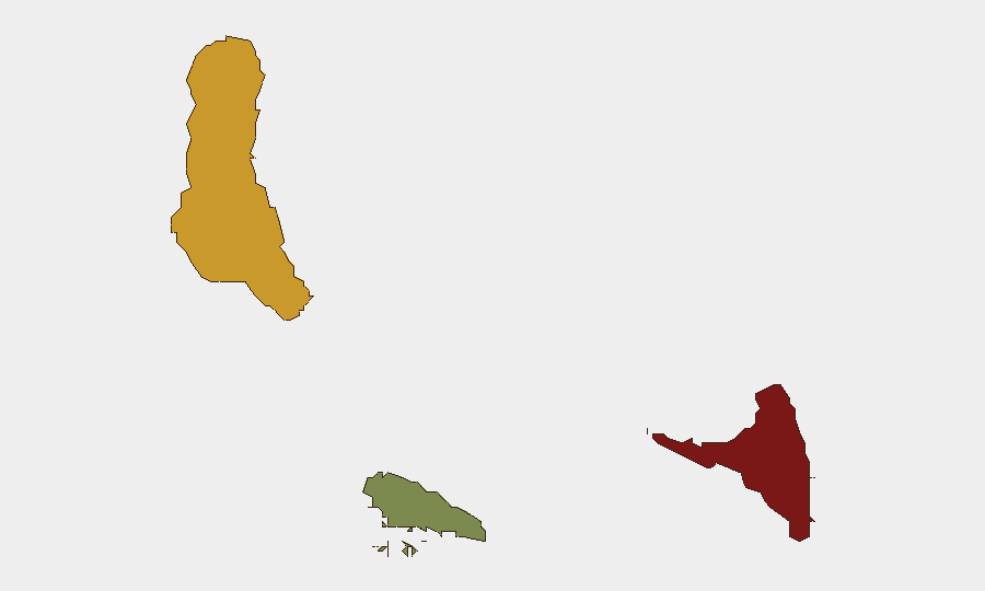
Anjouan (composite risk 88) and Grande Comore (risk 72) drive the archipelago's overall threat profile. Anjouan's ranking reflects historical governance instability, separatist sentiment, and limited state capacity; Grande Comore, the largest island and administrative center, concentrates population and economic activity, amplifying exposure to baseline crime, informal dispute resolution, and infrastructure gaps. Moheli (risk 35) remains significantly lower-risk. Organizations with personnel or assets on Anjouan should maintain heightened duty-of-care protocols; those on Grande Comore should apply standard baseline precautions for a low-income, maritime-dependent jurisdiction.
How GeoBit Would Assist
Intel Sweep & OSINT Fusion would continuously monitor Comoros-focused news feeds, social platforms (X, Telegram), and local sources to flag emerging civil unrest, crime spikes, or political instability within hours of occurrence. AOI Monitoring & Early Warning on high-risk districts in Anjouan and Moroni would provide persistent alerting if protest activity, security force mobilization, or other acute events occur. Routing & Network Analysis would support duty-of-care teams in identifying secure transit corridors and alternative evacuation routes should a personnel security incident arise.
7-Day Outlook
No significant deterioration in the Comoros security environment is forecast over the next seven days based on current indicators. Monitoring should remain routine but consistent; organizations should ensure baseline contingency plans (personnel accountability, emergency transport, local authority contacts) are current and tested, given the archipelago's geographic isolation and limited rapid-response infrastructure.
ANALYST NOTE: This brief reflects the absence of incident reporting in the 24–48 hour window. Security conditions in Comoros can shift rapidly with political or administrative crises on Anjouan. Teams are advised to request expanded time-window analysis or sub-national monitoring if longer-term trend assessment is required.
Highest-Risk Areas — Ranked
| # | State / Region | Risk |
|---|---|---|
| 1 | Anjouan | 88 |
| 2 | Grande Comore | 72 |
| 3 | Moheli | 35 |
Sources
Previous Daily Briefs
A new Comoros brief is written every day — each with its own risk map and downloadable CSV. Here's the last week; use the calendar to go further back.
📅 Browse every day by calendar →
Highlighted days have a brief. Tap a day for that day's map & analysis, or “csv” for that day's dataset ($5).
Atlas — our AI intelligence desk — emails them this snapshot personally. Nothing else, no list.