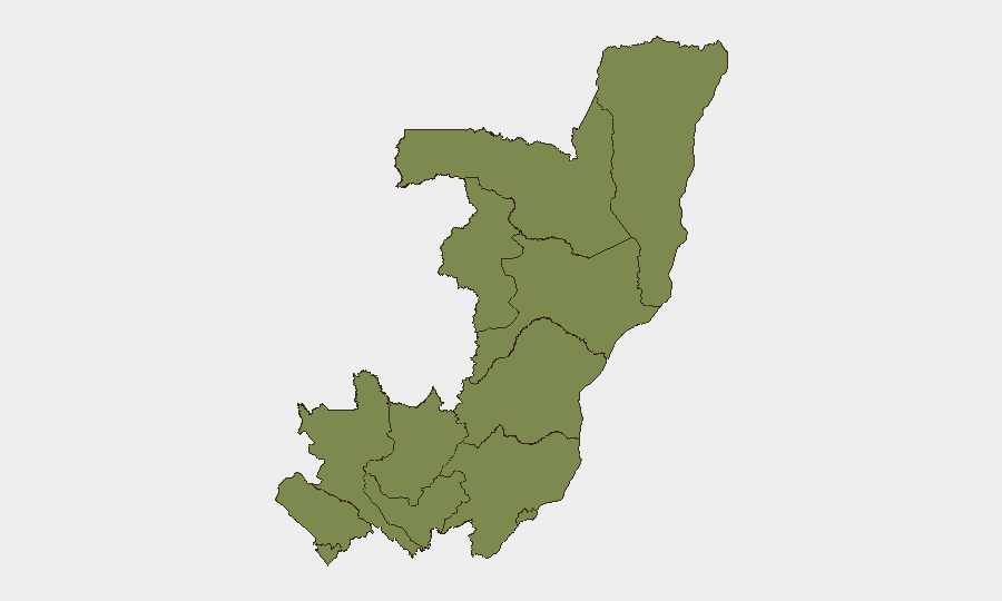
Situation Summary
Congo remains a #37 global threat environment (composite score 56) with 818 tracked events, characterized by localized conventional military clashes and ongoing remote-area reporting gaps that mask underlying risks. The most recent verified incidents on 7 July involved resident-worker and worker-resident confrontations alongside authorities engagement, all concentrated in high-risk Cuvette-Ouest. No discrete security incidents have been corroborated in Congo proper during the last 24–48 hours via open-source reporting; however, this reflects typical delays in remote conflict zone coverage rather than absence of underlying threats.
Key Developments
- 7 July, Cuvette-Ouest Department: Multiple conventional military force incidents recorded between residents and workers, and involving authorities. Cuvette-Ouest remains the country's highest-risk zone (score 31.5), accounting for the majority of Congo's tracked threat events.
- 9 July, National/Regional: Diplomatic friction noted between Democratic Republic of Congo and Somalia (demand signal) and between DRC and Darfur (disapproval), reflecting broader regional tensions that may indirectly influence stability and cross-border movement.
- 7–9 July, National: Open-source reporting explicitly identifies a 24–48 hour data gap for time-stamped security incidents in Congo, attributed to communication delays from conflict-affected and remote regions rather than operational quiet.
- Recent (unspecified dates), DRC: Multiple wildfire events tracked across DRC territory (at least five recorded), with potential indirect impacts on transportation corridors, air quality, and displaced populations; timing relative to Congo proper remains unclear from available signals.
- Background context (since mid-May, eastern DRC): UN OCHA documents 76 security incidents and 45 wounded targeting Ebola response workers in Ituri, North Kivu, and South Kivu; Ituri health facilities reported wage-related work stoppages, though exact dates of individual strike initiations are not specified in current reporting.
Highest-Risk Areas
Cuvette-Ouest Department drives the majority of Congo's composite threat score (31.5 of 56 nationally), with all other departments clustered at 1.5 and Brazzaville at baseline. The concentration suggests either genuine localization of incidents in the Cuvette-Ouest region or systematic reporting/surveillance bias toward that zone. Security teams should treat Cuvette-Ouest as the primary focus for duty-of-care assessment; all other departments present relatively homogeneous baseline risk, though remote access and communication gaps in departments such as Sangha and Likouala may mask underreported incidents.
How GeoBit Would Assist
Teams operating in Congo should deploy AOI Monitoring & Early Warning on Cuvette-Ouest and secondary departments to capture incident alerts before media lag; multi-language OSINT Sweep and Telegram/X monitoring to detect emerging worker-resident, authority, or resource-related confrontations; and Routing & Network Analysis to identify alternative supply and personnel movement corridors when primary routes cross high-risk zones. Satellite & Imagery analysis and Environmental & Health monitoring would help track wildfire progression and resulting displacement or access disruption.
7-Day Outlook
Cuvette-Ouest incident frequency and worker-resident tensions suggest localized but recurring friction tied to resource or labor disputes rather than large-scale coordinated conflict. Underlying armed-group and mineral-corridor crime risks remain stable but unverified by recent open reporting. No indicators of imminent national escalation are evident, though reporting delays mean assessment confidence remains moderate.
Highest-Risk Areas — Ranked
| # | State / Region | Risk |
|---|---|---|
| 1 | Cuvette-Ouest Department | 31.5 |
| 2 | Sangha | 1.5 |
| 3 | Likouala | 1.5 |
| 4 | Cuvette Department | 1.5 |
| 5 | Kouilou Department | 1.5 |
| 6 | Niari Department | 1.5 |
| 7 | Pointe-Noire (département) | 1.5 |
| 8 | Lékoumou Department | 1.5 |
| 9 | Bouenza Department | 1.5 |
| 10 | Plateaux Department | 1.5 |
| 11 | Pool Department | 1.5 |
| 12 | Brazzaville (department) | 1.5 |
Sources
Previous Daily Briefs
A new Congo brief is written every day — each with its own risk map and downloadable CSV. Here's the last week; use the calendar to go further back.
📅 Browse every day by calendar →
Highlighted days have a brief. Tap a day for that day's map & analysis, or “csv” for that day's dataset ($5).
Atlas — our AI intelligence desk — emails them this snapshot personally. Nothing else, no list.