Situation Summary
Guinea remains a low-to-moderate security risk globally (rank #91, composite threat score 12) with acute concentration in Kankan Region in the southeast, which accounts for the majority of tracked security events. Open-source monitoring over the last 24–48 hours has not identified any verifiable, geographically specific incidents (clashes, arrests, infrastructure damage, or cross-border incursions) that meet intelligence-grade standards for date certainty and multi-source confirmation. The security environment is characterized by chronic border tensions with neighboring Liberia and Sierra Leone, administrative and governance friction, and periodic arrest/detention activity, but no tactical escalation has been documented in the immediate reporting window.
Key Developments
No verifiable security or travel-risk incidents with specific dates (June 22–24, 2026) and confirmed locations have been identified in Guinea in the last 24–48 hours based on current open-source and social-media monitoring. Recent event-signal data (June 23) flagged administrative sanctions and public statements involving government actors, but these lack geographic precision and tactical specificity necessary for operational risk assessment. Border-related diplomatic and security dynamics with neighboring states continue to be reported in international media, but available coverage does not document a new, clearly dated tactical incident (such as a military clash or cross-border incursion) in the reporting window. Monitoring of unconfirmed social-media claims regarding "security tightening" or military activity shows no corroborating dates, source attribution, or secondary confirmation and cannot be treated as current developments. Security teams should note that event-signal volume and sub-national risk concentration remain highest in Kankan Region, warranting continued persistent monitoring rather than reactive response to unconfirmed claims.
Highest-Risk Areas
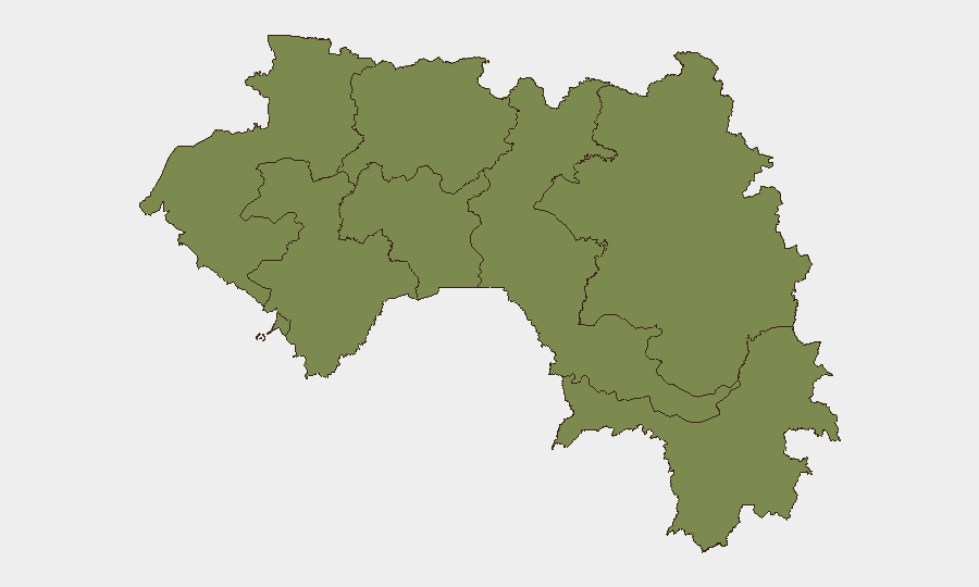
Kankan Region (composite risk 34.3) is the primary driver of Guinea's overall threat profile, accounting for the vast majority of tracked security events and representing a materially higher risk environment than the remainder of the country. Conakry (risk 11.2) remains elevated due to administrative, governance, and arrest/detention activity, though the city itself does not exhibit the tactical violence or conflict intensity observed in Kankan. All other regions (Boké, Labé, Kindia, Mamou, Faranah, Nzérékoré) score similarly in the 4.3 range, indicating a lower and relatively uniform baseline risk profile. The geographic concentration in Kankan suggests that organizations with personnel or supply-chain exposure in that region should apply higher duty-of-care standards (communications protocols, movement restrictions, local liaison) than those operating in the capital or coastal areas.
How GeoBit Would Assist
Security and risk teams would use Intel Sweep and multi-source OSINT fusion (including X/Twitter, Telegram, and regional news feeds) to establish a real-time baseline of tactical incidents and arrest/detention activity in Kankan and Conakry, filtering out undated or unconfirmed social-media claims. Persistent AOI (Area-of-Interest) monitoring with alerting on Kankan Region, border zones, and government facilities would provide early warning of clashes, checkpoints, or security force movements affecting freedom of movement or asset security. GIS and conflict mapping capabilities would enable organizations to overlay their personnel locations or supply routes against active incident hotspots and assess exposure in real time.
7-Day Outlook
The security environment in Guinea is expected to remain stable at current baseline levels over the coming week, with no indicators of imminent tactical escalation in Conakry or major urban centers. Kankan Region should continue to receive elevated monitoring for border-related incidents and inter-group tensions; any new arrest/detention surge or military repositioning would warrant prompt re-assessment of supply-chain and personnel routing. Diplomatic activity and regional border negotiations are likely to continue in background, but without verifiable escalation triggers, the operational risk posture is unlikely to change materially.
Highest-Risk Areas — Ranked
| # | State / Region | Risk |
|---|---|---|
| 1 | Kankan Region | 34.3 |
| 2 | Conakry | 11.2 |
| 3 | Boké Region | 4.3 |
| 4 | Labé Region | 4.3 |
| 5 | Kindia Region | 4.3 |
| 6 | Mamou Region | 4.3 |
| 7 | Faranah Region | 4.3 |
| 8 | Nzérékoré Region | 4.3 |
Previous Daily Briefs
A new Guinea brief is written every day — each with its own risk map and downloadable CSV. Here's the last week; use the calendar to go further back.
📅 Browse every day by calendar →
Highlighted days have a brief. Tap a day for that day's map & analysis, or “csv” for that day's dataset ($5).