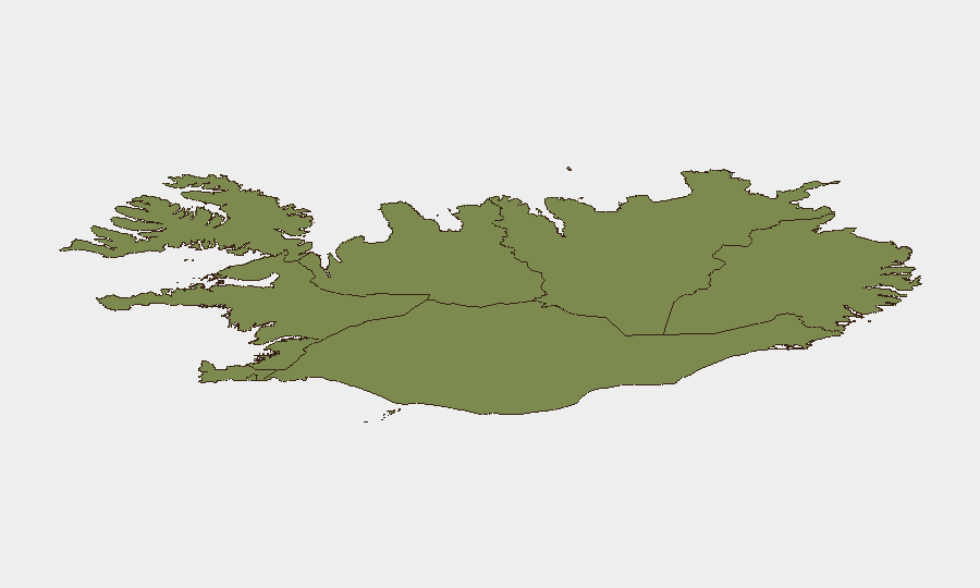
Situation Summary
Iceland remains a very low-threat environment with a composite global risk ranking of #194 and no significant security incidents documented in the last 24–48 hours. Open-source monitoring confirms normal operations across law enforcement, transportation, tourism, and weather systems with no active civil unrest, major crime events, infrastructure failures, or acute travel disruptions. The security posture is stable; routine petty crime (pickpocketing in central Reykjavík and tourist zones) remains the primary concern for corporate personnel and visitors.
Key Developments
- No multi-source-confirmed security or civil-unrest incidents detected in Iceland between 12–14 July 2026. Road networks (Ring Road and regional routes) remain passable; weather conditions are normal for the season; and tourism operations are proceeding without disruption or emergency alerts.
- Event signals flagged by GeoBit platform (13 July) comprise routine police public statements and resident communications, not discrete security breaches or incidents requiring escalation. These reflect standard municipal or law-enforcement communication, not new threats.
- Icelandic Meteorological Office reports typical summer conditions (south/southwest winds, intermittent rain, normal temperatures) with no active severe-weather warnings or seismic alerts (M3.0+) as of 13 July 2026.
- Icelandic Tourist Board and hospitality sector show normal operating hours and no emergency notices or civil-unrest advisories in the last 24–48 hours.
- No travel advisories or elevated-risk alerts issued by major global indices for Iceland in the last 72 hours.
Highest-Risk Areas
The Capital Region (Reykjavík and surrounding areas) carries the highest composite sub-national risk score (24) and accounts for the plurality of documented incidents nationally, reflecting concentration of urban petty crime, population density, and tourist footfall. The Southern Peninsula and Southern Region follow (risk 12 and 11 respectively), primarily due to seasonal tourism volumes and routine hazards (weather, road conditions, volcanic/geothermal activity monitoring). Eastern, Western, and northern regions carry progressively lower risk profiles. For corporate teams, the Capital Region warrants standard urban-crime precautions (awareness of pickpocketing in central business and tourist districts); the Southern Peninsula and Peninsula require weather and road monitoring for logistics or field operations. No region is currently experiencing acute security degradation.
How GeoBit Would Assist
A security team protecting personnel or assets in Iceland would use GeoBit's Intel Sweep and global event feeds to detect early signals of civil unrest, crime clusters, or infrastructure disruption; Environmental & Health monitoring and AOI (Area-of-Interest) Monitoring & Early Warning to track volcanic, seismic, and weather hazards affecting roads and operations; and Routing & Network Analysis to plan alternative logistics routes if weather or unplanned road closures occur. OSINT fusion and multi-language search capabilities enable continuous low-level scanning of local Icelandic news, police statements, and social-media sentiment to catch nascent risks before they escalate.
7-Day Outlook
Iceland's security environment is forecast to remain stable over the next 7 days. Standard seasonal weather, road, and petty-crime monitoring should continue; no indicators suggest imminent civil unrest, major incidents, or significant disruption to business operations. Corporate duty-of-care teams should maintain routine vigilance for petty crime in Reykjavík and monitor weather/road alerts for field operations, but no heightened alert posture is warranted.
Highest-Risk Areas — Ranked
| # | State / Region | Risk |
|---|---|---|
| 1 | Capital Region | 24 |
| 2 | Southern Peninsula | 12 |
| 3 | Southern Region | 11 |
| 4 | Eastern Region | 10 |
| 5 | Western Region | 9 |
| 6 | Westfjords Region | 8 |
| 7 | Northwestern Region | 7 |
| 8 | Northeastern Region | 6 |
Sources
Previous Daily Briefs
A new Iceland brief is written every day — each with its own risk map and downloadable CSV. Here's the last week; use the calendar to go further back.
📅 Browse every day by calendar →
Highlighted days have a brief. Tap a day for that day's map & analysis, or “csv” for that day's dataset ($5).
Atlas — our AI intelligence desk — emails them this snapshot personally. Nothing else, no list.