Situation Summary
The Maldives remains a low-incident jurisdiction with no confirmed acute security, civil-unrest, or terrorism events in the past 24–48 hours. National police leadership continues standard posture statements around crime prevention and sovereignty protection. The country's security environment is characterized by structural risk factors (reflected in elevated international travel advisories) rather than active operational incidents, and the trajectory is stable.
Key Developments
- Malé (national) – late July 2026 – Police Commissioner Ahmed Mohamed issued a public statement reaffirming the Maldives Police Service's commitment to national security, sovereignty protection, and low-crime society development; no specific new incident was cited, indicating routine operational messaging rather than crisis response.
- Sinamalé Bridge (Malé–Hulhumalé corridor) – 25 July 2026 – Police fined three individuals MVR 8,000 total and impounded three motorcycles for 30 days following high-speed dangerous riding captured on social media; case referred to Ministry of Transport as part of road-safety enforcement.
- Hulhumalé Phase 1, Apollo Crystal Building – 25 July 2026 – Fire broke out in an eighth-floor residential balcony (wood material ignition) at approximately 1:57 p.m.; police and residents extinguished fire with no casualties; Maldives Police Service investigation ongoing on cause.
- National (Maldives Customs) – late July 2026 – Customs Service intercepted narcotics valued at approximately MVR 2 million in air-cargo smuggling; interdiction is routine border enforcement with no associated violence or wider operational impact reported.
- National – travel advisory status unchanged – late July 2026 – Australian Smartraveller advisory maintains "exercise a high degree of caution" recommendation for Maldives citing civil-unrest and terrorism risk; no new specific incidents recorded to justify further escalation in the last 48 hours.
Highest-Risk Areas
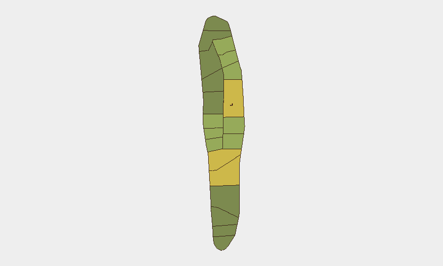
Malé and Malé Atoll (risk scores 85 and 68 respectively) dominate the sub-national ranking, reflecting the capital's role as the political, administrative, and commercial hub where governance instability, civil unrest, and organized crime pose the primary structural risks. The northern atolls—Hadhdhunmathi, Kolhumadulu, and Felidhu (scores 65, 60, 58)—show elevated but secondary risk, likely driven by limited state capacity, inter-island governance friction, and informal economic activity. Southern atolls (North and South Nilandhe, South Ari) register lower scores, suggesting less political volatility and crime concentration, though tourism infrastructure in South Ari may warrant separate duty-of-care assessment.
How GeoBit Would Assist
Security teams with staff or assets in Maldives should deploy AOI Monitoring & Early Warning on Malé and the northern atolls to detect early signals of civil unrest or governance crisis before they escalate. OSINT fusion (X/Twitter, Telegram, local news aggregation) provides real-time detection of protest mobilization, police activity, and public sentiment shifts across political or economic flashpoints. Risk & Threat Assessment tools enable continuous recalibration of duty-of-care protocols as structural risk (terrorism, organized crime, maritime piracy in shipping corridors) evolves; Routing & Network Analysis supports contingency evacuation planning for personnel based in Malé or resort islands.
7-Day Outlook
No acute incident indicators are present. The security environment is expected to remain stable in the near term, with police and customs operations continuing routine law-enforcement and border-interdiction activities. Structural risks—including low-level civil-unrest potential tied to domestic politics and transnational organized crime—remain unchanged and warrant sustained monitoring rather than crisis readiness.
Highest-Risk Areas — Ranked
| # | State / Region | Risk |
|---|---|---|
| 1 | Malé | 85 |
| 2 | Malé Atoll | 68 |
| 3 | Hadhdhunmathi | 65 |
| 4 | Kolhumadulu | 60 |
| 5 | Felidhu Atoll | 58 |
| 6 | Mulaku Atoll | 55 |
| 7 | Faadhippolhu | 52 |
| 8 | South Miladhunmadulu | 48 |
| 9 | North Miladhunmadulu | 45 |
| 10 | South Nilandhe Atoll | 44 |
| 11 | North Nilandhe Atoll | 42 |
| 12 | South Ari Atoll | 40 |
Sources
Previous Daily Briefs
A new Maldives brief is written every day — each with its own risk map and downloadable CSV. Here's the last week; use the calendar to go further back.
📅 Browse every day by calendar →
Highlighted days have a brief. Tap a day for that day's map & analysis, or “csv” for that day's dataset ($5).
Atlas — our AI intelligence desk — emails them this snapshot personally. Nothing else, no list.