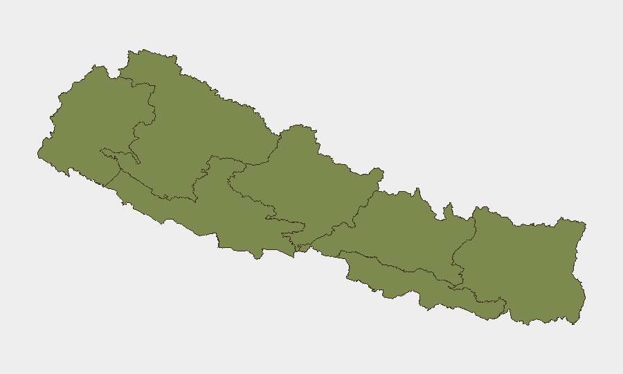
Situation Summary
Nepal faces a mixed but volatile security environment, with the overall national threat composite at 20 (ranked #null globally), but with significant regional concentration in Koshi Province. A fatal communal clash in Sunsari district on 26–27 July, coupled with elevated road casualties, wildlife incidents, and ongoing monsoon-related flooding, reflects both acute flashpoint risk and systemic hazards. While no nationwide political instability is evident from recent signals, the clustering of events in Koshi Province and the imposition of prohibitory orders in Sunsari warrant close duty-of-care monitoring.
Key Developments
- Communal clash with live-fire response, Sunsari district (Koshi Province), 26–27 July: A religious community dispute over loudspeakers and flags escalated into violence in Kaptangunj, Devgunj Rural Municipality. Security forces fired live rounds, killing a 24-year-old man and injuring more than a dozen. Authorities imposed indefinite prohibitory orders from 07:00 on 27 July, banning gatherings of four or more people, demonstrations, and public meetings across five market areas, with penalties of fines or up to one month imprisonment.
- Nationwide road casualties, 24-hour period ending 27 July: Nepal Police documented at least 7 deaths and 105 injuries in traffic accidents across the country within 24 hours, indicating elevated risk on highways and local roads during monsoon season.
- Large marijuana seizure on Koshi Highway, Dhankuta district, 26–27 July: Police intercepted 775 kg of concealed marijuana on a mini-truck in Sangurigadhi Rural Municipality-6, Kolbote. The scale of the seizure suggests significant trafficking activity and signals likely intensified police enforcement and vehicle checks on this route.
- Fatal wildlife attack, Bharatpur Metropolitan City, Chitwan district, 25 July: A wild elephant attacked a residential home, killing a woman and four-year-old child. The incident underscores human–wildlife conflict risk near forested conservation zones, particularly during night hours.
- Ongoing flood rescue, Dolpa district, current monsoon period: A flooding event claimed one life and injured six; 176 security personnel, divers, drones, and a military helicopter are conducting active search operations in hazardous water conditions, indicating infrastructure disruption and ongoing emergency response in the region.
- Security sweep with arrests, Rautahat district, within 24–48 hours of 27 July: Police arrested 21 convicted fugitives in a single-day enforcement operation and have deployed drone surveillance over Gaur and surrounding areas, signalling intensified visible policing activity.
- Passport system investigation, Kathmandu, 24–48 hours: Authorities widened investigations into data migration failures and tender irregularities affecting passport issuance and stock levels, raising risk of processing delays for international travel.
Highest-Risk Areas
Koshi Province dominates the sub-national risk ranking at 31.3 and is the immediate flashpoint, driven by the communal violence in Sunsari district and drug-trafficking activity on the Koshi Highway. Bagamati Province (risk 22) remains elevated, likely reflecting urban unrest signals and administrative issues in the Kathmandu area. Lumbini Province (16.1) presents secondary concern. All other provinces remain below 6.0, suggesting risk is geographically concentrated in the eastern and central lowlands and Kathmandu valley.
How GeoBit Would Assist
Security teams should employ AOI Monitoring & Early Warning to maintain persistent watch over Koshi Province, particularly Sunsari district, with alerting on police mobilization, gatherings, or transport disruptions. Intel Sweep and X/Twitter & Telegram OSINT provide real-time signals on communal sentiment and local announcements of curfews or prohibitory orders. Routing & Network Analysis identifies alternative routes around Koshi Highway given trafficking enforcement and accident risk, and Conflict & Military tracking monitors police positioning and force deployment.
7-Day Outlook
The prohibitory orders in Sunsari are likely to suppress immediate escalation but do not resolve underlying communal tensions; risk of renewed flare-up remains if restrictions are eased prematurely or triggers resurface. Monsoon-season road and flooding hazards will persist; businesses and personnel should expect continued operational disruption, particularly in Dolpa, Humla, and other mountainous zones. No indication of national-level political crisis, but Koshi Province warrants daily intelligence review.
Highest-Risk Areas — Ranked
| # | State / Region | Risk |
|---|---|---|
| 1 | Koshi Province | 31.3 |
| 2 | Bagamati Province | 22 |
| 3 | Lumbini Province | 16.1 |
| 4 | Karnali Province | 5.5 |
| 5 | Gandaki Province | 1.8 |
| 6 | Sudurpashchim Province | 1.3 |
| 7 | Madhesh Province | 1.3 |
Sources
Previous Daily Briefs
A new Nepal brief is written every day — each with its own risk map and downloadable CSV. Here's the last week; use the calendar to go further back.
📅 Browse every day by calendar →
Highlighted days have a brief. Tap a day for that day's map & analysis, or “csv” for that day's dataset ($5).
Atlas — our AI intelligence desk — emails them this snapshot personally. Nothing else, no list.