Situation Summary
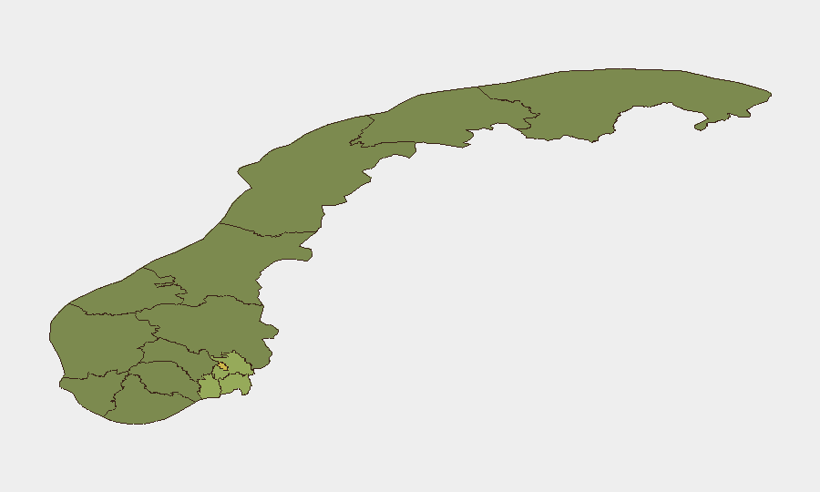
Norway maintains a low overall security profile with a composite threat score of 7 and no indicators of large-scale conflict, terrorist execution, or widespread civil unrest in the last 24–48 hours. The security environment is characterized by routine localized crime and police operations, with open-source travel advisories continuing to recommend standard safety precautions. Risk concentration is highest in the southeastern corridor—Oslo, Akershus, and Østfold counties—reflecting urban crime patterns rather than political instability or infrastructure threats. The trajectory remains stable with no emerging nationwide security developments.
Key Developments
- Trondheim, Trøndelag – 29 July 2026: Armed police operation at a commercial premises in Angeltrøa following a threatening individual's entry; evacuation of customers and staff executed; individual secured by approximately 15:05 with no reported injuries or ongoing danger to surrounding residents.
- Oslo and surrounding regions: Elevated composite risk scores (Oslo 68, Akershus 52, Østfold 48) reflect documented concentration of localized crime activity rather than coordinated security incidents; no new escalation reported in the last 48 hours.
- International political signaling: Signal traffic from international actors (Africa, South Africa, Israel, United States, Palestinian entities) regarding Norway detected in event feeds; however, no evidence these translate into on-ground security impact or operational threats within Norwegian territory as of 30 July 2026.
- Routine crime baseline: Police and open-source reporting confirm only standard urban and regional crime patterns; no organized violence, gang activity escalation, or criminal infrastructure disruptions reported in the last 24–48 hours.
- Travel and infrastructure: No new advisories, transport disruptions, or critical-infrastructure incidents reported; normal operations continue.
Highest-Risk Areas
Oslo (risk 68) and the Akershus–Østfold corridor (52 and 48 respectively) account for the concentration of documented security events and drive the national ranking. This pattern reflects expected urban crime density in Norway's largest metropolitan area and southeastern population centers rather than novel threats or conflict dynamics. Rogaland and Buskerud counties show moderate residual risk (38 and 35), while rural and northern regions (Innlandet, Møre og Romsdal, Agder) register significantly lower composite scores. Risk distribution is consistent with demographic and economic geography; no region shows signs of acute political instability, organized extremism, or infrastructure vulnerability at present.
How GeoBit Would Assist
Corporate security teams with personnel or assets in Norway should deploy AOI Monitoring & Early Warning on Oslo and the southeastern corridor to detect escalation in crime or localized police operations before they affect business continuity. Network & Actor Analysis and OSINT Fusion capabilities enable continuous intelligence synthesis from local police statements, municipal announcements, and sentiment shifts on Norwegian-language social platforms (X, Telegram) to flag emerging threats weeks ahead of mainstream media. Routing & Network Analysis supports duty-of-care teams by identifying alternative transportation and site-access pathways around documented high-risk zones, reducing operational friction without assuming broad travel restrictions.
7-Day Outlook
No material deterioration in the Norwegian security environment is anticipated in the next seven days. The single armed police operation in Trondheim appears contained and localized. Trajectory remains stable, contingent on no major escalation in documented international political tensions directed specifically at Norwegian interests or population centers.
Highest-Risk Areas — Ranked
| # | State / Region | Risk |
|---|---|---|
| 1 | Oslo | 68 |
| 2 | Akershus | 52 |
| 3 | Østfold | 48 |
| 4 | Vestfold | 42 |
| 5 | Rogaland | 38 |
| 6 | Buskerud | 35 |
| 7 | Trøndelag | 32 |
| 8 | Telemark | 28 |
| 9 | Vestland | 27 |
| 10 | Agder | 26 |
| 11 | Møre og Romsdal | 22 |
| 12 | Innlandet | 20 |
Sources
Previous Daily Briefs
A new Norway brief is written every day — each with its own risk map and downloadable CSV. Here's the last week; use the calendar to go further back.
📅 Browse every day by calendar →
Highlighted days have a brief. Tap a day for that day's map & analysis, or “csv” for that day's dataset ($5).
Atlas — our AI intelligence desk — emails them this snapshot personally. Nothing else, no list.