Situation Summary
Taiwan remains at composite threat level 6 (rank #136 globally), with 32 tracked events under active monitoring. The security environment is characterized by routine government resilience activities, baseline cross-strait tension, and diplomatic developments, with no major kinetic incidents reported in the last 24–48 hours. Taipei's elevated sub-national risk score (31.5) reflects its role as the political and administrative center, while Nantou County's secondary ranking (12.1) follows from a planned multi-hazard resilience exercise conducted July 3. The overall trajectory remains stable within Taiwan's endemic geopolitical and natural-disaster risk profile.
Key Developments
Note: GeoBit's 24–48-hour web research has not surfaced clearly time-stamped, verifiable security incidents specific to July 5–6, 2026. The most recent confirmed development falls outside this window:
- Taipei – June 25, 2026 – Espionage sentencing (legal/security domain). Taiwan High Court reduced prison sentences for three ex-DPP staffers convicted of passing classified information to Chinese intelligence and acquitted a fourth. This signals ongoing counterintelligence enforcement in the capital and underscores state-actor penetration as a persistent threat vector.
- Nantou County – July 3, 2026 – Tabletop resilience exercise (planned government activity). President Lai's administration conducted a closed-door multi-hazard crisis simulation incorporating Chinese blockade, earthquake, infrastructure sabotage, bank runs, civil unrest, and invasion scenarios. This is a structural government preparedness effort, not an incident, but reflects elevated official concern regarding compound crisis risk in central Taiwan.
Assessment: The absence of breaking security incidents in the last 24–48 hours does not indicate reduced underlying risk—rather, it reflects the current operational baseline. GeoBit event feeds continue to track low-frequency signals (arrests, military posture, diplomatic statements, cross-strait rhetoric) that are consistent with Taiwan's structural threat environment but have not crystallized into acute escalation in the immediate reporting window.
Highest-Risk Areas
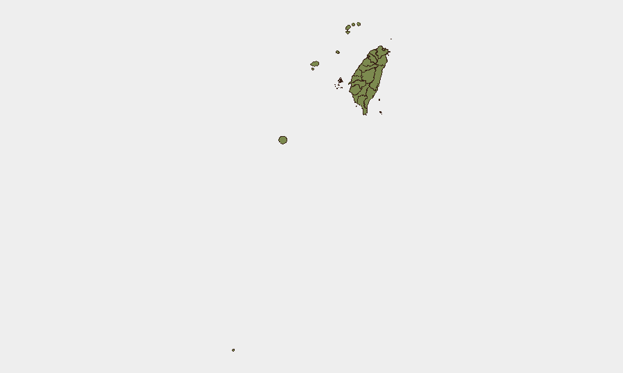
Taipei dominates the sub-national risk profile (31.5) as Taiwan's capital, political seat, and primary target for both conventional and non-kinetic operations. Its elevated score reflects concentration of government institutions, military command nodes, critical infrastructure, and foreign-national presence. Nantou County's secondary ranking (12.1) is driven by the July 3 resilience exercise and reflects its geography (central, mountainous, logistics-critical) and role in Taiwan's defense planning. All other counties score uniformly at 1.5–1.6, indicating distributed baseline risk with no acute localized threats outside the capital and central regions. For duty-of-care planning, Taipei should remain the primary geographic focus for contingency and evacuation protocols.
How GeoBit Would Assist
Corporate teams managing Taiwan exposure should employ AOI Monitoring & Early Warning to maintain persistent surveillance of Taipei and secondary risk zones (Nantou, Kaohsiung) for emerging unrest, infrastructure disruptions, or military activity. Intel Sweep and multi-language OSINT (including X/Telegram monitoring and entity extraction) provide early detection of cross-strait rhetoric escalation, diplomatic ruptures, or cyber/espionage activity before they reach conventional media. Conflict & Military tracking and satellite/imagery analysis enable real-time assessment of PRC force posture and exercise activity that may signal policy shifts or heightened readiness.
7-Day Outlook
Taiwan's security posture is expected to remain in a routine monitoring state over the next seven days, absent new diplomatic ruptures or PRC military exercises. Government resilience activities and baseline cross-strait tensions will likely persist. Any material change would likely manifest first in diplomatic signaling, military repositioning, or cyber/espionage activity, all of which GeoBit tracks continuously.
Highest-Risk Areas — Ranked
| # | State / Region | Risk |
|---|---|---|
| 1 | Taipei | 31.5 |
| 2 | Nantou County | 12.1 |
| 3 | Kaohsiung | 1.5 |
| 4 | Pingtung County | 1.5 |
| 5 | Taitung County | 1.5 |
| 6 | Lienchiang County | 1.5 |
| 7 | Kinmen | 1.5 |
| 8 | Penghu | 1.5 |
| 9 | Changhua County | 1.5 |
| 10 | Miaoli County | 1.5 |
| 11 | Taichung | 1.5 |
| 12 | Yunlin County | 1.5 |
Sources
Previous Daily Briefs
A new Taiwan brief is written every day — each with its own risk map and downloadable CSV. Here's the last week; use the calendar to go further back.
📅 Browse every day by calendar →
Highlighted days have a brief. Tap a day for that day's map & analysis, or “csv” for that day's dataset ($5).
Atlas — our AI intelligence desk — emails them this snapshot personally. Nothing else, no list.