Situation Summary
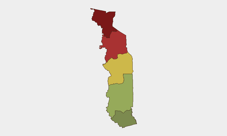
Togo remains a low-threat environment globally (rank #86) with a composite threat score of 19, though acute security concerns are concentrated in the Savanes and Kara regions bordering Burkina Faso and Benin, where jihadist activity and cross-border movement pose ongoing risks. The country's northern tier faces significantly elevated exposure; the southern Maritime Region remains comparatively secure. No new violence, attacks, or major protests were recorded in the past 24–48 hours; the security environment has remained stable at the national level since mid-August.
Key Developments
- Binah Prefecture (Kara Region), 22 August 2026 – The Togolese government issued a formal public statement clarifying the detention of two French journalists and a Togolese collaborator arrested on 27 July near the Matchatom market while filming with a drone. Authorities cited "serious and corroborated indications" of false declarations under the penal code in immigration procedures; all three remain under pre-trial detention following formal charges on 17 August, with the case now assigned to an investigating judge. The government's statement emphasized that the arrest location falls within a jihadist-sensitive security zone near the Benin border.
Highest-Risk Areas
The Savanes Region (risk score 92) and Kara Region (risk score 78) drive Togo's security profile and account for the majority of documented threats. Both regions border Burkina Faso and Benin and are subject to reported jihadist infiltration, cross-border weapons movement, and sporadic militant activity—factors that informed authorities' characterization of the Binah filming incident as occurring in a "special security sensitivity" area. Centrale Region (65) carries moderate risk; Plateaux (45) and Maritime (28) are substantially lower-risk but warrant standard duty-of-care monitoring. Organizations with personnel or assets in Savanes and Kara should maintain enhanced vigilance, verify local security conditions before travel, and coordinate with host-nation authorities on area restrictions.
How GeoBit Would Assist
Security teams should deploy Area-of-Interest (AOI) Monitoring & Early Warning on Savanes and Kara regions to track cross-border movement, militant positioning, and checkpoint activity in real time. Intel Sweep and multi-language OSINT (X/Twitter, Telegram, local news) provide ongoing situational awareness of arrests, government statements, and security incidents—as demonstrated by the 22 August government communication. GIS & Spatial Analysis combined with Conflict & Military capability enables mapping of jihadist-active zones and travel-route risk assessment for corporate personnel transiting northern Togo.
7-Day Outlook
No imminent escalation is anticipated in the near term. The journalist detention case is likely to proceed through judicial review without triggering wider instability; however, the case underscores government sensitivity to foreign media activity in border zones and may affect approval timelines for documentary or research teams. Northern border regions will remain under baseline jihadist pressure, and organizations should continue standard AOI monitoring and liaison with host authorities to confirm movement corridors and curfew status.
Highest-Risk Areas — Ranked
| # | State / Region | Risk |
|---|---|---|
| 1 | Savanes Region | 92 |
| 2 | Kara Region | 78 |
| 3 | Centrale Region | 65 |
| 4 | Plateaux Region | 45 |
| 5 | Maritime Region | 28 |
Sources
Previous Daily Briefs
A new Togo brief is written every day — each with its own risk map and downloadable CSV. Here's the last week; use the calendar to go further back.
- August 21, 2026
- August 19, 2026
- August 17, 2026
- August 15, 2026
- August 13, 2026
- August 11, 2026
- August 9, 2026
📅 Browse every day by calendar →
Highlighted days have a brief. Tap a day for that day's map & analysis, or “csv” for that day's dataset ($5).
Atlas — our AI intelligence desk — emails them this snapshot personally. Nothing else, no list.