Situation Summary
Tonga remains in a low-threat, routine operating environment with no credible security, civil-unrest, crime, or infrastructure incidents reported in the last 24–48 hours. The country ranks #166 globally on composite threat score and presents a stable baseline for corporate operations. A minor seismic event (M 4.3, 124 km WSW of Hihifo) was recorded but caused no reported damage or disruption. Overall trajectory remains stable absent new triggers.
Key Developments
- No significant security or travel-risk incidents reported across open-source channels (news, official statements, social media) in Tonga during July 3–5, 2026.
- Seismic activity: M 4.3 earthquake recorded 124 km WSW of Hihifo; within normal regional seismic patterns and no casualties or infrastructure damage reported.
- Regional maritime/diplomatic activity ongoing (e.g., multilateral exercises involving Tonga representatives) but assessed as routine; no incidents or internal disruptions noted.
- No protest, political instability, or transport disruption signals detected in last 48 hours across Tongatapu, Vavaʻu, Haʻapai, or other districts.
- Law-enforcement and disaster-management channels show normal operational posture; no emergency alerts or advisories issued.
Highest-Risk Areas
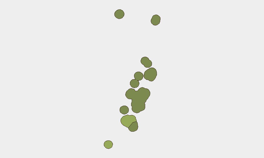
Tongatapu (risk score 45) dominates sub-national risk, driven by concentration of population, commerce, government, and transport infrastructure in and around Nukuʻalofa. Vavaʻu (28) and Haʻapai (22) present secondary risk layers, likely reflecting isolation, limited emergency services, and exposure to maritime and volcanic hazards. ʻEua and Ongo Niua carry minimal current risk signals. Risk in all districts remains baseline; no acute developments in the last 24–48 hours have elevated or lowered these standings.
How GeoBit Would Assist
Persistent monitoring via AOI Monitoring & Early Warning on Tongatapu and outlying districts would detect rapid shifts in protest activity, crime, or infrastructure disruption. OSINT fusion (X/Twitter, government social channels, news feeds, multi-language search) enables daily confirmation that the current quiet baseline is genuine, not a data gap. Early Warning & Prediction combined with event-feed integration would flag emerging political, maritime-safety, or natural-hazard triggers 24–72 hours before they affect operations. For duty-of-care teams, direct liaison with local contacts and regional diplomatic advisories remains the fastest escalation path.
7-Day Outlook
Tonga's security posture is expected to remain stable through early July barring unexpected seismic, meteorological, or political shocks. Regional maritime activity and routine governance are unlikely to produce material risk to corporate personnel or assets. Monitoring should continue at baseline intensity; no elevated alert warranted at this time.
Data Sources: Open-source news, social media OSINT, government and disaster-management channels, seismic databases.
Confidence: Moderate–High (low-incident environment; limited real-time ground verification in remote districts).
Next Brief: 2026-07-06 or on-demand if significant developments occur.
Highest-Risk Areas — Ranked
| # | State / Region | Risk |
|---|---|---|
| 1 | Tongatapu | 45 |
| 2 | Vavaʻu | 28 |
| 3 | Haʻapai | 22 |
| 4 | ʻEua | 18 |
| 5 | Ongo Niua | 12 |
Sources
Previous Daily Briefs
A new Tonga brief is written every day — each with its own risk map and downloadable CSV. Here's the last week; use the calendar to go further back.
📅 Browse every day by calendar →
Highlighted days have a brief. Tap a day for that day's map & analysis, or “csv” for that day's dataset ($5).
Atlas — our AI intelligence desk — emails them this snapshot personally. Nothing else, no list.