Situation Summary
Vanuatu's security environment remains low and stable, with no verified incidents of civil unrest, crime escalation, political instability, infrastructure disruption, or travel risk reported in the last 24–48 hours. The primary hazard profile is geophysical rather than human-security related: multiple active volcanoes are monitored at existing alert levels (1–3) with no recent escalations, and El Niño conditions are now established but have not triggered security-relevant emergencies to date. Emergency services (police, fire, medical) remain operational in major population centers.
Key Developments
- No verified security, civil-unrest, or crime incidents in Vanuatu over the last 24–48 hours across national monitoring feeds, travel advisories, or regional security bulletins.
- Geohazard status stable: Vanuatu Meteorology and Geohazards Department reports no new escalations to volcano alert levels for Yasur (Tanna), Lopevi, Ambrym, Ambae, Gaua, or Vanua Lava; no evacuation or disruption notices issued in the last monitoring cycle.
- El Niño now fully established: Department advisory recommends rainwater management for communities, but no El Niño–related emergencies, resource conflicts, or security incidents reported in the last 24–48 hours.
- Recent seismic activity: Five earthquakes (M 4.4–4.9) recorded across multiple islands in recent days (Port-Olry, Isangel, Port-Vila areas); consistent with Vanuatu's high seismic baseline and not indicative of new hazard escalation. No tsunami or damage alerts issued.
- Travel and transport functioning: Australia's Smartraveller advisory maintains "exercise normal safety precautions" posture with no newly issued warnings, curfews, or transport/port disruptions in the last 24–48 hours.
Highest-Risk Areas
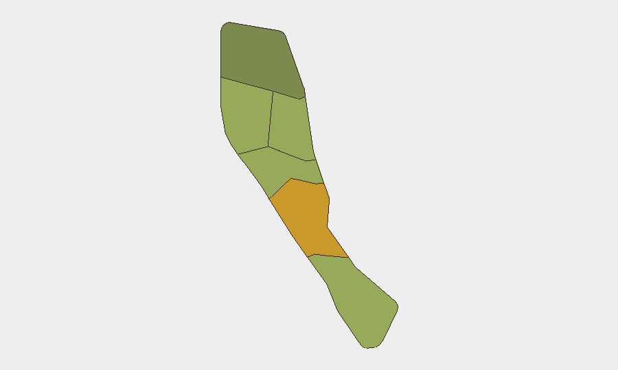
Shefa Province (composite risk 72) and Penama Province (58) rank highest in GeoBit's sub-national assessment, driven primarily by geophysical exposure rather than civil-security factors. Shefa encompasses Port-Vila and surrounding areas on Efate and includes proximity to several active volcanic zones; Penama includes Ambae, an active volcano with a history of major eruptions. Sanma (52), Malampa (48), and Tafea (45) follow, each containing populated areas near monitored volcanic systems. Risk rankings reflect exposure to earthquakes, volcanic activity, and associated secondary hazards (ash fall, lahars, evacuation disruption) rather than current incident clustering. Organizations with personnel or assets in these provinces should maintain geohazard awareness and continuity protocols for volcano-triggered service disruptions.
How GeoBit Would Assist
AOI Monitoring & Early Warning would enable persistent watch on Shefa and Penama provinces with automated alerting for new seismic, volcano-alert, or civil-incident signals. Environmental & Health monitoring would track Vanuatu Meteorology Department volcano and El Niño advisories in real time, feeding corporate continuity teams ahead of disruptions. GIS & Spatial Analysis combined with Satellite & Imagery analysis would support risk teams in assessing facility exposure to volcanic ash fall, lava paths, and ash-column drift under current meteorological conditions, improving duty-of-care assessments for personnel in high-risk provinces.
7-Day Outlook
No escalation in civil-security or infrastructure incidents is forecast. Geophysical risk remains the dominant hazard; seismic and volcanic activity are expected to remain within normal operational baselines for the region. El Niño conditions may prompt localized water-security advisories but are unlikely to trigger acute security incidents. Duty-of-care teams should maintain standard geohazard contingency protocols and monitor official volcano-alert channels.
Highest-Risk Areas — Ranked
| # | State / Region | Risk |
|---|---|---|
| 1 | Shefa Province | 72 |
| 2 | Penama | 58 |
| 3 | Sanma | 52 |
| 4 | Malampa | 48 |
| 5 | Tafea | 45 |
| 6 | Torba | 35 |
Sources
Previous Daily Briefs
A new Vanuatu brief is written every day — each with its own risk map and downloadable CSV. Here's the last week; use the calendar to go further back.
📅 Browse every day by calendar →
Highlighted days have a brief. Tap a day for that day's map & analysis, or “csv” for that day's dataset ($5).
Atlas — our AI intelligence desk — emails them this snapshot personally. Nothing else, no list.