Situation Summary
Comoros remains a low-threat jurisdiction globally (rank #200, composite score 2) with no discrete security incidents tracked in the current reporting window. The archipelago's risk profile is highly concentrated in Anjouan, which carries significantly elevated vulnerability compared to Grande Comore and Moheli. No credible security, civil unrest, crime, political instability, or infrastructure disruptions were verified in web research over the last 24–48 hours.
Key Developments
No verified security, conflict, civil-unrest, crime, political-instability, or infrastructure incidents were identified in Comoros during 12–13 July 2026. Routine weather monitoring (tropical conditions expected) does not constitute a security development. Personnel and asset teams should rely on standing duty-of-care protocols rather than reactive incident response at this time.
Highest-Risk Areas
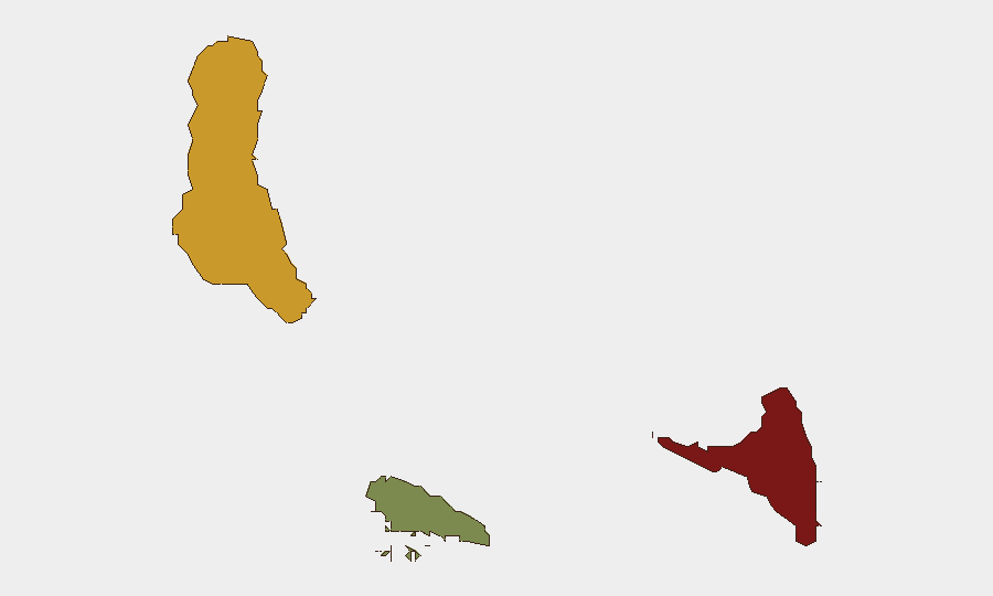
Anjouan (composite risk 88) dominates the sub-national threat landscape and warrants priority monitoring. This island's elevated risk reflects historical governance fragility, periodic separatist and autonomy tensions, and limited state security capacity—patterns established over preceding years. Grande Comore (risk 72) carries secondary but material risk, likely reflecting the capital's political and administrative concentration. Moheli (risk 35) presents substantially lower exposure. Security teams with personnel or operations on Anjouan should maintain heightened situational awareness and contingency protocols; Grande Comore operations require standard baseline precautions.
How GeoBit Would Assist
AOI Monitoring & Early Warning with persistent watch on Anjouan and Grande Comore would provide real-time alerting if unrest, political friction, or security degradation emerges, reducing reaction time for duty-of-care teams. Multi-language OSINT and entity-network analysis (leveraging local media, social platforms, and actor tracking) would surface early signals of political instability or communal tension before they escalate to operational risk. Routing & Network Analysis and GIS spatial mapping would enable alternative movement planning and asset-protection routing should access, transportation, or border conditions shift unexpectedly.
7-Day Outlook
No imminent security triggers are visible. Comoros' political and security environment typically exhibits slow-moving, background tensions rather than acute flash incidents. Teams should maintain standard vigilance protocols and periodic intelligence reviews; escalation to heightened alert posture is not warranted absent new intelligence.
NEXT REVIEW: 2026-07-13
CONFIDENCE LEVEL: Moderate (limited real-time data availability for Comoros; reliance on open-source corroboration)
Highest-Risk Areas — Ranked
| # | State / Region | Risk |
|---|---|---|
| 1 | Anjouan | 88 |
| 2 | Grande Comore | 72 |
| 3 | Moheli | 35 |
Sources
Previous Daily Briefs
A new Comoros brief is written every day — each with its own risk map and downloadable CSV. Here's the last week; use the calendar to go further back.
📅 Browse every day by calendar →
Highlighted days have a brief. Tap a day for that day's map & analysis, or “csv” for that day's dataset ($5).
Atlas — our AI intelligence desk — emails them this snapshot personally. Nothing else, no list.