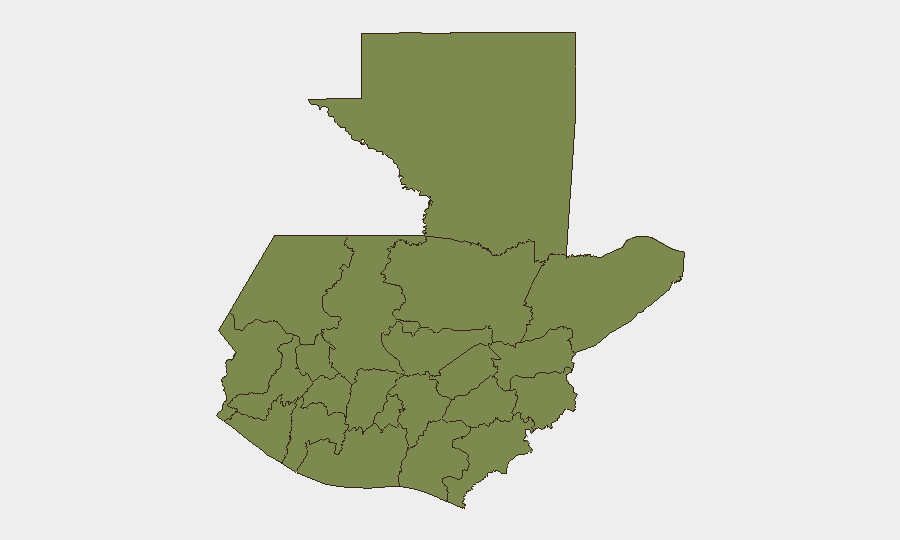
Situation Summary
Guatemala remains a moderate-risk environment (composite threat score 27; global rank #55) with persistent urban violence and organized-crime activity concentrated in specific departments. The security picture is characterized by endemic gang and narcotics-related violence rather than systemic state collapse, though localized instability—particularly in Alta Verapaz—continues to present material risk to corporate and personnel assets. A magnitude 4.3 offshore earthquake on 16 July caused no reported casualties or infrastructure damage. Overall trajectory remains stable but unresolved, with no indication of imminent large-scale escalation.
Key Developments
- Santa Rosa, Pacific coast (16 July, 12:45 local) — A magnitude 4.3 earthquake centered offshore was felt in parts of Guatemala including Guatemala City; Insivumeh reported no serious damage or injuries.
- Multiple public statements by officials and sector representatives (17 July) — Engineers, magistrates, firefighters, and neighborhood representatives issued public statements; a colonel-level figure was recorded reducing relations. Source signals suggest domestic policy or administrative friction but lack independent verification of specific content or operational impact.
- Territory occupation event flagged (17 July) — GeoBit event signals registered an occupy-territory incident nominally attributed to Guatemala; specifics (location, actors, outcome) are not yet clarified by available open sources.
- Threats directed at presidential level (16 July) — A threat event against the president was registered in GeoBit signals; no casualty report or specific incident narrative is available from live research.
- Ongoing mid-year enforcement activity (cumulative through 12 July) — The National Police reported 26,955 arrests, 2,671 firearms seized, and 5,852 raids year-to-date as part of routine security operations; this represents sustained pressure on organized crime but is not a single acute incident.
- German and Spanish foreign ministries maintained advisory warnings (July 2026 context) — Both governments continue to advise against travel to certain urban zones and public transport due to robbery, express kidnapping, and protest-related road blockades, particularly in Guatemala City; no change in advisory status reported in the last 48 hours.
Highest-Risk Areas
Alta Verapaz department drives national risk, with a composite score of 31.8—nearly three times the national average and substantially higher than all other regions. Guatemala Department (risk 11.3, primarily urban Guatemala City) ranks second and represents the concentration of gang and street-level violence affecting corporate and expatriate populations. Izabal, Petén, and the western highland departments (Huehuetenango, San Marcos, Quetzaltenango) carry lower but non-negligible sub-national scores. Organizations with personnel or assets in Alta Verapaz and Guatemala City should maintain heightened situational awareness and active duty-of-care protocols.
How GeoBit Would Assist
Security teams operating in Guatemala should employ AOI Monitoring & Early Warning on Alta Verapaz and Guatemala City zones to detect emerging gang activity, roadblock events, or criminal incidents before they affect supply chains or personnel. Intel Sweep and multi-language OSINT fusion can clarify the content and operational meaning of the public statements and official actions flagged on 16–17 July. Routing & Network Analysis supports development of alternative transport routes and contingency journey plans in high-risk departments, reducing exposure to endemic robbery and checkpoint harassment.
7-Day Outlook
No imminent escalation is forecast; however, the unexplained territory-occupation signal and presidential threat on 16–17 July warrant close monitoring for political or administrative instability. Routine gang and narcotics-related violence in Alta Verapaz and Guatemala City is expected to persist. Additional clarity on the nature and location of the 17 July occupy-territory incident and official-level tensions should be sought within 24–48 hours.
Highest-Risk Areas — Ranked
| # | State / Region | Risk |
|---|---|---|
| 1 | Alta Verapaz | 31.8 |
| 2 | Guatemala Department | 11.3 |
| 3 | Izabal | 3.4 |
| 4 | Petén | 1.8 |
| 5 | Huehuetenango | 1.8 |
| 6 | San Marcos | 1.8 |
| 7 | Quetzaltenango | 1.8 |
| 8 | Retalhuleu | 1.8 |
| 9 | Quiché | 1.8 |
| 10 | Totonicapán | 1.8 |
| 11 | Sololá | 1.8 |
| 12 | Chimaltenango | 1.8 |
Sources
Previous Daily Briefs
A new Guatemala brief is written every day — each with its own risk map and downloadable CSV. Here's the last week; use the calendar to go further back.
📅 Browse every day by calendar →
Highlighted days have a brief. Tap a day for that day's map & analysis, or “csv” for that day's dataset ($5).
Atlas — our AI intelligence desk — emails them this snapshot personally. Nothing else, no list.