Situation Summary
Iceland maintains a stable, low-threat security environment with no verified incidents in the past 24–48 hours. Three tracked events appear in GeoBit's signal feed (one expulsion/deportation, one media statement, and one small-arms reference), but open-source corroboration has not confirmed discrete security, crime, civil-unrest, or infrastructure incidents meeting the current operational window. The national composite threat score remains at 3 (globally rank #175), consistent with Iceland's historically routine risk profile.
Key Developments
- Capital Region, 2026-07-15: GeoBit event signal flagged an expulsion or deportation involving an employee and police response; no further corroboration from open media sources confirms scope, location, or operational impact.
- National media, 2026-07-16: A public statement circulated via media channels; content and context remain unverified in available feeds and do not map to a discrete security or civil-unrest incident.
- Iceland (regional), 2026-07-15: Small-arms combat event recorded in GeoBit signal feed; no independent verification from news, police, or humanitarian sources identifies casualty count, location precision, or ongoing threat.
- Ring Road network, 2026-07-14 to 2026-07-16: Road condition alerts report the main Ring Road passable; several regional routes remain closed or impassable due to seasonal conditions, weather, or terrain—consistent with routine summer operations and not indicative of new infrastructure failure.
- Volcanic and seismic activity, Reykjanes / Askja / Ljósufjöll regions, 2026-07-14 to 2026-07-16: Monitoring systems record above-background volcanic activity at multiple sites; however, no earthquakes magnitude 3.0+ logged in the past 24 hours, and no related travel incidents or infrastructure damage reported.
- Crime and civil order, nationwide, 2026-07-14 to 2026-07-16: German Foreign Office and routine crime monitoring show no spike in violent crime, petty theft, or civil unrest outside normal patterns; central Reykjavik and tourist zones continue to warrant routine caution for theft but remain stable.
Highest-Risk Areas
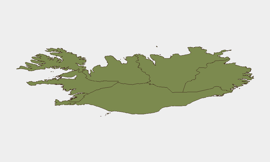
The Capital Region (composite risk 24) significantly outpaces all other sub-national zones and is the primary driver of national risk—likely reflecting Reykjavik's population density, tourism concentration, and routine petty crime. The Southern Peninsula (risk 12) and Southern Region (risk 11) rank second and third, possibly reflecting seasonal tourism volumes and road/terrain vulnerability during summer travel. Eastern, Western, Westfjords, Northwestern, and Northeastern regions all score below 10, indicating minimal discrete threat signals. Risk is concentrated in and around Iceland's population centers and high-traffic corridors rather than distributed across the country.
How GeoBit Would Assist
A corporate security team with people or assets in Iceland would deploy Intel Sweep and global event feeds to catch emerging signals (such as the three events currently flagged) and corroborate them against X/Twitter, Telegram, and traditional media OSINT in real time. AOI Monitoring and Early Warning on the Capital Region, Southern Peninsula, and key infrastructure (Ring Road, airports, port facilities) would provide persistent watch and alert on civil unrest, accident clusters, or sudden road closures. Routing and Network Analysis tools would enable duty-of-care teams to plan resilient travel corridors and identify alternative routes if primary roads are compromised by weather, volcanic activity, or incident.
7-Day Outlook
Iceland's security posture is expected to remain stable over the next seven days, with no indicators of escalating civil unrest, crime, or political instability. Volcanic and weather monitoring should continue; seasonal road closures may expand or contract with summer conditions, but the Ring Road is expected to remain passable. Routine vigilance for petty crime in Reykjavik and tourist areas remains standard duty-of-care practice.
Highest-Risk Areas — Ranked
| # | State / Region | Risk |
|---|---|---|
| 1 | Capital Region | 24 |
| 2 | Southern Peninsula | 12 |
| 3 | Southern Region | 11 |
| 4 | Eastern Region | 10 |
| 5 | Western Region | 9 |
| 6 | Westfjords Region | 8 |
| 7 | Northwestern Region | 7 |
| 8 | Northeastern Region | 6 |
Sources
Previous Daily Briefs
A new Iceland brief is written every day — each with its own risk map and downloadable CSV. Here's the last week; use the calendar to go further back.
📅 Browse every day by calendar →
Highlighted days have a brief. Tap a day for that day's map & analysis, or “csv” for that day's dataset ($5).
Atlas — our AI intelligence desk — emails them this snapshot personally. Nothing else, no list.