Situation Summary
Indonesia maintains a composite threat score of 46 globally, placing it in the mid-tier of tracked jurisdictions with 663 documented events. The country faces persistent challenges across multiple threat vectors—including governance instability, maritime security exposure, and regional separatism—concentrated in high-density urban and resource-extraction zones. Recent event signals (26–28 June) point to heightened tension among government, political, and religious actors, though the full operational context remains under analysis. The trajectory suggests continued volatility without immediate indication of systemic collapse or major escalation.
Key Developments
- Presidential-level instability (26 June) — Arrest/detention event involving the President signals internal political turbulence; concurrent threats directed at both government and state institutions indicate deepening intra-elite friction.
- Ministry of Health public statement (26 June) — Health sector engagement in public discourse suggests either policy crisis or response to public-health emergency; operational detail and location not yet specified in available signals.
- Municipal-level conflict (26 June) — Mayor statement vs. Sumatra-region jurisdiction indicates sub-national governance dispute, likely resource or administrative in nature; escalation risk depends on armed-group involvement.
- Village–government antagonism (26 June) — Localized contention between settlement and state authority; consistent with land-rights, environmental-impact, or resource-extraction disputes endemic to rural Indonesia.
- Religious sector disapproval (26 June) — Islam-linked disapproval event suggests reputational, policy, or security trigger affecting Islamic institutions or constituencies; could signal radicalization risk or state policy pushback.
- Diplomatic escalation (27 June) — UN public statement implicates international attention to domestic Indonesian affairs; possible human-rights, environmental, or governance concern.
- Maritime exposure (27 June, non-domestic) — Pertamina VLCC *Pertamina Pride* monitoring in Strait of Hormuz reflects broader regional geopolitical risk and potential disruption to Indonesian energy infrastructure; not a domestic incident but a supply-chain vulnerability.
Highest-Risk Areas
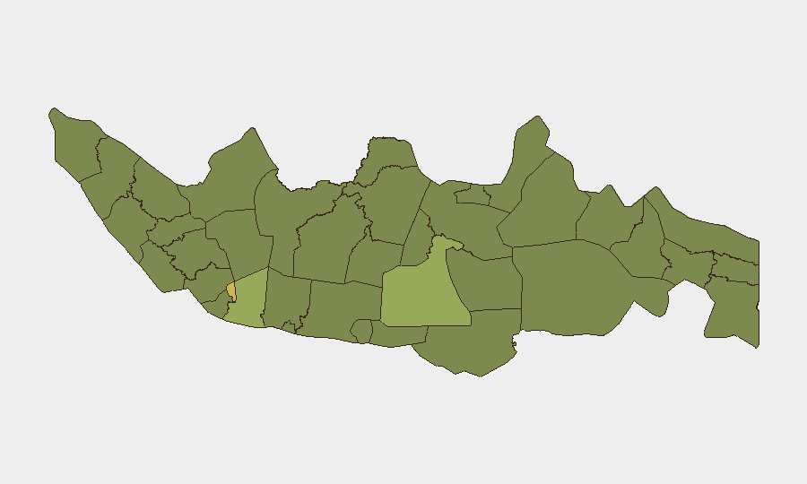
Jakarta (risk 62.1) and South Sulawesi (risk 56.6) drive the national risk profile, reflecting population density, government concentration, and regional separatism respectively. West Java (50.3), Riau (36.6), and East Java (36.6) follow, with Riau and Kalimantan provinces indicating resource-conflict and environmental-governance flashpoints. Jakarta's elevated score correlates with recent political arrests and institutional instability; South Sulawesi's reflects historical militant networks and inter-communal tension. Corporate and diplomatic presence in Jakarta faces the highest immediate exposure; supply chains and extractive operations in Sumatra and Kalimantan face secondary but sustained risk from land disputes and labor unrest.
How GeoBit Would Assist
Duty-of-care teams should deploy AOI Monitoring & Early Warning against Jakarta, South Sulawesi, and West Java to track institutional, political, and crowd events with real-time alerting. Intel Sweep and multi-language OSINT (X, Telegram, local media) will disambiguate recent ministerial and political signals and surface ground-level reporting missed by English-language feeds. Network & Actor Analysis can map decision-makers and militant/separatist constituencies in high-risk provinces, enabling threat characterization. Routing & Network Analysis supports contingency evacuation or supply-chain rerouting if political instability or regional unrest accelerates.
7-Day Outlook
Political tension and institutional stress are likely to remain elevated through early July, with possible additional arrest or policy announcements. No imminent collapse or coordinated uprising is signaled, but localized escalation in village disputes or religious-sector flashpoints could accelerate if state response is heavy-handed. Monitor Jakarta governance moves and South Sulawesi militant activity as leading indicators of broader trajectory.
Highest-Risk Areas — Ranked
| # | State / Region | Risk |
|---|---|---|
| 1 | Special capital Region of Jakarta | 62.1 |
| 2 | South Sulawesi | 56.6 |
| 3 | West Java | 50.3 |
| 4 | Riau | 36.6 |
| 5 | East Java | 36.6 |
| 6 | Central Kalimantan | 35.5 |
| 7 | Banten | 34.9 |
| 8 | North Sumatra | 34.6 |
| 9 | Central Java | 34.3 |
| 10 | Special Region of Yogyakarta | 33.8 |
| 11 | West Kalimantan | 33.2 |
| 12 | Bangka-Belitung Islands | 32.6 |
Sources
Previous Daily Briefs
A new Indonesia brief is written every day — each with its own risk map and downloadable CSV. Here's the last week; use the calendar to go further back.
📅 Browse every day by calendar →
Highlighted days have a brief. Tap a day for that day's map & analysis, or “csv” for that day's dataset ($5).