Situation Summary
Maldives remains a low-threat environment with a composite threat score of 4 and no tracked conflict or terrorism events in the current window. The country faces near-term operational friction from active coastal flooding and elevated marine hazard conditions affecting Malé and outlying atolls, combined with routine immigration enforcement and new regulatory compliance requirements for food and pharmaceutical sectors. Infrastructure and marine recreation risks are elevated; political and security stability remain intact.
Key Developments
- Malé City, Thursday 30–Friday 31 July 2026: Swell waves (2–5 ft) overtopped coastal defences, flooding the Carnival area and northern waterfront/Industrial Village zones. MNDF deployed pump teams to clear seawater. Meteorological Service issued alerts for overtopping waves (10:30–15:00) and swell surges (22:00–02:30), with rain forecast through Sunday 02 August, indicating ongoing coastal flood and transport disruption risk.
- Malé City harbour, Sunday 01 August 2026 (recent 24–48h): A speedboat carrying approximately 20 passengers collided with the southern harbour entrance, capsized, and sustained significant damage. Two passengers sustained minor injuries; police investigation opened. Incident circulated on social media, underlining marine safety concerns during elevated sea-state conditions.
- Kaafu Atoll, Maafushi, Thursday 30–Friday 31 July 2026: During strong winds and swell, a parasail canopy burst mid-flight and became tangled in a zip-line; the tourist fell into the sea. Jet-ski operators rescued individuals with no serious injuries reported. Incident highlights elevated marine recreation risk during the current weather window.
- Hulhumalé/Rashu Market, Tuesday 29–Wednesday 30 July 2026: Maldives Immigration inspected the market, checked 55 foreign workers, and detained 20 undocumented workers for operating without valid permits. Operation reflects ongoing heightened labour enforcement at commercial hubs and may affect foreign worker populations in the Hulhumalé area.
- G.Dh. Atoll, Faresmaathodaa area, within last 24–48h: Island Council intercepted a vessel illegally extracting sand from an uninhabited island, forcing operators to return bagged material. Council cited long-term reef damage and signalled stepped-up local enforcement, flagging environmental crime and regulatory risk for extraction operators in the region.
- Nationwide, Wednesday 29–Friday 31 July 2026: New Maldives Food and Drug Authority (MFDA) regulations came into force, introducing fines of MVR 5,000–100,000 for inspector conduct breaches and similar penalties for unlicensed medicine imports. Represents compliance and enforcement risk for food and pharmaceutical businesses.
- Villimalé & Hulhumalé International Terminal, Thursday 30–Friday 31 July 2026: President Muizzu opened a Maritime Coordination Centre and commissioned an Australian-gifted MNDF Coast Guard vessel ("Imaaduddin"). Development marginally strengthens maritime incident response and emergency capacity.
Highest-Risk Areas
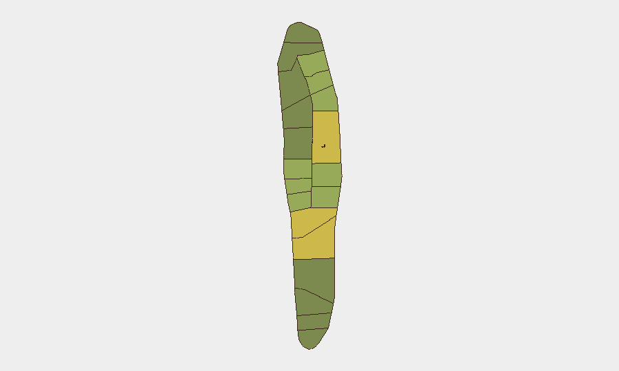
Malé (risk 85) and Malé Atoll (risk 68) dominate the sub-national ranking, driven by population density, critical infrastructure concentration, and current coastal flooding exposure. Northern atolls—Hadhdhunmathi (65), Kolhumadulu (60), and Felidhu (58)—register elevated risk from swell and marine hazard conditions affecting transport, fisheries, and tourism infrastructure. Southern and central atolls (Nilandhe, Ari) show lower but non-negligible risk, primarily linked to marine and environmental compliance friction rather than security events.
How GeoBit Would Assist
Corporate security teams would leverage AOI Monitoring & Early Warning to track coastal flood progression and maritime incidents in real time across Malé and key atolls, with automated alerting for transport and tourism disruptions. Maritime & Aviation tracking combined with multi-language OSINT and X/Telegram feeds would enable rapid detection of harbour incidents, worker enforcement actions, and environmental enforcement developments affecting supply chains and personnel. Routing & Network Analysis would support duty-of-care teams in identifying safe passage alternatives during elevated sea-state windows.
7-Day Outlook
Coastal swell and rain are forecast to persist through 02 August, maintaining elevated flood and marine transport risk in Malé and northern atolls. Immigration and regulatory enforcement activity appears routine but elevated; compliance exposure for labour and food/pharmaceutical operators will remain. No political or security deterioration is anticipated; trajectory remains stable with operational friction concentrated in maritime and weather domains.
Highest-Risk Areas — Ranked
| # | State / Region | Risk |
|---|---|---|
| 1 | Malé | 85 |
| 2 | Malé Atoll | 68 |
| 3 | Hadhdhunmathi | 65 |
| 4 | Kolhumadulu | 60 |
| 5 | Felidhu Atoll | 58 |
| 6 | Mulaku Atoll | 55 |
| 7 | Faadhippolhu | 52 |
| 8 | South Miladhunmadulu | 48 |
| 9 | North Miladhunmadulu | 45 |
| 10 | South Nilandhe Atoll | 44 |
| 11 | North Nilandhe Atoll | 42 |
| 12 | South Ari Atoll | 40 |
Sources
Previous Daily Briefs
A new Maldives brief is written every day — each with its own risk map and downloadable CSV. Here's the last week; use the calendar to go further back.
📅 Browse every day by calendar →
Highlighted days have a brief. Tap a day for that day's map & analysis, or “csv” for that day's dataset ($5).
Atlas — our AI intelligence desk — emails them this snapshot personally. Nothing else, no list.