Situation Summary
Nepal is experiencing a sharp escalation in communal violence across the eastern Terai and southern plains, with three confirmed deaths and dozens injured over the past 48 hours. Tensions originating in Sunsari District—reportedly tied to religious flags and sound systems—have spread rapidly to Siraha, Dhanusa, and Parsa districts, prompting authorities to impose indefinite curfews across multiple municipalities and market areas. The government has activated border-security protocols and the Central Security Committee has convened in response, signaling official concern that unrest may persist or expand further into Madhesh Province and along the Nepal–India frontier.
Key Developments
- Sunsari District (Kaptangunj, Dewanganj RM-3, East–West Highway) – July 29–30: Local administration expanded indefinite curfews across at least ten areas under the Local Administration Act following communal clashes; the curfew remains "until further notice."
- Sunsari District (southern border areas) – July 29–30: Koshi provincial government tightened Nepal–India border controls in southern Sunsari, mandating valid identity documents for Indian nationals and deploying reinforced police units from Madhesh Province and neighboring districts.
- Siraha District (Golbazar market) – July 30: Communal violence spread from Sunsari, resulting in the death of a teenager and multiple injuries; this represents the geographic extension of tensions into Madhesh Province.
- Dhanusa District (Janakpur, Laxminia Hatbazaar, Belauni Road, Nagarain Municipality, Dudhmati bridge) – July 30: District authorities imposed indefinite curfews from 3:30 p.m. as a precautionary measure in response to spreading communal tensions.
- Parsa District (Birgunj and adjoining areas) – July 30: District authorities enforced indefinite curfew orders and prohibitory measures Thursday in response to violence spillover from Sunsari.
- Central Security Committee / Border Posture – July 29–30: Following the Sunsari incident, the committee met in Kathmandu and provincial authorities implemented stricter checks at southern border checkpoints, with instructions to deny entry to individuals without proper identification.
- Prime Minister Statement – July 30: Balendra Shah issued a public appeal for calm and harmony as curfews expanded across Sunsari, Siraha, Janakpur, and Parsa; the appeal coincided with reports of three deaths and dozens injured.
Highest-Risk Areas
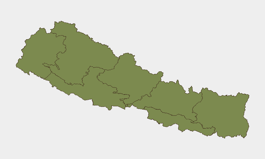
Bagamati Province dominates the risk ranking (31.3), though the active violence in the past 48 hours is concentrated in Koshi Province (25.5) and bordering Madhesh Province (2.4). Sunsari and Siraha districts in Koshi are the epicenters of current communal clashes, while Dhanusa and Parsa in Madhesh are experiencing rapid spillover and curfew expansions. The concentration of incidents along the Nepal–India border, combined with rapid geographic spread over 48 hours and government-level security responses, suggests the risk profile in eastern districts is now acute and dynamic, even if national composite scores remain moderate.
How GeoBit Would Assist
Security teams should employ Area-of-Interest Monitoring & Early Warning with persistent watch on Sunsari, Siraha, Dhanusa, and Parsa districts to detect curfew changes, violence incidents, and police deployments in near-real-time. Multi-language OSINT (X, Telegram, YouTube, local media feeds) coupled with sentiment and temporal analysis will track communal rhetoric, official announcements, and crowd signals ahead of escalations. Routing & Network Analysis can identify alternative supply-chain and personnel-movement corridors around active curfew zones and the tightened India–Nepal border.
7-Day Outlook
Communal tensions are likely to remain elevated throughout the eastern Terai for at least 7 days, with curfew orders remaining in place and border controls sustained. Further spillover into additional districts is possible if underlying grievances—religious symbolism and local governance—are not addressed; any large religious or political gathering in the region carries heightened risk of renewed clashes. Security deployments and government messaging suggest authorities are committed to containment, but the rapid geographic spread in 48 hours and involvement of police indicate limited predictability of the next trigger point.
Highest-Risk Areas — Ranked
| # | State / Region | Risk |
|---|---|---|
| 1 | Bagamati Province | 31.3 |
| 2 | Koshi Province | 25.5 |
| 3 | Madhesh Province | 2.4 |
| 4 | Gandaki Province | 2.1 |
| 5 | Sudurpashchim Province | 1.3 |
| 6 | Karnali Province | 1.3 |
| 7 | Lumbini Province | 1.3 |
Sources
Previous Daily Briefs
A new Nepal brief is written every day — each with its own risk map and downloadable CSV. Here's the last week; use the calendar to go further back.
📅 Browse every day by calendar →
Highlighted days have a brief. Tap a day for that day's map & analysis, or “csv” for that day's dataset ($5).
Atlas — our AI intelligence desk — emails them this snapshot personally. Nothing else, no list.