Situation Summary
Tonga remains a low-incident environment with a composite threat score of 5 globally (#163). Open-source monitoring over the last 24–48 hours has not surfaced any independently confirmed security incidents, civil unrest, major crime, or infrastructure disruptions. The nation's risk profile is dominated by natural hazards (seismic and volcanic activity) rather than conflict or instability, though recent moderate earthquakes warrant continued environmental monitoring.
Key Developments
- No credible security incidents reported in the last 24–48 hours. Systematic monitoring of regional news wires, Pacific-focused media outlets, social media, and travel/tourism data has not identified new protests, civil unrest, political crises, or travel disruptions affecting Tonga during this period.
- Seismic activity remains a baseline hazard. Three moderate earthquakes (M 5.1, 4.6, and 4.3) have been recorded in recent days across waters around Tonga (211 km ESE of Hihifo, 112 km NNW of Neiafu, and 263 km WNW of Houma). No tsunami or significant damage has been reported, but ongoing seismic monitoring is warranted.
- Platform alerts contain non-Tonga content. Two algorithmic signals appearing in the system (Artillery/Tanks — China vs Government; Judge public statement) do not correspond to independently verified Tonga incidents and may reflect data-feed noise or misfiling; no credible reporting corroborates these as current Tonga events.
Highest-Risk Areas
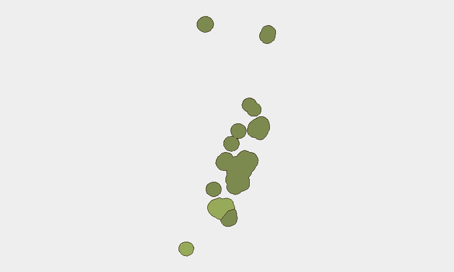
Tongatapu (risk 45) remains the primary concern, driven by its status as the national capital and demographic center where political, economic, and infrastructure vulnerabilities concentrate. Vavaʻu (risk 28) and Haʻapai (risk 22) represent secondary risk zones, likely reflecting isolation, limited emergency services, and exposure to natural hazards including seismic and cyclonic events. ʻEua and Ongo Niua carry lower but non-negligible risk profiles. Risk rankings in Tonga are primarily influenced by natural-hazard exposure and baseline governance capacity rather than acute conflict or crime drivers.
How GeoBit Would Assist
Corporate security and duty-of-care teams operating in Tonga should employ AOI Monitoring & Early Warning on Tongatapu and secondary islands to detect emerging civil unrest, infrastructure failures, or maritime incidents in real time. Environmental & Health monitoring—particularly seismic and volcanic activity tracking via satellite imagery and official Pacific Tsunami Warning Center feeds—provides early signals of natural-hazard escalation. Multi-language OSINT fusion and X/Twitter/social-media intelligence across regional sources enables rapid confirmation or dismissal of platform alerts and surfaces community-level disruption signals before formal announcements.
7-Day Outlook
No material escalation in security risk is anticipated over the next seven days based on current trajectory and open-source indicators. Seismic activity may persist but is unlikely to produce widespread damage or population displacement given historical patterns and depth/location of recent quakes. Monitoring should remain routine but continuous, with particular attention to any changes in official government statements, maritime activity, or cyclone-season developments.
Next Update: 2026-07-08 or upon significant event detection.
Highest-Risk Areas — Ranked
| # | State / Region | Risk |
|---|---|---|
| 1 | Tongatapu | 45 |
| 2 | Vavaʻu | 28 |
| 3 | Haʻapai | 22 |
| 4 | ʻEua | 18 |
| 5 | Ongo Niua | 12 |
Sources
Previous Daily Briefs
A new Tonga brief is written every day — each with its own risk map and downloadable CSV. Here's the last week; use the calendar to go further back.
📅 Browse every day by calendar →
Highlighted days have a brief. Tap a day for that day's map & analysis, or “csv” for that day's dataset ($5).
Atlas — our AI intelligence desk — emails them this snapshot personally. Nothing else, no list.