Situation Summary
Vanuatu maintains a stable security environment with no reported incidents of civil unrest, major crime, political instability, or infrastructure disruption in the last 24–48 hours. The national threat ranking reflects low composite risk; however, sub-national variance is significant, with Shefa Province presenting elevated exposure (risk score 72). The primary operational hazards remain geophysical—ongoing volcanic activity and seismic events—rather than security or civil disorder.
Key Developments
- Seismic activity, northwest Vanuatu (Torba/Sanma region), recent: Multiple moderate earthquakes detected in recent days, including M 6.0 (82 km W of Sola), M 5.1 (75 km WSW of Sola), and M 4.9 (4 km WNW of Sola). No casualties, structural damage reports, or tsunami warnings issued as of 25 July 2026.
- Volcano alert status, countrywide (standing advisory as of 24–25 July): Manaro Voui (Ambae, Penama) remains at Level 3; Yasur, Lopevi, Benbow/Marum, and Mount Garet at Level 2. No fresh eruptions or new evacuation orders reported in the last 48 hours.
- El Niño water-security advisory, countrywide (ongoing, not acute): Vanuatu Meteorology and Geohazards Department continues to advise rainwater-dependent communities on conservation; no emergency water shortage or civil action reported in the last 24–48 hours.
- Australian travel advisory status (24–25 July): No change; Vanuatu remains at "exercise normal safety precautions" with no new incident-driven alerts or emergency notices.
No credible open-source reporting identifies new security incidents, crime spikes, or political events in Vanuatu in the last 24–48 hours.
Highest-Risk Areas
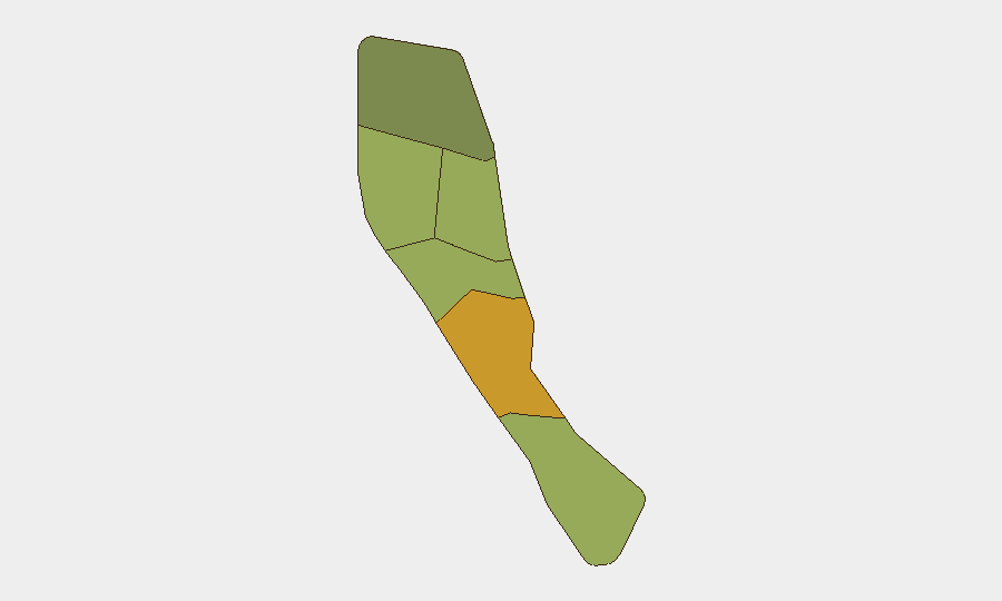
Shefa Province dominates sub-national risk (score 72), driven primarily by its concentration of population, economic activity, and infrastructure in and around the capital, Port Vila—amplifying exposure to seismic and volcanic hazards, as well as port and maritime vulnerabilities. Penama (58) and Sanma (52) follow, reflecting ongoing volcanic monitoring (Ambae Level 3, northern seismic activity) and more limited emergency-response capacity in outer islands. Malampa, Tafea, and Torba carry lower but material scores, typically linked to geographic isolation, infrastructure gaps, and cumulative natural-hazard exposure. None of these rankings currently reflect acute security or civil-unrest drivers; risk is predominantly environmental and structural.
How GeoBit Would Assist
Security teams with personnel or assets in Vanuatu should employ AOI Monitoring & Early Warning to track Shefa Province (Port Vila) and key outer-island infrastructure continuously, with alert thresholds set for seismic magnitude, volcanic-alert-level escalation, and any civil-order disruptions. Satellite & Imagery analysis and GIS & Spatial Analysis capabilities enable rapid damage assessment and route-closure mapping following significant seismic or volcanic events, supporting duty-of-care evacuation or supply-chain continuity planning. Environmental & Health monitoring, integrated with local meteorology and civil-protection feeds, provides early notice of water-security deterioration or disease vectors linked to El Niño conditions.
7-Day Outlook
Seismic activity in the northwest is expected to continue at moderate levels; no major escalation in volcanic alert status is forecast. Geophysical risk remains the primary operational concern for the next week. If El Niño moisture patterns persist, water-security pressures in outer islands may intensify, though no acute shortage or civil unrest is anticipated in the immediate term.
Highest-Risk Areas — Ranked
| # | State / Region | Risk |
|---|---|---|
| 1 | Shefa Province | 72 |
| 2 | Penama | 58 |
| 3 | Sanma | 52 |
| 4 | Malampa | 48 |
| 5 | Tafea | 45 |
| 6 | Torba | 35 |
Previous Daily Briefs
A new Vanuatu brief is written every day — each with its own risk map and downloadable CSV. Here's the last week; use the calendar to go further back.
📅 Browse every day by calendar →
Highlighted days have a brief. Tap a day for that day's map & analysis, or “csv” for that day's dataset ($5).
Atlas — our AI intelligence desk — emails them this snapshot personally. Nothing else, no list.