Situation Summary
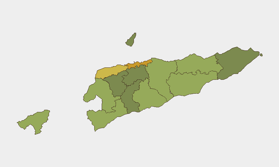
East Timor remains a low-threat operating environment globally (composite score 2) with minimal tracked security incidents in the reporting period. The single confirmed development in the past 48 hours—a police operation against foreign nationals suspected of operating a cybercrime center in Dili—reflects ongoing law-enforcement activity rather than a deterioration in the overall security posture. Dili continues to register the highest sub-national risk (72), driven by urban crime, migration pressures, and criminal networks; secondary concern zones exist in Liquiçá (62) and Baucau (58), but risk levels decline sharply toward peripheral and rural districts. No active conflict, political instability, or mass casualty events are currently tracked.
Key Developments
- Dili (Cristo Rei area), 27 July 2026: Timor-Leste National Police conducted a raid on a suspected online fraud operation, detaining 30 foreign nationals and seizing digital equipment. The operation signals sustained law-enforcement focus on transnational cybercrime networks operating from within the capital.
Highest-Risk Areas
Dili dominates the risk landscape, accounting for roughly one-third of the country's composite threat score and serving as a hub for urban crime, human trafficking, and organized cybercrime. Liquiçá and Baucau follow, reflecting ongoing pressures from border-adjacent activity, gang-related crime, and limited state capacity in secondary urban centers. The marked drop-off in risk scores moving toward peripheral districts (Aileu, Ermera, Ermera at 32–36) indicates that security threats concentrate in capital and transportation-corridor zones, with relative stability in rural hinterlands. For personnel and asset placement, the risk gradient is steep: operations in Dili require elevated security protocols; those in Aileu, Ermera, or Manatuto face substantially lower incident probabilities.
How GeoBit Would Assist
A corporate security team should employ AOI Monitoring & Early Warning to maintain persistent watch on Dili's commercial and port zones, coupled with Intel Sweep and multi-language OSINT to track emerging gang activity, trafficking flows, and cybercrime networks operating regionally. Network & Actor Analysis would map criminal and transnational smuggling relationships, while GIS & Spatial Analysis can identify safe and high-risk movement corridors between Dili, Liquiçá, and Baucau. These capabilities enable early detection of deterioration and real-time route optimization for personnel movement.
7-Day Outlook
No significant escalation is forecast over the next seven days. Routine law-enforcement operations against cybercrime and street crime are likely to continue, particularly in Dili. Seasonal weather and port logistics may influence maritime security posture; however, the absence of political drivers, conflict parties, or mass-mobilization events suggests stability will persist in the near term.
Highest-Risk Areas — Ranked
| # | State / Region | Risk |
|---|---|---|
| 1 | Dili | 72 |
| 2 | Liquiçá | 62 |
| 3 | Baucau | 58 |
| 4 | Cova Lima | 55 |
| 5 | Bobonaro | 53 |
| 6 | Oecussi-Ambeno | 48 |
| 7 | Manufahi | 45 |
| 8 | Viqueque | 42 |
| 9 | Manatuto | 40 |
| 10 | Ainaro | 38 |
| 11 | Ermera | 36 |
| 12 | Aileu | 32 |
Sources
Previous Daily Briefs
A new East Timor brief is written every day — each with its own risk map and downloadable CSV. Here's the last week; use the calendar to go further back.
📅 Browse every day by calendar →
Highlighted days have a brief. Tap a day for that day's map & analysis, or “csv” for that day's dataset ($5).
Atlas — our AI intelligence desk — emails them this snapshot personally. Nothing else, no list.