Situation Summary
Iceland remains a low-risk, stable environment with a composite threat score of 1 and no tracked major security events at the national level. However, localized property crime in Reykjavík has intensified since early July, with 50–60+ residential burglaries reported in central neighborhoods through late July; simultaneously, serious assault and emergency-service strain in the Capital Region reflect occasional interpersonal violence typical of Nordic cities. Infrastructure and road-safety issues (carousel collapse, swimming-facility closures, highland road closures) indicate active hazard management rather than systemic failure, and routine seismic activity presents no elevated volcanic or structural risk.
Key Developments
- Reykjavík – residential burglary surge (2026-07-27 to 07-28): Central-city neighborhoods (Vesturbær, Miðborg, Hlíðar, Laugardalur) continue to experience opportunistic break-ins; on 2026-07-28, Reykjavík mayor convened a security consultation at City Hall with police, residents, and businesses to address the ongoing wave. Police characterize incidents as non-organized but persistent.
- Hafnarfjörður, Capital Region – serious assault (night of 2026-07-27): A major physical assault ("stórfelld líkamsárás") occurred in central Hafnarfjörður town center, prompting police and medical response and triggering criminal investigation. No indication of wider unrest.
- Reykjavík emergency services – high overnight workload (night of 2026-07-27): Multiple simultaneous incidents across the capital area strained local emergency responders on July 27, reinforcing police calls for residents to report all crimes to improve situational awareness.
- Stokkseyri Harbour, South Iceland – children's carousel collapse (evening of 2026-07-27): A carousel at a harbour festival collapsed, injuring several children and prompting safety review of temporary amusement structures and event procedures.
- Laugardalslaug, Reykjavík – spectator-stand closure (decision reported 2026-07-28): Large public swimming complex closed spectator stands for several months due to identified structural safety risks; reflects proactive hazard management.
- North and Highlands road network – active axle-weight restrictions and closures (live alerts through late July): F-road closures and urgent weight limits affect heavy vehicles and highland travel; real-time road-condition monitoring remains essential.
- National seismic routine (last 48 hours): Minor earthquakes (magnitudes 1.5–3.7) recorded at multiple locations; no volcanic unrest or infrastructure damage alerts issued.
Highest-Risk Areas
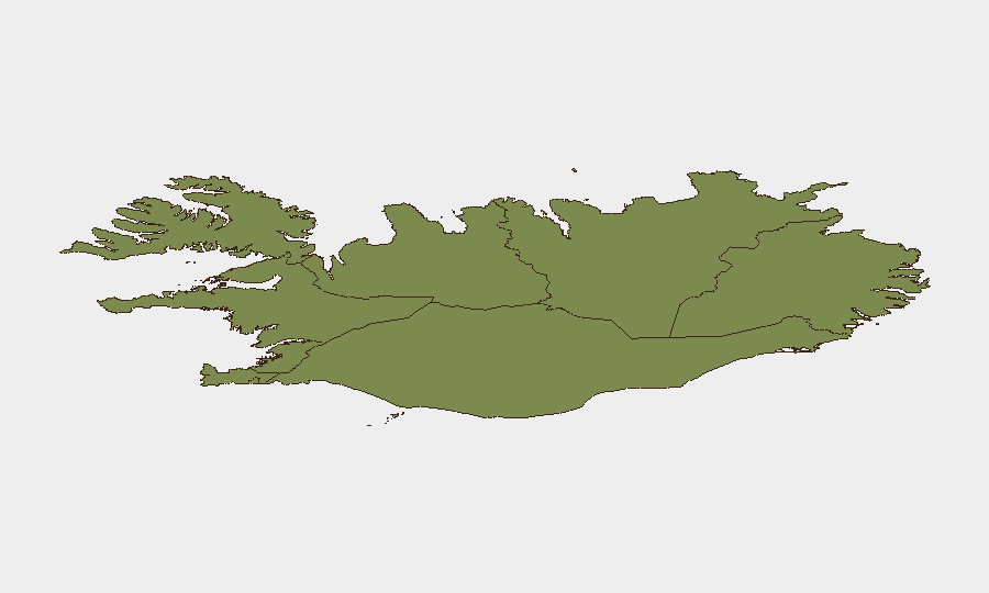
The Capital Region (risk score 24) drives the majority of current tracked risk, concentrated in Reykjavík's property-crime surge and Hafnarfjörður's violent incident. The Southern Peninsula and Southern Region (scores 12 and 11) remain secondary risk zones, with the carousel-collapse incident in Stokkseyri underscoring event and infrastructure-safety management as low-level hazards. Remaining regions (Eastern through Northeastern) show minimal tracked risk and no current security events; risk concentration in the Capital Region reflects urban-density patterns and periodic crime cycles rather than systemic instability.
How GeoBit Would Assist
Security teams with personnel or assets in Iceland would employ AOI Monitoring & Early Warning to track Reykjavík burglary patterns and police response in near-real time, enabling proactive asset protection and staff briefing. OSINT Fusion & Corroboration across Icelandic police statements, local media, and emergency-services data would provide rapid, verified situational updates on violent incidents and infrastructure hazards. Routing & Network Analysis would identify safe transit corridors and current road closures in the north and highlands, supporting duty-of-care compliance for travel and logistics.
7-Day Outlook
The Reykjavík burglary trend is likely to persist through August absent a coordinated police surge or environmental shift; residents and transient accommodation should maintain heightened property vigilance. Road closures and seismic activity will remain routine; no escalation in violent crime, civil unrest, or organized threat activity is indicated. Iceland's overall risk posture is expected to remain low to moderate, with localized property crime as the primary operational concern.
Highest-Risk Areas — Ranked
| # | State / Region | Risk |
|---|---|---|
| 1 | Capital Region | 24 |
| 2 | Southern Peninsula | 12 |
| 3 | Southern Region | 11 |
| 4 | Eastern Region | 10 |
| 5 | Western Region | 9 |
| 6 | Westfjords Region | 8 |
| 7 | Northwestern Region | 7 |
| 8 | Northeastern Region | 6 |
Sources
Previous Daily Briefs
A new Iceland brief is written every day — each with its own risk map and downloadable CSV. Here's the last week; use the calendar to go further back.
📅 Browse every day by calendar →
Highlighted days have a brief. Tap a day for that day's map & analysis, or “csv” for that day's dataset ($5).
Atlas — our AI intelligence desk — emails them this snapshot personally. Nothing else, no list.