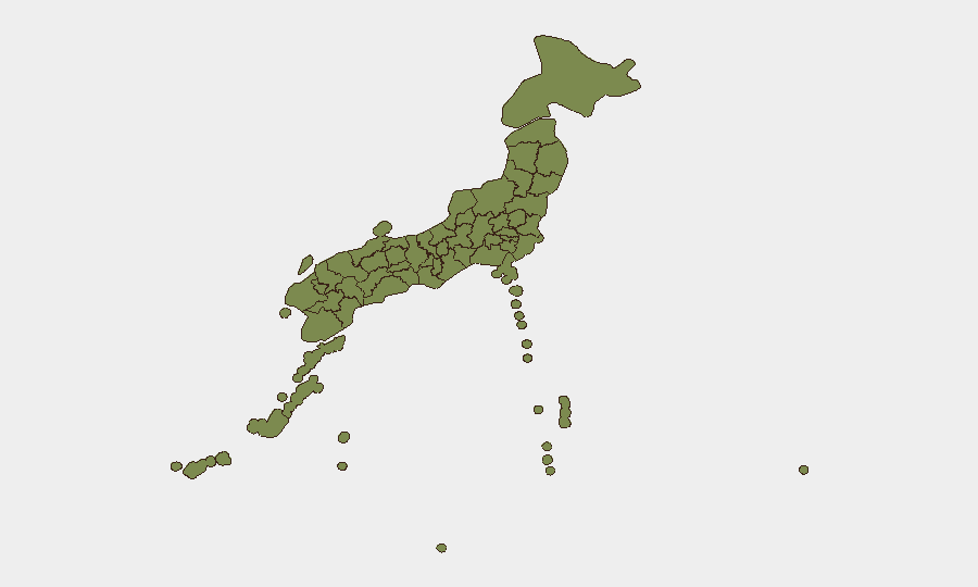
Situation Summary
Japan faces a composite threat level of 7/100 globally (#124 ranking), but this baseline is now shadowed by a significant natural-hazard event: a magnitude 7.2 offshore earthquake struck Aomori and Iwate prefectures on June 25, causing injuries, transport disruption, and ongoing aftershock risk. Political-diplomatic signals over the past 72 hours—including disapproval statements, military-posture activity, and investigative actions involving South Korea, China, and the EU—remain routine in tenor and localized in impact. The primary risk trajectory over the next week is driven by seismic aftershock danger and cascading transport/logistics recovery, not by imminent security escalation.
Key Developments
- Hashikami, Aomori Prefecture – June 25, 06:00 UTC: Magnitude 7.2 earthquake struck offshore near Iwate with upper-6 seismic intensity in Hashikami; at least 10 non-life-threatening injuries recorded across Aomori and Iwate (falls, struck-by-object incidents). Authorities issued guidance for continued high-alert status through early July due to expected strong aftershocks.
- Hachinohe, Aomori Prefecture – June 24–25: Structural and retail damage observed, including collapsed shelving in convenience stores and scattered goods; security camera footage confirmed shaking but no major building collapses or casualties reported.
- Tohoku Shinkansen (Tokyo–Hachinohe corridor) – June 25, post-quake: Shinkansen operations suspended for safety inspection immediately after quake; full northbound service resumed by afternoon, but regional rail lines in Iwate and Aomori remain suspended with no announced restart times, creating significant travel delays for commuters and business traffic.
- Japan Self-Defense Forces deployment – June 25: Defense Minister Shinjiro Koizumi authorized aerial reconnaissance missions over Iwate and Aomori to assess landslides, infrastructure damage, and access routes in support of prefectural disaster response.
- Tokyo and Kanto region – June 25: Secondary shaking from the same earthquake reached the greater Tokyo area; minor rattling of fixtures reported but no casualties or structural damage; business continuity impact minimal.
Highest-Risk Areas
Nagano Prefecture's exceptionally high risk score (33.4) stands alone and merits immediate investigation—it shows no correlation with the current Tohoku seismic event and may reflect unreported or evolving threats (terrain, industrial, or civil unrest) requiring targeted AOI monitoring. Tokyo (6.8) and Hiroshima (5.9) remain elevated due to their population density, critical infrastructure, and diplomatic exposure. The earthquake's immediate impact is confined to Aomori and Iwate, which do not appear in the top 12 sub-national rankings, suggesting either pre-quake risk modeling or a data-refresh lag; however, operational duty-of-care teams with personnel in the northern Tohoku corridor should escalate local monitoring for the coming week.
How GeoBit Would Assist
Security teams should deploy AOI Monitoring & Early Warning on Aomori, Iwate, and Nagano prefectures with alerting set for seismic, infrastructure, and transport disruption signals; couple this with Routing & Network Analysis to identify alternative transport and supply-chain corridors around the suspended rail lines. GIS & Spatial Analysis linked to earthquake aftershock forecasts and landslide risk maps will help prioritize asset-check priorities and predict secondary hazard zones over the next 7 days.
7-Day Outlook
Seismic aftershock activity is the dominant near-term risk; JMA forecasts significant tremors possible through early July, with potential for localized infrastructure disruption and minor injuries if magnitude 6+ events occur. Rail recovery is expected incrementally; Shinkansen resumption suggests transport resilience, but regional lines may remain disrupted through June 27–28. No escalation of geopolitical or security incidents is anticipated absent new diplomatic provocations.
Highest-Risk Areas — Ranked
| # | State / Region | Risk |
|---|---|---|
| 1 | Nagano Prefecture | 33.4 |
| 2 | Tokyo | 6.8 |
| 3 | Hiroshima Prefecture | 5.9 |
| 4 | Hokkaido Prefecture | 5.6 |
| 5 | Hyogo Prefecture | 5.6 |
| 6 | Okinawa Prefecture | 4 |
| 7 | Kagoshima Prefecture | 3.8 |
| 8 | Fukuoka Prefecture | 3.8 |
| 9 | Tokushima Prefecture | 3.6 |
| 10 | Osaka Prefecture | 3.6 |
| 11 | Niigata Prefecture | 3.6 |
| 12 | Miyagi Prefecture | 3.6 |
Sources
Previous Daily Briefs
A new Japan brief is written every day — each with its own risk map and downloadable CSV. Here's the last week; use the calendar to go further back.
📅 Browse every day by calendar →
Highlighted days have a brief. Tap a day for that day's map & analysis, or “csv” for that day's dataset ($5).