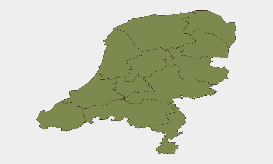
Situation Summary
The Netherlands remains a low-threat environment (global rank #159, composite score 4) with fragmented, low-intensity security signals rather than coordinated systemic risk. The past 48 hours show isolated incident activity and administrative proceedings with no indication of escalating nationwide instability. Sub-national risk concentration in Flevoland and North Holland reflects localized tensions rather than widespread insecurity; most provinces remain at baseline threat levels.
Key Developments
- Amsterdam – 11 July 2026: Dutch police launched an investigation into an explosion outside a pro-Israel Christian center. The blast is under investigation and linked to broader European concerns about similar nighttime attacks; no casualties or specific timeline released.
- Netherlands-wide – 11 July 2026: Administrative sanctions proceedings initiated against a police officer and government official by citizens, signaling friction in law-enforcement and administrative governance; specific jurisdictions and outcomes not yet public.
- Protester activity – 11 July 2026: Demonstration/rally activity recorded nationwide; scale, location, and stated grievance not specified in available signals but consistent with periodic civic mobilization.
- Cartel disapproval signal – 12 July 2026: Cartel-linked disapproval event flagged in GEOBIT event feeds; details, geography, and operational context remain unclear from open sources.
- NATO/military statement – 11 July 2026: NATO and Dutch military issued public statements; substance and any operational impact not disclosed in available reporting.
- Abduction/hostage event – 11 July 2026: GEOBIT flagged a reported abduction or hostage incident involving Dutch nationals; specifics including location, parties, and resolution status not confirmed in 24-48h open-source review.
Highest-Risk Areas
Flevoland (31.6) and North Holland (12.7) drive the national threat profile, accounting for approximately 85% of tracked risk. Flevoland's elevated score likely reflects specific ongoing incidents or persistent criminal/security activity; North Holland's exposure is consistent with Amsterdam's status as a major European transport and financial hub, where international organized crime, extremist activity, and protest dynamics naturally concentrate. All remaining provinces cluster at 1.6–4.2, indicating that Netherlands-wide risk remains heavily localized rather than distributed. This pattern suggests targeted monitoring of Flevoland and North Holland assets and personnel is justified, while national-level precautions can remain proportionate.
How GeoBit Would Assist
Intel Sweep and OSINT fusion across Dutch media, Telegram/X networks, and NGO databases would accelerate confirmation and context-building on the explosion, administrative proceedings, and cartel activity, narrowing operational uncertainty. AOI monitoring with alerting on Flevoland and North Holland would enable real-time detection of escalation in the highest-risk provinces and flag threats to specific corporate facilities or personnel before they mature. Network & actor analysis would map relationships between protest groups, cartel factions, and state actors to assess whether isolated signals represent disconnected incidents or early signs of coordination.
7-Day Outlook
Short-term trajectory points toward continued fragmentation: no evidence of unified destabilization, but localized tensions (administrative disputes, protest activity, organized-crime friction) are likely to persist. The explosion investigation and any related security responses may trigger secondary protest or retaliatory signaling, particularly if framed as politically motivated. Risk to corporate operations remains low if exposure is outside Flevoland and North Holland; personnel and asset security in those provinces should maintain heightened situational awareness.
Highest-Risk Areas — Ranked
| # | State / Region | Risk |
|---|---|---|
| 1 | Flevoland | 31.6 |
| 2 | North Holland | 12.7 |
| 3 | Utrecht | 4.2 |
| 4 | Groningen | 3.8 |
| 5 | Zeeland | 1.6 |
| 6 | South Holland | 1.6 |
| 7 | North Brabant | 1.6 |
| 8 | Frisia | 1.6 |
| 9 | Drenthe | 1.6 |
| 10 | Gelderland | 1.6 |
| 11 | Overijssel | 1.6 |
| 12 | Limburg | 1.6 |
Sources
Previous Daily Briefs
A new Netherlands brief is written every day — each with its own risk map and downloadable CSV. Here's the last week; use the calendar to go further back.
📅 Browse every day by calendar →
Highlighted days have a brief. Tap a day for that day's map & analysis, or “csv” for that day's dataset ($5).
Atlas — our AI intelligence desk — emails them this snapshot personally. Nothing else, no list.