Situation Summary
Vanuatu remains in a low-threat security environment with no current national-level conflict, terrorism, or organized-crime incidents tracked by GeoBit. The primary near-term hazard is seismic and volcanic activity: five earthquakes ranging from magnitude 4.7 to 6.0 have been recorded in recent days, primarily in the northern and central island groups (Torba and Sanma provinces). A localized diplomatic dispute over the appointment of the MSG Director General is under way, but poses no immediate security risk to corporate operations or expatriate communities.
Key Developments
- Torba Province (Sola vicinity) — 25–26 Jul 2026: Sequence of four earthquakes (M 6.0, 5.1, 4.9) within 80 km of Sola, indicating elevated seismic activity in the northern archipelago; no tsunami or damage alerts issued by national authorities to date.
- Sanma Province (Port-Olry to Luganville) — 24–26 Jul 2026: Two additional earthquakes (M 5.0 near Port-Olry, M 4.7 east of Luganville) extending seismic sequence southward; continued monitoring required for potential infrastructure impact on northern logistics hubs.
- Port Vila (National Level) — 23 Jul 2026: Malvatumauri National Council of Chiefs and government officials in public dispute over MSG Director General appointment; dispute is political and institutional, not a security or civil-order incident, but reflects heightened domestic political sensitivity.
- Nationwide — 26 Jul 2026: Official government travel advisory remains at "exercise normal safety precautions" with no elevation in threat level or restrictions on movement.
Highest-Risk Areas
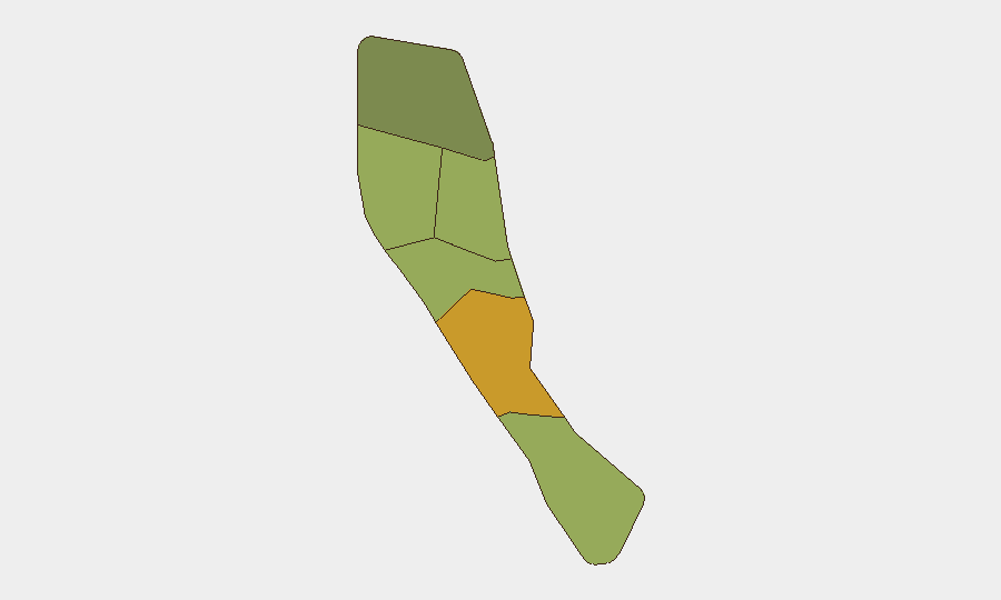
Shefa Province (risk score 72) — which includes the capital Port Vila — carries the highest composite risk and requires ongoing monitoring for political and administrative disruptions tied to the ongoing MSG leadership dispute. Penama (58) and Sanma (52) rank second and third, with Sanma's risk profile now elevated by active seismic activity that may impact infrastructure and logistics. Torba (35), while lowest-ranked, is the epicenter of current earthquake swarms and warrants priority watch for aftershocks and secondary hazards (landslides, coastal instability). Northern provinces as a group face dual exposure: ongoing political sensitivity at the national level and immediate geological hazard.
How GeoBit Would Assist
GeoBit's AOI Monitoring & Early Warning capability would establish persistent watch on northern provinces (Torba, Sanma) for seismic aftershocks, secondary hazards, and infrastructure disruptions; alerts would notify security teams of significant activity or service interruptions in real time. GIS & Spatial Analysis and Satellite & Imagery Analysis would enable rapid assessment of earthquake impact on roads, ports, and power infrastructure critical to supply chains and personnel movement. Intel Sweep and multi-language search across local media and government channels would track the MSG dispute and any spillover into civil order, labor, or inter-provincial tensions, allowing duty-of-care teams to anticipate secondary risks to operations.
7-Day Outlook
The seismic sequence is expected to continue with diminishing magnitude over 5–7 days; no major structural damage has been reported, but aftershocks above M 4.5 remain possible in Torba and Sanma. The MSG appointment dispute is likely to remain confined to high-level political and chiefly discourse and is not expected to trigger civil unrest or movement restrictions in the near term. Overall security risk remains low; primary hazard is geological rather than human-driven.
Highest-Risk Areas — Ranked
| # | State / Region | Risk |
|---|---|---|
| 1 | Shefa Province | 72 |
| 2 | Penama | 58 |
| 3 | Sanma | 52 |
| 4 | Malampa | 48 |
| 5 | Tafea | 45 |
| 6 | Torba | 35 |
Sources
Previous Daily Briefs
A new Vanuatu brief is written every day — each with its own risk map and downloadable CSV. Here's the last week; use the calendar to go further back.
📅 Browse every day by calendar →
Highlighted days have a brief. Tap a day for that day's map & analysis, or “csv” for that day's dataset ($5).
Atlas — our AI intelligence desk — emails them this snapshot personally. Nothing else, no list.