Situation Summary
Comoros remains a low-threat environment by global standards (rank #190, composite score 3) with no verified security incidents or civil unrest reported in the last 24–48 hours. The archipelago's security profile is shaped by chronic governance fragility and localized administrative tensions, particularly in Anjouan, rather than active conflict or organized violence. No current developments indicate a shift in this baseline risk posture.
Key Developments
No discrete, verifiable security or civil-unrest incidents were identified in open-source reporting for 14–16 July 2026. International news wires, regional African media, and security-intelligence feeds contained no alerts, advisories, or confirmed events specific to Comoros in this window. Monitoring of social media (X, Telegram) and major news outlets (Reuters, AFP, AP, CNN) found no cross-corroborated reports meeting brief criteria. Absence from East African and Indian Ocean security digests during this period is consistent with the absence of reportable incidents.
Highest-Risk Areas
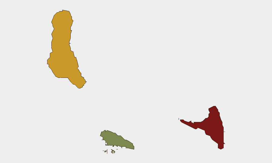
Anjouan (risk score 88) dominates the sub-national threat landscape, driven by its history of secessionist grievance, weak central governance, and sporadic intercommunal and administrative friction. Grande Comore (risk 72), the capital island, sustains elevated risk through political volatility and informal-economy-linked crime; administrative and factional disputes periodically surface but have not escalated to organized violence in recent months. Moheli (risk 35) remains significantly lower-risk. The ranking reflects structural institutional weakness and periodic local disputes rather than active armed conflict; corporate and humanitarian operations should calibrate presence and movement protocols accordingly, with heightened diligence in Anjouan.
How GeoBit Would Assist
Teams with personnel or assets in Comoros should employ AOI (Area-of-Interest) Monitoring & Early Warning on Anjouan and Grande Comore to detect early signals of administrative breakdown, intercommunal tension, or infrastructure disruption before they mature into travel restrictions or asset risk. Multi-language OSINT (X/Telegram, local media, radio SIGINT) enables continuous low-cost detection of local grievance narratives and protest mobilization that may not reach international wires immediately. Routing & Network Analysis can support contingency planning for alternative transport and supply chains if local volatility constrains primary routes, particularly on the Anjouan–Grande Comore corridor.
7-Day Outlook
No imminent escalation is forecast for the next 7 days. Comoros' baseline risk is driven by institutional fragility rather than acute triggers; absent a political shock (e.g., disputed election outcome, sudden administrative dispute), the security environment is expected to remain stable. Routine monitoring for signs of governance strain or intercommunal friction in Anjouan should continue as part of standard duty-of-care practice.
Report Date: 16 July 2026 | Next Update: 17 July 2026 (or upon significant event alert)
Highest-Risk Areas — Ranked
| # | State / Region | Risk |
|---|---|---|
| 1 | Anjouan | 88 |
| 2 | Grande Comore | 72 |
| 3 | Moheli | 35 |
Sources
Previous Daily Briefs
A new Comoros brief is written every day — each with its own risk map and downloadable CSV. Here's the last week; use the calendar to go further back.
📅 Browse every day by calendar →
Highlighted days have a brief. Tap a day for that day's map & analysis, or “csv” for that day's dataset ($5).
Atlas — our AI intelligence desk — emails them this snapshot personally. Nothing else, no list.