Situation Summary
Maldives remains a low-threat environment with a composite threat score of 4 globally and no tracked discrete security events. The security picture is dominated by weather-driven maritime hazards and routine enforcement rather than political violence, organized crime, or terrorism. Recent incidents—vessel sinkings, marine flooding, and coastal erosion enforcement—reflect seasonal sea conditions and operational risk rather than security deterioration. The overall trajectory is stable.
Key Developments
- Kaafu Gaafaru – Friday, August 01, 2026: A landing craft from K. Thilafushi sank near K. Gaafaru with 10 persons on board; 8 were rescued and transported to Gaafaru, while 2 Bangladeshi nationals remain missing. MNDF Coast Guard and Police search operations are ongoing.
- Kaafu Maafushi – Friday, August 01, 2026: A safari boat was destroyed when its anchor came loose and the vessel ran aground on a reef, in a separate marine incident the same morning.
- Nationwide coastal areas including Malé – July 31–August 01, 2026: Maldives Met Office issued white alerts for overtopping and swell waves (2–5 ft) nationwide; seawater flooding affected Malé's carnival area, Industrial Village, and northern waterfront, impacting some restaurants.
- Off Kaafu Maafushi – Thursday, July 31, 2026: A tourist fell into the sea when a parasail canopy burst in strong winds; jet-ski operators rescued those involved with no reported injuries.
- Faresmaathodaa, Gaafu Dhaalu Atoll – Thursday, July 31, 2026: The Faresmaathodaa Island Council intercepted a vessel illegally extracting sand from an uninhabited island, forced return of the bagged sand, and documented the enforcement action; illegal sand extraction damages reefs and is prohibited.
- Hulhumalé / Villimalé – Thursday, July 31, 2026: President Muizzu commissioned an Australian-gifted vessel into the MNDF Coast Guard and opened a Maritime Coordination Centre in Villimalé to improve maritime and aviation incident response capability.
Highest-Risk Areas
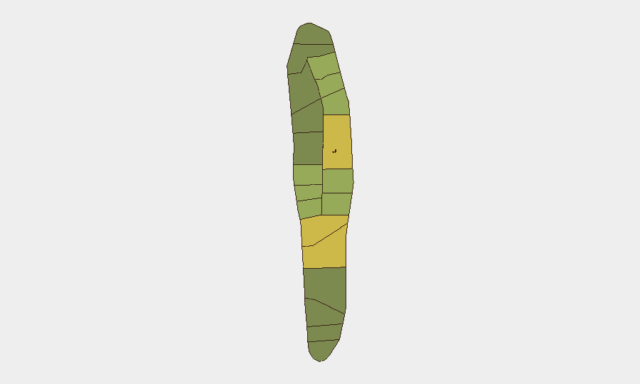
Malé (risk 85) and Malé Atoll (risk 68) dominate the sub-national risk ranking, reflecting concentration of national institutions, population, maritime traffic, and administrative activity in the capital region. Hadhdhunmathi (65), Kolhumadulu (60), and Felidhu Atoll (58) follow, but risk scores across all atolls remain moderate. The ranking reflects operational density and hazard exposure rather than active conflict or criminal violence; risk is primarily maritime and weather-related in the northern atolls and administrative/infrastructural in Malé itself.
How GeoBit Would Assist
Security teams with personnel or assets in Maldives should employ AOI Monitoring & Early Warning to track Malé, major atolls, and port/maritime zones for civil unrest, maritime incidents, or infrastructure disruption; pair this with Maritime & Aviation tracking to monitor vessel movements around high-risk zones and detect anomalies in traffic patterns or vessel behavior. Environmental & Health monitoring would provide advance warning of seasonal weather hazards (swell, flooding) that drive the current incident pattern and enable duty-of-care planning for offshore or waterfront operations.
7-Day Outlook
Hazardous sea conditions are expected to persist through the near-term window; maritime incidents and localized flooding remain the primary operational risk. No credible indicators suggest escalation toward civil unrest, organized violence, or political instability. Routine maritime and weather vigilance, combined with early-warning monitoring of the Malé corridor, remain the appropriate operational posture.
Highest-Risk Areas — Ranked
| # | State / Region | Risk |
|---|---|---|
| 1 | Malé | 85 |
| 2 | Malé Atoll | 68 |
| 3 | Hadhdhunmathi | 65 |
| 4 | Kolhumadulu | 60 |
| 5 | Felidhu Atoll | 58 |
| 6 | Mulaku Atoll | 55 |
| 7 | Faadhippolhu | 52 |
| 8 | South Miladhunmadulu | 48 |
| 9 | North Miladhunmadulu | 45 |
| 10 | South Nilandhe Atoll | 44 |
| 11 | North Nilandhe Atoll | 42 |
| 12 | South Ari Atoll | 40 |
Sources
Previous Daily Briefs
A new Maldives brief is written every day — each with its own risk map and downloadable CSV. Here's the last week; use the calendar to go further back.
📅 Browse every day by calendar →
Highlighted days have a brief. Tap a day for that day's map & analysis, or “csv” for that day's dataset ($5).
Atlas — our AI intelligence desk — emails them this snapshot personally. Nothing else, no list.