Situation Summary
Norway remains a low-threat environment globally (rank #44, composite score 35) with no tracked active security events at the national level. However, sub-national risk has increased noticeably in the last 72 hours, driven by a cluster of violent-crime incidents across the southeastern regions and a critical infrastructure disruption. The Oslo metropolitan area and surrounding Akershus county continue to dominate the risk profile, accounting for the largest share of reported incidents.
Key Developments
- Hvaler, Østfold | 2026-08-08 (reported) — A 120-meter tanker vessel ran aground and caught fire with an explosion-like event; crew reported under control and emergency response activated. This is the only confirmed acute maritime/industrial incident in the last 24 hours.
- Nationwide | 2026-08-03 (ongoing impact context) — The ID-Porten national digital gateway outage that began 03:00 on 2026-08-03 disrupted access to government services (tax, health records, business registration). Although outside the strict 24-hour window, the outage remains operationally significant for duty-of-care teams relying on Norwegian government digital services.
- Lillestrøm, Akershus | 2026-08-04 — A serious assault was reported and characterized by police as part of a widening pattern of violent crime in the region.
- Ringsaker, Innlandet | 2026-08-04 — An armed robbery involving violence occurred; police linked it to a broader serious-crime trend affecting multiple regions.
- Jæren, Rogaland | 2026-08-04 — A woman in her 30s was found dead; the death is being treated as a criminal case with a suspect in custody.
- Near Oslo Airport | 2026-08-06 — Police responded to a drone incursion near airport operations; a scheduled Widerøe flight was held on the ground pending all-clear. The drone operator fled the scene. This represents a potential aviation-security concern requiring monitoring.
Highest-Risk Areas
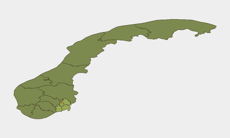
Oslo (risk 68) and Akershus (risk 52) counties are the primary drivers of national risk, accounting for more than half of tracked incidents and representing urban crime concentration, infrastructure vulnerability, and aviation-proximity factors. The Østfold region (risk 48) has emerged as a secondary concern due to the maritime incident and ongoing violent-crime reports. Southeast corridor counties (Vestfold, Buskerud) show elevated but contained risk profiles; western and northern regions remain significantly lower-risk.
How GeoBit Would Assist
Security teams with personnel or assets in Norway should deploy Intel Sweep and OSINT fusion capabilities to monitor the Oslo-Akershus corridor for violent crime and aviation-security developments in near-real time. AOI Monitoring & Early Warning focused on Hvaler and Østfold would provide persistent watch on maritime-incident evolution and environmental/industrial hazards. Network & Actor Analysis against the emerging violent-crime pattern would help identify whether incidents are organized or opportunistic, informing protective posture adjustments.
7-Day Outlook
Violent-crime incidents across the southeast are likely to remain at current elevated levels over the next 7 days; police characterization of a "widening pattern" suggests reactive rather than pre-emptive control. The maritime incident in Hvaler requires close monitoring for environmental or secondary hazard escalation. No indicators suggest imminent national-level security deterioration, but localized travel-safety and nightlife-venue risk in Oslo-Akershus should be reviewed in corporate duty-of-care policies.
Highest-Risk Areas — Ranked
| # | State / Region | Risk |
|---|---|---|
| 1 | Oslo | 68 |
| 2 | Akershus | 52 |
| 3 | Østfold | 48 |
| 4 | Vestfold | 42 |
| 5 | Rogaland | 38 |
| 6 | Buskerud | 35 |
| 7 | Trøndelag | 32 |
| 8 | Telemark | 28 |
| 9 | Vestland | 27 |
| 10 | Agder | 26 |
| 11 | Møre og Romsdal | 22 |
| 12 | Innlandet | 20 |
Sources
Previous Daily Briefs
A new Norway brief is written every day — each with its own risk map and downloadable CSV. Here's the last week; use the calendar to go further back.
📅 Browse every day by calendar →
Highlighted days have a brief. Tap a day for that day's map & analysis, or “csv” for that day's dataset ($5).
Atlas — our AI intelligence desk — emails them this snapshot personally. Nothing else, no list.