Situation Summary
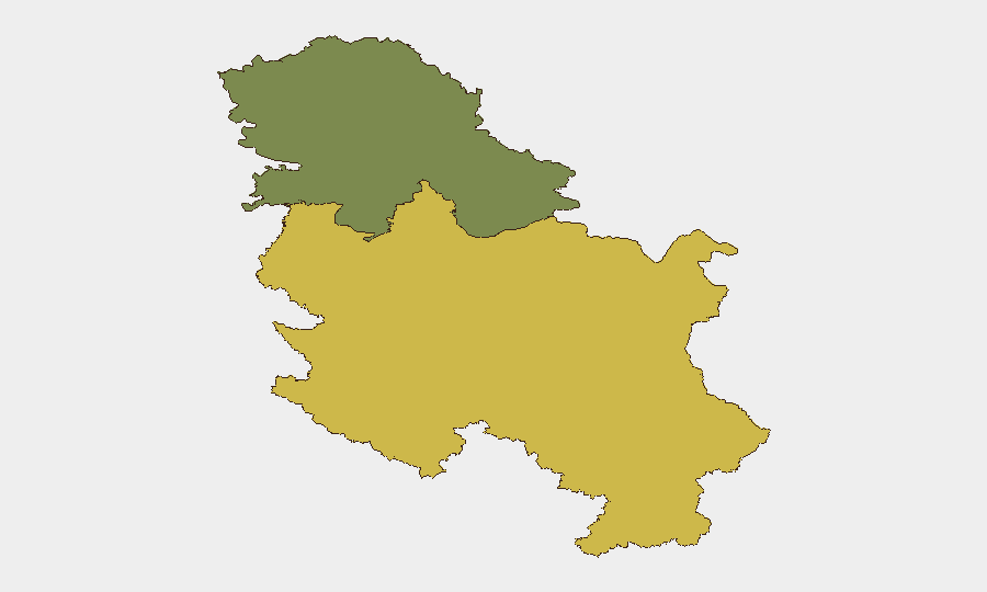
Serbia remains a low-threat environment globally (composite score 7), with no major security incidents tracked in the current reporting window. Road safety represents the most observable acute risk; multiple traffic accidents in the Belgrade–Novi Sad corridor occurred within the last 24 hours, injuring at least seven persons. The security posture across the country is stable, with Central Serbia registering elevated sub-national risk (65) relative to Vojvodina (35), though neither reflects imminent political, criminal, or conflict-related instability.
Key Developments
- Novi Sad–Belgrade motorway (today) – A serious traffic accident injured five persons and triggered significant traffic congestion on a major national transport corridor.
- Belgrade (overnight/today) – Two separate traffic incidents resulted in light injuries to two persons, indicating elevated accident frequency in the capital's road network over a compressed timeframe.
- No discrete security, crime, or civil unrest events were corroborated from open sources within the last 24–48 hours.
*Note: Traffic incidents are documented; broader crime, protest, or conflict data for the same window remain unconfirmed from available open-source materials.*
Highest-Risk Areas
Central Serbia's composite risk score (65) substantially exceeds Vojvodina (35), reflecting concentrated urban density, transport infrastructure vulnerability, and historical incident concentration in and around Belgrade. The capital and its motorway network remain the primary zone of observable acute risk—in this case, transportation safety—though the underlying drivers of the regional risk differential are not fully transparent from current event data alone. Duty-of-care teams should prioritize route planning and real-time traffic monitoring for personnel transiting the Belgrade–Novi Sad corridor and within Central Serbia's urban zones.
How GeoBit Would Assist
Security teams operating in Serbia should deploy AOI Monitoring & Early Warning focused on Central Serbia's transport corridors (motorways M1, M2) and Belgrade's urban crime zones to capture accidents, congestion, and civil incidents in near-real time with alerting. Routing & Network Analysis can generate alternative journey plans that avoid high-incident clusters and congestion zones, reducing exposure during peak-risk periods. Multi-language OSINT (social media, local news feeds, transport authority channels) provides continuous visibility into unconfirmed incidents, weather disruptions, and protest activity that may not yet reach international newswires, enabling earlier protective action than reactive reporting alone.
7-Day Outlook
No significant deterioration in the security environment is anticipated over the next week. Road safety will remain the primary operational concern for personnel movement; summer holiday traffic and heat-related driving fatigue typically elevate accident rates in the region during August. Monitoring of Central Serbia's transport nodes and continuous liaison with local authorities and transport services will provide early notice of any shift in the threat landscape.
Highest-Risk Areas — Ranked
| # | State / Region | Risk |
|---|---|---|
| 1 | Central Serbia | 65 |
| 2 | Vojvodina | 35 |
Sources
Previous Daily Briefs
A new Serbia brief is written every day — each with its own risk map and downloadable CSV. Here's the last week; use the calendar to go further back.
📅 Browse every day by calendar →
Highlighted days have a brief. Tap a day for that day's map & analysis, or “csv” for that day's dataset ($5).
Atlas — our AI intelligence desk — emails them this snapshot personally. Nothing else, no list.