Situation Summary
Tonga remains a low-threat environment with no acute security incidents, civil unrest, or infrastructure disruption reported in the last 24–48 hours. The nation ranks #191 globally (composite threat score 3) with zero tracked active events. Seismic activity in the surrounding region continues (four earthquakes of magnitude 4.2–5.1 recorded recently), but these remain offshore and pose no immediate surface risk to population centers.
Key Developments
- Nuku'alofa, Tongatapu – 10 July 2026
The Women and Children Crisis Centre (WCCC) Tonga endorsed the First Tonga Women's Platform for Action (2026). No civil unrest, protests, or security incidents accompanied the announcement.
- Tonga (offshore, regional) – recent dates
Four seismic events recorded: M 5.1 (89 km NE of Hihifo, Tongatapu); M 5.0 (299 km W of Neiafu, Vavaʻu); M 4.3 and M 4.2 (both ~296 km WNW of Houma, Haʻapai). All epicenters are offshore; no tsunami warnings or coastal impact reported.
- Tonga (national) – 10–11 July 2026
Regional Pacific news monitored no domestic security incidents, crime spikes, or travel disruptions within Tonga. Coverage focused on broader South Pacific geopolitics (e.g., Fiji–Australia military partnership) without reporting local instability.
- Nuku'alofa and main islands – 10–11 July 2026
Open-source social media monitoring (X/Twitter) shows routine political commentary, sports, and community activity; no geolocated reports of demonstrations, riots, or major crimes.
- Diplomatic context – 10–11 July 2026
No new travel warnings, alerts, or incident advisories issued by international risk or diplomatic channels specific to Tonga during this period.
Highest-Risk Areas
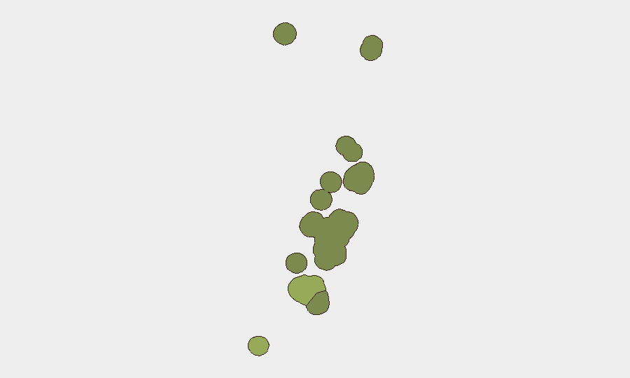
Tongatapu dominates the sub-national ranking (risk 45), driven by its status as the capital region and primary economic, political, and population center; routine administrative, social, and security activity concentrates here. Vavaʻu (risk 28) and Haʻapai (risk 22) follow, reflecting lower population density and reduced incident reporting infrastructure. ʻEua (18) and Ongo Niua (12) carry minimal tracked risk. The elevated Tongatapu score reflects greater human activity and data visibility rather than acute instability; baseline conditions remain stable across all regions.
How GeoBit Would Assist
Corporate security teams with personnel or assets in Tonga should employ AOI Monitoring & Early Warning on Nuku'alofa, Neiafu, and other key business centers to detect any emerging civil unrest, transport disruption, or infrastructure failures in real time. Intel Sweep and multi-language OSINT (monitoring local news, social platforms, and regional media in English and Tongan) provide continuous corroboration of stability and early signal of any deterioration. Maritime & Aviation tracking and Routing & Network Analysis enable real-time alternative-route planning should port or airport disruptions occur, and Environmental & Health monitoring tracks seismic and weather developments that could affect supply chains or personnel safety.
7-Day Outlook
No material change in Tonga's security posture is forecast for the next seven days. Offshore seismic activity may persist but poses no significant surface risk. Routine administrative and social activity will likely continue without elevated incident risk. Personnel and asset security measures should remain at baseline; organizations should maintain passive monitoring for any unexpected developments in the capital or outer islands.
Highest-Risk Areas — Ranked
| # | State / Region | Risk |
|---|---|---|
| 1 | Tongatapu | 45 |
| 2 | Vavaʻu | 28 |
| 3 | Haʻapai | 22 |
| 4 | ʻEua | 18 |
| 5 | Ongo Niua | 12 |
Sources
Previous Daily Briefs
A new Tonga brief is written every day — each with its own risk map and downloadable CSV. Here's the last week; use the calendar to go further back.
📅 Browse every day by calendar →
Highlighted days have a brief. Tap a day for that day's map & analysis, or “csv” for that day's dataset ($5).
Atlas — our AI intelligence desk — emails them this snapshot personally. Nothing else, no list.