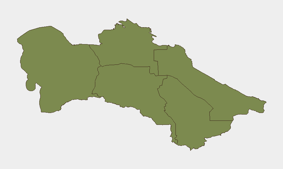
Situation Summary
Turkmenistan remains stable internally with no verified security incidents, protests, or infrastructure disruptions reported in the last 24–48 hours. However, the country faces indirect but material risk from escalating U.S.–Iran military tensions and resulting disruption to Iranian rail and trade infrastructure that Turkmenistan depends on for regional connectivity. The overall threat environment is low relative to global standards (rank #134), but concentrated in the northern Dashoguz Region; near-term trajectory is shaped by developments beyond Turkmenistan's borders rather than domestic instability.
Key Developments
- Iran–Central Asia Rail Corridor (Aky Tappe Khan area, northern Iran), 10–11 July 2026: U.S. strikes damaged the Aky Tappe Khan railway bridge serving the Iran–Turkmenistan–Kazakhstan rail link, disrupting freight logistics to Turkmenistan. No strikes or damage confirmed on Turkmenistan's own territory, but cargo rerouting and delays are expected.
- Strait of Hormuz and Persian Gulf region, 10–11 July 2026: U.S.–Iran ceasefire has deteriorated with renewed threat of intensified bombing and sanctions, elevating regional energy and trade-route risk for countries reliant on southbound sea passages and onward overland corridors through Iran (including Turkmenistan's export routes).
- Iranian coastal and rail infrastructure (general), 10–11 July 2026: Broader targeting of Iranian transport infrastructure by U.S. forces has affected segments of the cross-border rail network servicing Turkmen trade, signaling sustained logistics pressure in the near term.
- Turkmenistan (Ashgabat), 11 July 2026: Government sources reported a scientific-practical conference on hydrogen energy development. Signals that official communications remain focused on economic and energy policy rather than emergency or security crises; no operational security concerns indicated.
- Dashoguz Region (northern Turkmenistan), general watch: No new incidents in the last 24–48 hours, but the region's elevated risk profile (score 31.5) reflects its proximity to Iran and volatile border dynamics; monitor for secondary effects if U.S.–Iran tension escalates further.
Highest-Risk Areas
Dashoguz Region in northern Turkmenistan dominates the sub-national risk ranking (31.5) due to its direct adjacency to conflict-affected Iranian territory and exposure to cross-border spillover. The recent strike on the Aky Tappe Khan bridge, approximately 100 km south of the Turkmen border, underscores the proximity of disruption. Ashgabat City (risk 4.0) carries baseline governance and access restrictions typical of the capital, while remaining the seat of state control and thus lower-risk for uncontrolled unrest. Balkan, Lebap, Ahal, and Mary regions (all 1.5) are lower-risk; monitoring should focus on any secondary effects from Iranian logistics disruption affecting regional commerce and border crossings.
How GeoBit Would Assist
Security teams should deploy AOI Monitoring & Early Warning on Dashoguz Region and the Iran–Turkmenistan border to detect cross-border spillover, weapons movement, or refugee flows in real time. Trade & Economic routing analysis combined with OSINT fusion (X/Telegram, regional security feeds) would track logistics disruptions, sanctions impacts, and supply-chain rerouting affecting Turkmen operations. Satellite & imagery analysis and border & disputed-territory search capabilities enable continuous monitoring of Iranian infrastructure damage and cross-border security posture to forecast knock-on effects for personnel or assets in-country.
7-Day Outlook
If U.S.–Iran tensions de-escalate or stabilize, Turkmenistan's internal security profile should remain unchanged; rail and trade disruption will persist 1–2 weeks pending Iranian infrastructure repair. Conversely, further U.S. or Iranian military action could extend logistics delays, trigger secondary sanctions on Iranian border transit, or create localized displacement near Dashoguz. Recommend heightened monitoring of Iran–Turkmenistan border crossings and Iranian port activity as leading indicators of sustained disruption.
Highest-Risk Areas — Ranked
| # | State / Region | Risk |
|---|---|---|
| 1 | Dashoguz Region | 31.5 |
| 2 | Ashgabat City | 4 |
| 3 | Balkan Region | 1.5 |
| 4 | Lebap Region | 1.5 |
| 5 | Ahal Region | 1.5 |
| 6 | Mary Region | 1.5 |
Sources
Previous Daily Briefs
A new Turkmenistan brief is written every day — each with its own risk map and downloadable CSV. Here's the last week; use the calendar to go further back.
📅 Browse every day by calendar →
Highlighted days have a brief. Tap a day for that day's map & analysis, or “csv” for that day's dataset ($5).
Atlas — our AI intelligence desk — emails them this snapshot personally. Nothing else, no list.