Situation Summary
Vanuatu remains at low acute risk with no verified security incidents, civil unrest, infrastructure disruption, or travel-related incidents reported in the past 24–48 hours. The country is rated globally #144 on composite threat scoring and presents a stable security environment for corporate operations. Seismic activity in the offshore region (four earthquakes ranging M4.9–M6.0 west and northwest of Sola, Torba Province) continues within the country's normal tectonic pattern and does not indicate imminent volcanic or tsunami risk to populated areas. The security trajectory remains stable absent new incident reporting.
Key Developments
- No new security incidents reported (24–48h window). Web and social-media monitoring across English and regional sources has detected no verified events meeting security-incident criteria in the past two days.
- Seismic activity, offshore Torba Province (recent). Four earthquakes (M6.0, M5.1, M5.0, M4.9) have been recorded 4–96 km west and northwest of Sola. While consistent with Vanuatu's active seismic zone, these remain remote from major population or asset centers and do not currently indicate elevated volcanic or structural risk to onshore infrastructure.
- Routine travel advisory status maintained. Australia's Smartraveller advisory continues to recommend "exercise normal safety precautions" with no updated warnings on civil unrest, crime escalation, or service disruption as of the 24–48h reporting window.
- No verified incidents of crime, political instability, or infrastructure failure detected. Monitoring of local news outlets, social media, and international wire services has produced no corroborating reports of new threats to personnel, facilities, or supply chains in Vanuatu.
Highest-Risk Areas
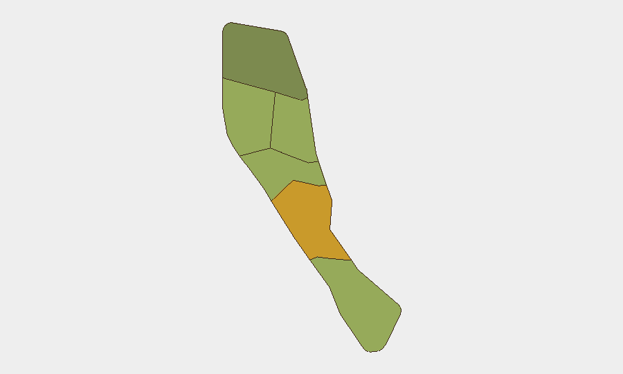
Shefa Province (composite risk 72) and Penama Province (risk 58) are the sub-national zones with the highest assessed threat scores, driven primarily by historical patterns of petty crime, informal settlement dynamics, and limited emergency-services capacity in peripheral areas. Sanma Province (risk 52) follows, with similar drivers of localized vulnerability. Port Vila (Shefa) and Luganville (Sanma), as the two largest urban centers, concentrate economic activity and transient populations, increasing exposure to opportunistic crime and social friction; however, no acute incident activity has been detected in these zones in the current 24–48h window. The outer provinces (Torba, Tafea, Malampa) carry lower composite scores and reflect more dispersed, lower-density risk profiles typical of remote island communities.
How GeoBit Would Assist
Security teams with people or assets in Vanuatu should prioritize AOI Monitoring & Early Warning to maintain persistent watch on Shefa and Penama provinces and alert on new incidents affecting facility locations or personnel transit routes. OSINT Fusion & Corroboration across multi-language social-media feeds, local news outlets, and wire services will provide real-time verification of any emerging unrest, crime activity, or infrastructure disruption. Routing & Network Analysis can support contingency planning for personnel movement and supply-chain resilience by identifying alternative routes and dependencies in the event of localized disruption.
7-Day Outlook
No indicators point to a significant shift in Vanuatu's security posture over the next seven days. Offshore seismic activity may continue but remains within normal range and does not warrant elevated onshore alert levels. Routine duty-of-care monitoring and standard security protocols are sufficient for current risk conditions.
Highest-Risk Areas — Ranked
| # | State / Region | Risk |
|---|---|---|
| 1 | Shefa Province | 72 |
| 2 | Penama | 58 |
| 3 | Sanma | 52 |
| 4 | Malampa | 48 |
| 5 | Tafea | 45 |
| 6 | Torba | 35 |
Sources
Previous Daily Briefs
A new Vanuatu brief is written every day — each with its own risk map and downloadable CSV. Here's the last week; use the calendar to go further back.
📅 Browse every day by calendar →
Highlighted days have a brief. Tap a day for that day's map & analysis, or “csv” for that day's dataset ($5).
Atlas — our AI intelligence desk — emails them this snapshot personally. Nothing else, no list.