Situation Summary
Chile faces a composite threat score of 15 globally and remains broadly stable, with no confirmed major civil unrest or violent crime escalation in the last 48 hours. The dominant near-term risk is weather-driven infrastructure disruption: a multi-day frontal system has triggered widespread flooding, landslides, power interruptions, and transport disruption across multiple regions since 19–25 July. Santiago Metropolitan Region carries significantly elevated risk (31.3 composite score), while Coquimbo Region—currently under a declared state of catastrophe—is experiencing the most acute operational impact. Political activity and inter-agency statements are elevated but do not yet indicate destabilization.
Key Developments
- Coquimbo Region & Huasco Province (23–24 Jul) — Authorities intensified emergency response including preventive evacuations in Tiltil, connectivity restoration in Huasco, and health/rescue reinforcement. A state of catastrophe declaration was issued for Coquimbo and Huasco provinces, indicating official recognition of critical infrastructure and mobility risk.
- National flooding & transport disruption (20–25 Jul) — Persistent rainfall across multiple regions generated flash flooding, road closures, landslides, and power interruptions. Social-media reports confirm ongoing evacuation alerts and mobility constraints; no definitive casualty toll or infrastructure-restoration timeline is yet publicly confirmed.
- Government & legislative activity (23–25 Jul) — Multiple public statements issued by ministers of agriculture, deputy representatives, and mayors; two legislative demands and a government disapproval vote were recorded. None publicly attributed to security-critical policy shifts, though may reflect response coordination and accountability pressure.
- Bolivia & Venezuela border activity (24–25 Jul) — An arrest/detain event in Bolivia on 25 Jul and an expel/deport action (Chile vs. Venezuela) on 24 Jul were recorded; specific details and nexus to broader regional instability remain unconfirmed by independent sources.
- Company & government investigations (23–24 Jul) — Investigation directives issued regarding one company and one government entity; scope and urgency are unclear without further detail.
Note: Verified developments are constrained by dominant weather reporting in available 24–48-hour sources. Political and cross-border signals are tracked but lack full corroboration and specific operational context.
Highest-Risk Areas
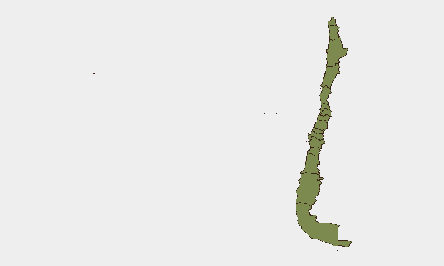
Santiago Metropolitan Region (31.3) accounts for the majority of tracked risk and requires priority focus for asset and personnel security; it hosts the capital's critical government, financial, and transport infrastructure. Coquimbo Region (4.7) is the acute operational hotspot due to the active state-of-catastrophe declaration, widespread flooding, and emergency-response strain. Los Lagos Region (4.7) shows comparable risk but with less immediate activation. All other tracked regions register low (1.3–3.0) composite scores, indicating secondary concern. The concentration of risk in Santiago and the coastal/northern regions reflects both political activity density and weather-system exposure.
How GeoBit Would Assist
Intel Sweep and OSINT Fusion would consolidate fragmented political and inter-agency statements to clarify response priorities and any emerging policy instability. AOI Monitoring & Early Warning with persistent satellite and ground-truthing watch would track real-time flooding extent, road-network status, and power restoration in Coquimbo and central regions, enabling agile routing and duty-of-care decisions. Network & Actor Analysis combined with multi-language OSINT (X, Telegram, local news) would detect early signs of supply-chain disruption, labor unrest, or political escalation that weather reporting alone does not surface.
7-Day Outlook
The frontal system is expected to weaken by late 25–26 July; however, recovery of transport, power, and supply chains in Coquimbo and surrounding regions will likely extend 5–10 days. Political and budgetary pressure on local and national government will remain elevated through statements and legislative debate. No imminent threat of civil unrest or significant crime escalation is indicated, but infrastructure-dependent businesses and travel should assume continued disruption in affected regions.
Highest-Risk Areas — Ranked
| # | State / Region | Risk |
|---|---|---|
| 1 | Santiago Metropolitan Region | 31.3 |
| 2 | Coquimbo Region | 4.7 |
| 3 | Los Lagos Region | 4.7 |
| 4 | Biobio Region | 3 |
| 5 | Valparaiso Region | 1.3 |
| 6 | Antofagasta Region | 1.3 |
| 7 | Atacama Region | 1.3 |
| 8 | Aysen del General Carlos Ibanez del Campo Region | 1.3 |
| 9 | Magallanes and Chilean Antarctica Region | 1.3 |
| 10 | O'Higgins Region | 1.3 |
| 11 | Maule Region | 1.3 |
| 12 | Nuble Region | 1.3 |
Previous Daily Briefs
A new Chile brief is written every day — each with its own risk map and downloadable CSV. Here's the last week; use the calendar to go further back.
📅 Browse every day by calendar →
Highlighted days have a brief. Tap a day for that day's map & analysis, or “csv” for that day's dataset ($5).
Atlas — our AI intelligence desk — emails them this snapshot personally. Nothing else, no list.