Situation Summary
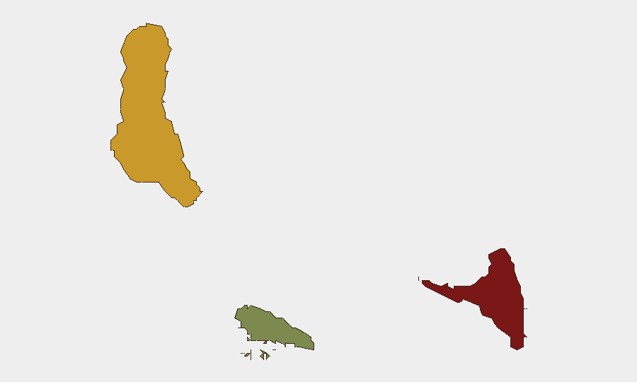
Comoros presents a composite threat score of 12 with no tracked security events in the current 24–48-hour window. The archipelago's risk profile remains characterized by underlying governance fragility and inter-island tensions rather than acute active incidents. Sub-national disparities are pronounced, with Anjouan (risk 88) and Grande Comore (risk 72) significantly outranking Moheli (risk 35), indicating concentrated vulnerability in the northern and central islands. The absence of recent discrete events should not be interpreted as stability; rather, it reflects the baseline structural vulnerabilities that define the operational environment.
Key Developments
No confirmed security, conflict, unrest, crime, political-instability, infrastructure, or travel-risk events have been verified in Comoros in the last 24–48 hours. Background reporting from July 24–25 documents ongoing internal government tensions and broader economic/political pressure narratives, but these do not constitute fresh incidents. A July 25 maritime incident involved a Comoros-flagged tanker in the Arabian Sea and is outside the territorial scope of this brief.
Recommendation: Monitor for escalation of existing inter-island administrative and political friction as a leading indicator of broader instability.
Highest-Risk Areas
Anjouan emerges as the clear priority, with a risk score of 88—substantially above the national composite and more than double that of Moheli. Governance disputes between the federal government in Moroni (Grande Comore) and Anjouan's autonomous administration have historically driven separatist sentiment, administrative paralysis, and occasional armed confrontations; this structural tension remains the primary driver of the island's elevated profile. Grande Comore (risk 72) faces secondary but significant vulnerabilities tied to capital-city concentration, informal economy pressures, and spillover from Anjouan friction. Moheli (risk 35) remains the lowest-risk island and offers a relative safe haven for operations requiring minimal exposure to political volatility.
How GeoBit Would Assist
Organizations with personnel or assets in Comoros should deploy AOI (Area-of-Interest) Monitoring & Early Warning on Anjouan and Grande Comore to track administrative announcements, public gatherings, and militia activity with real-time alerting. Intel Sweep and multi-language OSINT (X/Telegram, local Comorian and French sources, radio SIGINT where applicable) would provide continuous baseline awareness of political rhetoric, protest activity, and elite faction moves. For duty-of-care scenario planning, Routing & Network Analysis can identify alternative departure routes and safe zones on each island in advance of any escalation requiring staff relocation.
7-Day Outlook
No significant change in the baseline threat picture is anticipated over the next seven days absent a triggering event (e.g., disputed election outcome, administrative decree on Anjouan autonomy, or maritime incident affecting the capital). Monitoring should remain continuous at background intensity, with heightened alerting configured for the Anjouan risk zone. Organizations should maintain current travel advisories and ensure duty-of-care contact trees are current and tested.
Highest-Risk Areas — Ranked
| # | State / Region | Risk |
|---|---|---|
| 1 | Anjouan | 88 |
| 2 | Grande Comore | 72 |
| 3 | Moheli | 35 |
Sources
Previous Daily Briefs
A new Comoros brief is written every day — each with its own risk map and downloadable CSV. Here's the last week; use the calendar to go further back.
📅 Browse every day by calendar →
Highlighted days have a brief. Tap a day for that day's map & analysis, or “csv” for that day's dataset ($5).
Atlas — our AI intelligence desk — emails them this snapshot personally. Nothing else, no list.