Situation Summary
Iceland remains a very-low-threat environment with a composite threat score of 28 globally and no credible reports of large-scale civil unrest, political violence, or terrorism. The most significant current developments are a localized but notable surge in residential burglaries across Reykjavík (43 reported incidents over two weeks), a power outage affecting the Breiðholt district on July 31–August 1, and ongoing but stable volcanic activity on the Reykjanes Peninsula. National-level security posture has been reinforced by a new Iceland–EU Security and Defence Partnership signed around August 1, reflecting heightened focus on maritime and critical-infrastructure protection. Overall trajectory remains stable.
Key Developments
- Reykjavík – Breiðholt district – evening of July 31 & early August 1, 2026
A high-voltage grid fault caused a significant electricity outage across Breiðholt and adjacent residential areas, impacting lighting, services, and security systems; Veitur crews mobilized and power restoration was underway. This event underscores temporary infrastructure vulnerability in a major capital district.
- Reykjavík – multiple locations, citywide – late July through August 1–2, 2026
Local authorities announced a public security meeting in response to a sharp rise in burglaries and thefts, with 43 incidents reported over two weeks (approximately 20 in the city center), prompting police to urge residents to report all break-ins. This represents an elevated property-crime trend in the capital.
- Reykjavík – apartment building (capital area) – late July 31 / early August 1, 2026
Police received a report of a break-in where a perpetrator rang a doorbell, forced entry, and committed a burglary; case remains under investigation. This incident confirms ongoing residential-burglary activity and active police response.
- Iceland–EU – late July 31 / August 1, 2026 (signature date)
Iceland and the EU formally signed a Security and Defence Partnership focused on maritime security and critical-infrastructure protection, with explicit reference to Russian threats to seabed assets and China's Arctic interests. This policy development signals elevated national-level security attention.
- Reykjanes Peninsula – Grindavík area – ongoing as of August 1–2, 2026
Lava flows from the July 16 Sundhnúkur fissure eruption continue but at reduced intensity, concentrated in one crater; Grindavík and the Blue Lagoon have reopened, and all airports and national flights operate normally. Volcanic hazard remains stable; travelers near Reykjanes should remain alert to rapid-change notices.
Highest-Risk Areas
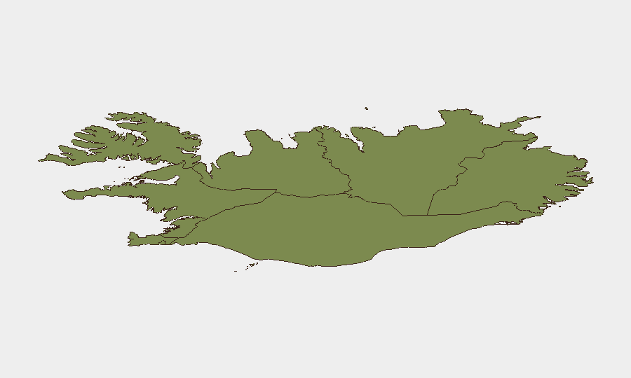
The Capital Region (Reykjavík and environs) accounts for the majority of tracked risk, driven primarily by the current burglary surge and the recent power outage in Breiðholt. The Southern Peninsula and Southern Region carry secondary risk owing to ongoing volcanic activity near Grindavík and Reykjanes, though infrastructure and transport remain open and operational. All other regions score below 10 and present minimal acute security concern. Threat concentration is strongly localized to the capital and its immediate suburbs.
How GeoBit Would Assist
A security team with personnel or assets in Reykjavík would benefit from AOI Monitoring & Early Warning focused on the Capital Region to track burglary trends, police activity, and infrastructure disruptions in real time. OSINT Fusion & Corroboration across local police announcements, utility reports, and media would provide rapid intelligence on property-crime patterns and outage status. GIS & Spatial Analysis would help map risk hotspots (city center, residential zones) and optimize secure routing for staff and assets.
7-Day Outlook
Burglary activity in Reykjavík is likely to remain elevated in the near term as police respond and awareness increases; property security measures should remain heightened. Volcanic activity on Reykjanes is forecast to remain stable and non-disruptive to transport. No major security escalation is anticipated; the threat environment is expected to remain consistent with current low-threat baseline.
Highest-Risk Areas — Ranked
| # | State / Region | Risk |
|---|---|---|
| 1 | Capital Region | 24 |
| 2 | Southern Peninsula | 12 |
| 3 | Southern Region | 11 |
| 4 | Eastern Region | 10 |
| 5 | Western Region | 9 |
| 6 | Westfjords Region | 8 |
| 7 | Northwestern Region | 7 |
| 8 | Northeastern Region | 6 |
Sources
Previous Daily Briefs
A new Iceland brief is written every day — each with its own risk map and downloadable CSV. Here's the last week; use the calendar to go further back.
📅 Browse every day by calendar →
Highlighted days have a brief. Tap a day for that day's map & analysis, or “csv” for that day's dataset ($5).
Atlas — our AI intelligence desk — emails them this snapshot personally. Nothing else, no list.