Situation Summary
Maldives remains a low-threat environment overall (composite score 2; no tracked systemic events), with security risks concentrated in urban centers and among vulnerable populations rather than organized violence or political instability. Recent incidents—petty theft, immigration enforcement, maritime accidents, and contraband recovery—reflect routine law-enforcement activity and operational hazards rather than escalating criminal or security trends. The capital region (Malé and surrounding atolls) accounts for the majority of documented risk, driven by population density, transit traffic, and enforcement visibility. The security trajectory is stable, with no indicators of sudden deterioration.
Key Developments
- Hulhumalé, Phase 1 / FW Residence vicinity (Sunday, reported Thursday): Two men on a motorcycle conducted a wallet snatch robbery from an expatriate cyclist; MVR 10,000 recovered by police. Indicates continued street-level theft targeting foreign nationals in populated residential areas.
- Hulhumalé Rashu Market (Tuesday): Joint Immigration–police raid detained 20 expatriate workers found in violation of immigration regulations; 20 of 55 inspected individuals flagged. Reflects heightened enforcement activity in labor-intensive zones.
- Malé City (Tuesday night, reported Thursday): Police arrested two foreign nationals and recovered 133 bottles of liquor from three linked locations; suspects transferred to Immigration. Suggests active enforcement of contraband and immigration protocols.
- K. Gaafaru, off Thilafushi route (Friday morning): Landing craft capsized after taking on water; eight persons rescued to Gaafaru, two Bangladeshi nationals reported missing. Critical maritime safety incident indicating vessel maintenance or weather-response gaps.
- Kaafu Atoll, Maafushi harbor vicinity (Friday morning): Safari vessel *Princess Laala* (Maafushi Floating Bar) ran aground and broke apart after anchor failure during severe weather. Infrastructure hazard and potential environmental/salvage risk; underscores maritime operational vulnerabilities in adverse conditions.
Highest-Risk Areas
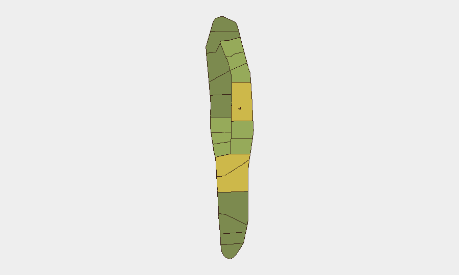
Malé (risk 85) and Malé Atoll (risk 68) dominate the sub-national ranking, reflecting high population density, tourism infrastructure, and enforcement visibility in the capital region. Secondary clusters in Hadhdhunmathi (65), Kolhumadulu (60), and Felidhu Atoll (58) suggest distributed but lower-intensity risk across central atolls. Risk gradients correlate with urbanization, expatriate populations, and maritime traffic rather than political conflict; petty crime, immigration enforcement, and maritime accidents are the primary drivers. Northern and southern atolls (North Miladhunmadulu, South Nilandhe, North Nilandhe, South Ari) register substantially lower composite scores (40–48), indicating relatively stable conditions outside the capital corridor.
How GeoBit Would Assist
Security teams operating in Maldives would leverage AOI Monitoring & Early Warning to track persistent hotspots (Malé, Hulhumalé, port facilities) for emerging patterns in theft, immigration enforcement, or maritime incidents. Maritime & Aviation Tracking combined with Environmental & Health data would provide early signals of weather-driven vessel risks and operational hazards during monsoon and high-wind seasons. Intel Sweep and multi-language OSINT would enable real-time monitoring of local police, Immigration, and port authority communications to anticipate enforcement activity or safety alerts affecting foreign personnel and asset movements.
7-Day Outlook
No systemic escalation is anticipated. Routine law-enforcement and maritime activity will likely continue in urban centers and transit corridors. Weather patterns and seasonal maritime traffic should be monitored; recent vessel incidents suggest heightened risk during adverse conditions. Personnel in Malé and Hulhumalé should maintain standard vigilance around theft and enforcement checkpoints; no recommendation for heightened alert status is warranted at this time.
Highest-Risk Areas — Ranked
| # | State / Region | Risk |
|---|---|---|
| 1 | Malé | 85 |
| 2 | Malé Atoll | 68 |
| 3 | Hadhdhunmathi | 65 |
| 4 | Kolhumadulu | 60 |
| 5 | Felidhu Atoll | 58 |
| 6 | Mulaku Atoll | 55 |
| 7 | Faadhippolhu | 52 |
| 8 | South Miladhunmadulu | 48 |
| 9 | North Miladhunmadulu | 45 |
| 10 | South Nilandhe Atoll | 44 |
| 11 | North Nilandhe Atoll | 42 |
| 12 | South Ari Atoll | 40 |
Sources
Previous Daily Briefs
A new Maldives brief is written every day — each with its own risk map and downloadable CSV. Here's the last week; use the calendar to go further back.
📅 Browse every day by calendar →
Highlighted days have a brief. Tap a day for that day's map & analysis, or “csv” for that day's dataset ($5).
Atlas — our AI intelligence desk — emails them this snapshot personally. Nothing else, no list.