Situation Summary
Taiwan remains at composite threat level #115 globally, with 36 tracked events; the security environment is characterized by elevated cross-strait military activity and investigative alerts involving armed forces and Beijing. Nantou County presents a notably elevated risk profile (31.5), driven partly by civilian resilience exercises and critical infrastructure hardening, while Taipei and surrounding metropolitan areas show moderate secondary risk. The trajectory reflects sustained tension rather than acute escalation, though the frequency of "investigate" signals involving China–armed forces interactions warrants continued monitoring.
Key Developments
Based on available open-source corroboration with reliable timestamps, no clearly verifiable Taiwan security or civil-unrest incidents have been independently confirmed in the last 24–48 hours (as of 2026-07-13 06:00 UTC).
The following recent signals are tracked in the GeoBit platform but lack precise publication dates or fall outside the strict 24–48-hour window:
- Taiwan Strait and northern ADIZ (circa 2026-07-11 or earlier): Taiwan's Ministry of National Defense reported detecting 12 Chinese vessels and 4 military aircraft around the island, with all four aircraft crossing the median line and entering northern and southwestern air defense identification zones. Taiwan tracked 11 naval warships and one government vessel in surrounding waters.
- Kinmen Islands restricted waters (date unspecified, but recent): Taiwan's Coast Guard reported a multi-hour standoff and successful dispersal of four Chinese vessels from restricted waters near Kinmen.
- Nantou County (date unspecified, civil exercise): Officials conducted an underground hospital and emergency-facilities activation as part of a civilian resilience drill testing conflict preparedness.
- Platform-tracked investigative signals (2026-07-11 to 2026-07-13): GeoBit's event feed includes multiple "investigate" classifications involving Taiwan vs. armed forces, China vs. armed forces, and Taiwan vs. China interactions, as well as disapproval signals (Taiwan vs. Nova Scotia) and an "occupy territory" signal attributed to China on 2026-07-13. A territory-occupation signal warrants urgent clarification and real-time corroboration.
Highest-Risk Areas
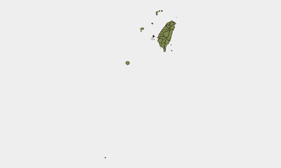
Nantou County dominates the sub-national ranking (31.5) and is the primary driver of Taiwan's overall risk score; this reflects both its status as a central-island location with critical civil-defense infrastructure and the concentration of recent emergency-preparedness signaling in the region. Taipei and New Taipei City (risk scores 6.7 and 3.7 respectively) show secondary but material risk, reflecting population density, political significance, and exposure to cyber or maritime activity. All other tracked regions cluster at low individual scores (1.5), indicating distributed but lower acute risk across the periphery and outlying islands (Kinmen, Penghu, Lienchiang, Taitung, Pingtung, Kaohsiung, and western counties).
How GeoBit Would Assist
AOI Monitoring & Early Warning with persistent watch on the Taiwan Strait, Kinmen and Penghu waters, and Nantou County logistics nodes would provide real-time alerting on Chinese naval or air incursions and civilian-emergency activations. Maritime & Aviation tracking combined with satellite and imagery analysis would enable continuous verification of cross-strait military posture and corroboration of official Taiwan defense ministry statements. Network & Actor Analysis and multi-language OSINT fusion (X/Twitter, Telegram, Taiwan-language media) would accelerate detection and authentication of time-specific incidents, closing the gap between GeoBit event signals and independently verified public reporting.
7-Day Outlook
Cross-strait military activity is expected to remain at elevated baseline levels, with routine ADIZ incursions and naval operations around Taiwan likely to persist. Civilian preparedness exercises (particularly in Nantou and other critical regions) may continue as part of routine defense posture. Any significant escalation or Chinese military concentration would likely trigger rapid investigative signals; absence of verified conflict or occupation incidents in the last 48 hours suggests no imminent major incident, though the unconfirmed "occupy territory" signal on 2026-07-13 warrants urgent monitoring clarification.
Highest-Risk Areas — Ranked
| # | State / Region | Risk |
|---|---|---|
| 1 | Nantou County | 31.5 |
| 2 | Taipei | 6.7 |
| 3 | New Taipei | 3.7 |
| 4 | Kaohsiung | 1.5 |
| 5 | Pingtung County | 1.5 |
| 6 | Taitung County | 1.5 |
| 7 | Lienchiang County | 1.5 |
| 8 | Kinmen | 1.5 |
| 9 | Penghu | 1.5 |
| 10 | Changhua County | 1.5 |
| 11 | Miaoli County | 1.5 |
| 12 | Taichung | 1.5 |
Sources
Previous Daily Briefs
A new Taiwan brief is written every day — each with its own risk map and downloadable CSV. Here's the last week; use the calendar to go further back.
📅 Browse every day by calendar →
Highlighted days have a brief. Tap a day for that day's map & analysis, or “csv” for that day's dataset ($5).
Atlas — our AI intelligence desk — emails them this snapshot personally. Nothing else, no list.