Situation Summary
Tonga remains a low-threat environment with a composite threat score of 3 and no tracked security incidents. The country's primary risk drivers are seismic activity—four moderate earthquakes (M 4.3–5.1) recorded in the past week in waters surrounding the archipelago—and regional geopolitical tension stemming from recent Chinese military activity in the Pacific. No civil unrest, significant crime spikes, infrastructure disruptions, or acute political instability have been reported in the last 24–48 hours.
Key Developments
- No major security incidents reported in Tonga in the last 24–48 hours. Open-source monitoring (news wires, regional Pacific outlets, social media, and Tonga-focused outlets) confirms absence of protests, violent crime, infrastructure failure, or travel-advisory changes.
- Seismic activity continues near Tonga. Four moderate-magnitude earthquakes (M 5.1, 5.0, 5.0, 4.3) have been recorded in recent days in waters 89–299 km from populated centers (Hihifo, Neiafu, ʻOhonua, Houma). No tsunami warnings or coastal impacts have been reported; monitoring is ongoing.
- Regional context: Chinese missile test. On 8 July, a PLA Navy submarine test-fired a missile that passed over the Philippines and splashed down in international waters between Tonga and Nauru. Tonga's Prime Minister publicly condemned the test on 10–13 July, citing regional tension and confirming discussion of a new defense alliance with Fiji and Australia. This is regional geopolitical activity, not a domestic security incident.
- Heilala Festival road enforcement concluded. Police conducted a multi-day enforcement operation during the Heilala Festival weekend (reported 7 July), resulting in 41 DUI arrests and 12 traffic fines. No similar operations or mass arrests have been reported in the last 24–48 hours.
Highest-Risk Areas
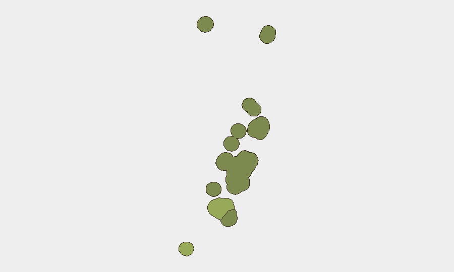
Tongatapu (risk score 45) dominates the sub-national risk landscape and accounts for the majority of Tonga's composite threat exposure, reflecting its status as the capital island and population center. Vavaʻu (risk 28) and Haʻapai (risk 22) represent secondary concentrations of risk, likely driven by geographic exposure to seismic and maritime hazards rather than civil or political instability. ʻEua and Ongo Niua carry minimal risk scores. Risk rankings reflect structural vulnerabilities—infrastructure density, population concentration, maritime exposure—rather than active conflict or unrest.
How GeoBit Would Assist
Organizations with personnel or assets in Tonga should employ Intel Sweep and multi-language OSINT to maintain real-time awareness of civil, crime, and political developments across Tonga-focused outlets and regional news feeds. AOI Monitoring & Early Warning configured for Tongatapu and key transport nodes (ports, airport) provides automated alerting for infrastructure disruptions, unrest, or security incidents. Earthquake and seismic hazard tracking (via environmental & GIS capabilities) complements official warnings and supports duty-of-care assessments for teams near coastal or low-lying zones.
7-Day Outlook
Seismic activity is expected to continue given Tonga's position on the Pacific Ring of Fire; the current frequency (4 events in one week) remains within historical norms and poses low immediate risk to populated areas. Regional geopolitical commentary around the Chinese missile test and Pacific defense alliances may continue, but no direct security impact on Tonga is anticipated. The operational environment in-country is expected to remain stable, with standard travel and business-continuity precautions sufficient for most corporate operations.
Highest-Risk Areas — Ranked
| # | State / Region | Risk |
|---|---|---|
| 1 | Tongatapu | 45 |
| 2 | Vavaʻu | 28 |
| 3 | Haʻapai | 22 |
| 4 | ʻEua | 18 |
| 5 | Ongo Niua | 12 |
Sources
Previous Daily Briefs
A new Tonga brief is written every day — each with its own risk map and downloadable CSV. Here's the last week; use the calendar to go further back.
📅 Browse every day by calendar →
Highlighted days have a brief. Tap a day for that day's map & analysis, or “csv” for that day's dataset ($5).
Atlas — our AI intelligence desk — emails them this snapshot personally. Nothing else, no list.