Situation Summary
Vanuatu presents a low acute security risk as of 29 July 2026, with no verified incidents of civil unrest, violence, or infrastructure disruption reported in the past 24–48 hours. The security environment is currently shaped by policy-level activity and natural hazards rather than active conflict or crime spikes. Volcanic activity on Ambae Island (Alert Level 3, confined to Lake Voui) and marine strong winds across coastal waters remain the primary travel and safety considerations; neither has generated incident reports in the most recent period.
Key Developments
- No acute security incidents reported, 27–29 July 2026. Open-source monitoring feeds and national security bulletins confirm stable conditions with no shootings, riots, bombings, or major crime events across Vanuatu in the last 24–48 hours.
- Ambae volcanic activity remains confined, 29 July 2026. Vanuatu Meteorology & Geo-Hazards Department maintains Volcanic Alert Level 3 with minor eruption activity limited to Lake Voui; danger zone radius approximately 3 km. No new casualties or evacuations reported.
- Marine strong wind warning issued for coastal waters, current. Affects small craft and marine operations nationwide; no associated maritime incidents documented in the past 48 hours.
- Political debate over MSG Director-General appointment continues without escalation, as of 23 July. Malvatumauri National Council of Chiefs ultimatum regarding Dr Anna Naupa's appointment remains unresolved; however, no protests, violence, or security incidents linked to this dispute have been recorded in the last 24–48 hours.
- WWII ordnance cataloguing operation completed at Cook Barracks, Port Vila, 17 July (background). Joint EOD operations by Vanuatu Mobile Force, Royal Solomon Islands Police, and Australian Defence Force identified and secured munitions; operation concluded and does not represent an active current threat.
Highest-Risk Areas
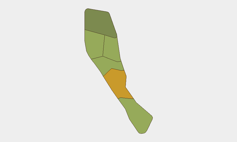
Shefa Province (risk score 72) and Penama (58) drive the sub-national risk ranking, though absolute risk levels remain modest. Shefa's elevated score likely reflects Port Vila's status as the capital and economic hub, concentrating political activity, maritime traffic, and infrastructure assets; Penama's secondary ranking suggests lower-level criminal or governance concerns. Sanma, Malampa, and Tafea present moderate-range scores (52–45), while Torba is lowest-risk (35). The ranking does not currently correlate with acute incidents but signals where security monitoring and duty-of-care protocols should maintain focus.
How GeoBit Would Assist
A security team with personnel or assets in Vanuatu would prioritize AOI Monitoring & Early Warning on Shefa (Port Vila and surrounds) and Penama to detect emerging civil unrest, crime, or political violence with near-real-time alerting. Environmental & Health monitoring of Ambae's volcanic status via satellite imagery, VMGD feeds, and OSINT fusion would provide advance notice of escalation or evacuation orders. Maritime & Aviation tracking, combined with multi-language OSINT and radio SIGINT, would yield visibility of port and airfield disruptions, weather impacts, and maritime safety incidents affecting supply chains and personnel movement.
7-Day Outlook
No significant deterioration in Vanuatu's security posture is forecast over the next seven days. Ambae volcanic activity is expected to remain stable at current levels; however, any sustained increase in seismic activity or ash emission could trigger tighter travel restrictions. Political resolution of the MSG Director-General dispute or further escalation remains possible but is not expected to manifest as street-level violence in the immediate term.
Highest-Risk Areas — Ranked
| # | State / Region | Risk |
|---|---|---|
| 1 | Shefa Province | 72 |
| 2 | Penama | 58 |
| 3 | Sanma | 52 |
| 4 | Malampa | 48 |
| 5 | Tafea | 45 |
| 6 | Torba | 35 |
Sources
Previous Daily Briefs
A new Vanuatu brief is written every day — each with its own risk map and downloadable CSV. Here's the last week; use the calendar to go further back.
📅 Browse every day by calendar →
Highlighted days have a brief. Tap a day for that day's map & analysis, or “csv” for that day's dataset ($5).
Atlas — our AI intelligence desk — emails them this snapshot personally. Nothing else, no list.