Situation Summary
Iceland remains a low-threat environment with a composite threat score of 28 and no reported civil unrest, terrorism, or political instability in the last 24–48 hours. The security picture is defined by routine incidents—a large-scale maritime rescue operation in Eyjafjörður, an adventure-tourism accident in the South, and a localized power outage in Reykjavík—rather than systemic risks. Authorities have initiated precautionary security reviews for upcoming public events in response to international attack trends, but no direct or imminent threat to the country has been identified.
Key Developments
- Eyjafjörður (north Iceland, ~24–48h ago): All available rescue teams and a search-and-rescue helicopter were mobilized for a large-scale maritime or coastal emergency; operation outcome remained unconfirmed at reporting time. No casualties or civil-unrest element reported.
- South of Mýrdalsjökull, South Iceland (~24h ago): Icelandic Coast Guard helicopter rescued a paraglider who became separated from companions; patient transported to Landspítali for examination. Isolated adventure-tourism accident with no wider security impact.
- Reykjavík, Breiðholt district (~24h ago): High-voltage grid fault caused power outage in Bakkar, Seljahverfi, and surrounding residential areas; utility Veitur attributed incident to technical fault with repairs ongoing. No indication of sabotage or infrastructure attack.
- Reykjavík, Hinsegin Dagar (Iceland Pride) security review (~last 24h): Following the July 2026 vehicle attack on Berlin's Christopher Street Day parade, Icelandic authorities initiated a formal precautionary security update for the upcoming Reykjavík Pride festival. No cancellation announced; expected measures under consideration include expanded vehicle-exclusion zones and barrier deployment.
- Nationwide aviation sector: Regional reporting noted GPS jamming and spoofing affecting Gulf operators, but no Iceland-specific airspace closures or operational disruption confirmed. Iceland's flight operations remain normal.
- Central Reykjavík residential crime (ongoing since early July): Opportunistic burglaries continue in Station 1 area (Vesturbær, Miðborg, Hlíðar, Laugardalur, Háaleiti, Seltjarnarnes); no new spike or geographic expansion reported in the last 48 hours.
- Seismic and volcanic activity: Icelandic Meteorological Office reports no earthquakes above magnitude 3.0 in the past 24 hours and routine low-magnitude activity only; no new volcanic or seismic emergency.
Highest-Risk Areas
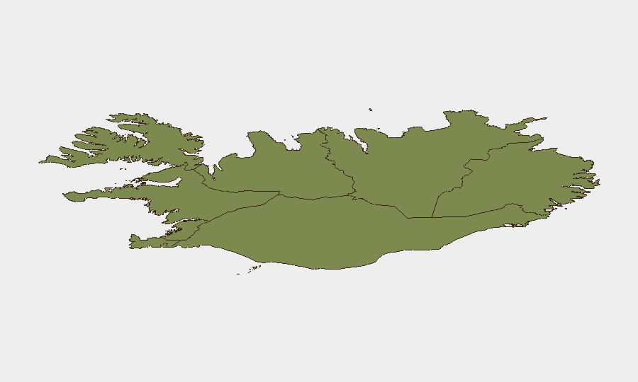
The Capital Region (risk score 24) drives Iceland's overall threat profile, reflecting concentrated population, infrastructure density, and recurring property crime in central Reykjavík. The Southern Peninsula (score 12) and Southern Region (score 11) rank second and third, likely reflecting tourism volumes, remote emergency-response dependencies, and weather-related hazards. Eastern, Western, Westfjords, Northwestern, and Northeastern regions carry materially lower scores (10 to 6), indicating dispersed populations and limited incident clustering. Risk concentration in the capital reflects property crime and event-security planning rather than violent crime or political instability.
How GeoBit Would Assist
Security teams operating in Iceland would deploy AOI Monitoring & Early Warning to track the Capital Region's burglary hotspots and flag cluster expansion in real time. OSINT fusion (X/Twitter, Telegram, multi-language search) would provide early detection of event-security developments and protest or activism signaling ahead of Hinsegin Dagar and other public gatherings. Aviation tracking and maritime tracking capabilities would enable duty-of-care teams to monitor ongoing rescue operations and airspace advisories, particularly for personnel in remote regions or engaged in adventure tourism.
7-Day Outlook
Iceland's security environment is expected to remain low-threat over the next seven days, with event-security measures for Hinsegin Dagar likely finalized and deployed without disruption. Routine property crime in central Reykjavík will persist at current levels. Weather and remote-area rescue demand may fluctuate with seasonal conditions, but no spike in political, civil, or security incidents is anticipated.
Highest-Risk Areas — Ranked
| # | State / Region | Risk |
|---|---|---|
| 1 | Capital Region | 24 |
| 2 | Southern Peninsula | 12 |
| 3 | Southern Region | 11 |
| 4 | Eastern Region | 10 |
| 5 | Western Region | 9 |
| 6 | Westfjords Region | 8 |
| 7 | Northwestern Region | 7 |
| 8 | Northeastern Region | 6 |
Sources
Previous Daily Briefs
A new Iceland brief is written every day — each with its own risk map and downloadable CSV. Here's the last week; use the calendar to go further back.
📅 Browse every day by calendar →
Highlighted days have a brief. Tap a day for that day's map & analysis, or “csv” for that day's dataset ($5).
Atlas — our AI intelligence desk — emails them this snapshot personally. Nothing else, no list.